

- Usage in publication:
-
- Hudspeth Formation
- Modifications:
-
- Named
- Dominant lithology:
-
- Mudstone
- Siltstone
- AAPG geologic province:
-
- Blue Mountains province
Summary:
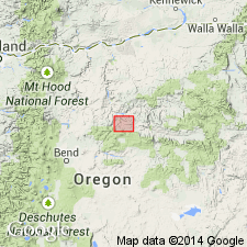
Named for main timber-hauling roads of Hudspeth Land and Cattle Co, of Prineville, OR. Previously referred to as part of Mitchell beds. Complex intertonguing with Gable Creek Formation (new) and details of contacts shown in reference sections on southeast flank of Mitchell anticline. Principal reference section terminal point is at 700 ft northeast of NE/4 NE/4 SW/4 sec.13 T11S R21E near summit of ridge on north side of canyon, Mitchell quad, Wheeler Co, OR. Consists of widespread and thick sequence of marine mudstone having subordinate siltstone and sandstone. Tongues are numbered in ascending order from 1 through 12. Thick sequence (3000 ft) overlying basal member is referred to as "Main Mudstone member". Shown on sketch map of Cretaceous rocks in south half of Mitchell quad, central OR. Overlies Permian metasedimentary rocks. Underlies and intertongues with Gable Creek Formation. Is Cretaceous age based on fossils of Albian to possibly Cenomanian age.
Tongues of the Hudspeth consist of mudstone, siltstone, and minor thin sandstone. Sandstone beds are laminated to 4-inch thick. Comprises of a series of discontinous, wedge-shaped tongues numbered 1 through 12 in ascending order. Thickness of tongues range from 0 at terminations to almost 3,000 feet (Main mudstone member); tongues tend to thin or wedge out northward. Complex intertonguing with Gable Creek Formation produce terminations of tongues generally within 1 mile distance along strike.
Source: GNU records (USGS DDS-6; Menlo GNULEX).
- Usage in publication:
-
- Hudspeth Formation
- Modifications:
-
- Overview
For more information, please contact Nancy Stamm, Geologic Names Committee Secretary.
Asterisk (*) indicates published by U.S. Geological Survey authors.
"No current usage" (†) implies that a name has been abandoned or has fallen into disuse. Former usage and, if known, replacement name given in parentheses ( ).
Slash (/) indicates name conflicts with nomenclatural guidelines (CSN, 1933; ACSN, 1961, 1970; NACSN, 1983, 2005, 2021). May be explained within brackets ([ ]).