

- Usage in publication:
-
- Howell formation*
- Modifications:
-
- Revised
- Biostratigraphic dating
- AAPG geologic province:
-
- Great Basin province
Summary:
Howell formation. Gave a resume of House Range section in which he recognized between Howell formation and underlying Pioche shale 205 feet of bluish gray arenaceous limestone which he called Langston(?) formation. Age is Middle Cambrian.
Source: US geologic names lexicon (USGS Bull. 896, p. 987-988).

- Usage in publication:
-
- Howell formation*
- Modifications:
-
- Original reference
- Dominant lithology:
-
- Limestone
- Shale
- AAPG geologic province:
-
- Great Basin province
Summary:
Pg. 9. 11. Howell formation. Dark, more or less massive limestone and pinkish argillaceous shales, 640 feet thick. Basal formation of Middle Cambrian in House Range, western Utah. Underlies Dome formation and overlies Pioche formation.
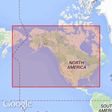
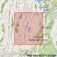
Type locality: slopes of Howell Peak, on west side of House Range, about 5 mi west of Antelope Springs [in T. 17 S., R. 14 W., Marjum Pass 7.5-min quadrangle, Millard Co.], western UT.
Source: US geologic names lexicons (USGS Bull. 896, p. 987-988).

- Usage in publication:
-
- Howell limestone
- Modifications:
-
- Revised
- Dominant lithology:
-
- Limestone
- AAPG geologic province:
-
- Great Basin province
Summary:
Pg. 1135-1138, 1141 (fig. 5), 1144-1145. Howell limestone (emended) overlies Tatow limestone (new) and underlies Dome limestone. Thickness 835 feet. Lower 275 feet consists of black and dark-gray fine-grained extremely thick- to thin-bedded limestone which contains buff clay flakes and nodules and numerous algae. Next 340 feet composed of pale-gray, pinkish, and light tan-gray massive fine-grained more or less argillaceous thick- and thin-bedded limestone which contains blebs of white calcite and tan clay flakes interbedded with pinkish zones near middle. Upper 225 feet composed of alternating thicker zones of dull- and black-gray fine-grained limestone which contains buff and reddish-tan clay flakes with thinner zones of gray and tan fissile shale. Walcott gave thickness 435 feet. Emended section approximately 5 miles south of Walcott's type locality. [Age is Middle Cambrian (Albertan).]
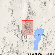
Type locality (emended): about 5 mi south of Walcott's type locality in spurs between tributary valleys on north side of Marjum Canyon, House Range, [Notch Peak 7.5-min quadrangle, Millard Co., western UT].
Source: US geologic names lexicon (USGS Bull. 1200, p. 1822).
- Usage in publication:
-
- Howell Limestone*
- Modifications:
-
- Overview
- Revised
- Biostratigraphic dating
- AAPG geologic province:
-
- Great Basin province
Summary:
Original description of Howell (Walcott, 1908a; b) was inadequate. Howell Formation (Walcott, 1908a) is renamed the Howell Limestone, as the later usage is more appropriate. Howell as restricted here contains only limestone. Contains two members (ascending): Millard Member and unnamed upper member; forms massive cliffs. Non-carbonate residues average 4.5 percent for the Millard Member and 3.8 percent for the upper member. Consists of light- to medium dark-gray, fine- to medium-grained limestone, which weathers to light gray and may contain many reddish-stained solution caverns. Impurities are mostly fine quartz and clay particles. Averages 96 percent carbonate. Oncolites and algal pisolites are abundant in the Millard. Thickness is 690 ft. Conformably overlies the Tatow Member (revised) of the Pioche Formation; conformably underlies the Chisholm Formation. Age is Middle Cambrian on the basis of fossils [trilobites].
Source: GNU records (USGS DDS-6; Menlo GNULEX).
- Usage in publication:
-
- Howell Limestone
- Modifications:
-
- Revised
- AAPG geologic province:
-
- Great Basin province
Summary:
Revised in that unit overlies Tatow Member (rank reduced) of Pioche Formation (revised) in Fish Springs, House, Wah Wah and Cricket Ranges in west-central UT, Great Basin province. Middle Cambrian age.
Source: GNU records (USGS DDS-6; Denver GNULEX).
For more information, please contact Nancy Stamm, Geologic Names Committee Secretary.
Asterisk (*) indicates published by U.S. Geological Survey authors.
"No current usage" (†) implies that a name has been abandoned or has fallen into disuse. Former usage and, if known, replacement name given in parentheses ( ).
Slash (/) indicates name conflicts with nomenclatural guidelines (CSN, 1933; ACSN, 1961, 1970; NACSN, 1983, 2005, 2021). May be explained within brackets ([ ]).