


- Usage in publication:
-
- Howard limestone
- Modifications:
-
- Original reference
- Dominant lithology:
-
- Limestone
- AAPG geologic province:
-
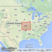
- Cherokee basin
Summary:
Pg. 67, 105. Howard limestone proposed by G.I. Adams in field notes, for limestone, 3 to 8 feet thick, overlying Severy shales and underlying what seems to be equivalent of Osage shales [not true †Osage but the higher Scranton shale] in Chautauqua, Elk, and Greenwood Counties, Kansas. [Age is Pennsylvanian.]
Source: US geologic names lexicon (USGS Bull. 896, p. 987).
- Usage in publication:
-
- Howard limestone member
- Modifications:
-
- Revised
Summary:
Defined Howard limestone member of Shawnee Formation as underlying Scranton shale member, and overlying Severy shale member, and this has been the generally approved definition for many years [in Missouri]. In Kansas, the Shawnee is treated as a group and the subdivisions as formations.
See also "Kansas-Nebraska Pennsyvlanian correlation chart," sheet 1, compiled by M.G. Wilmarth, Secretary of Committee on Geologic Names, USGS, Oct. 1936.
Source: Modified from US geologic names lexicon (USGS Bull. 896, p. 987).

- Usage in publication:
-
- Howard limestone member
- Modifications:
-
- Revised
- AAPG geologic province:
-
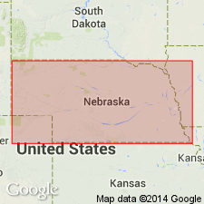
- Forest City basin
Summary:
Howard limestone member of Shawnee formation. Includes (ascending) Church limestone (2 to 6 feet), Kiewitz shale (2.5 feet), and "Louisville" limestone (12 feet) beds. Age is Late Pennsylvanian (Missourian). Report includes cross sections, measured sections, geologic maps, stratigraphic tables.
Source: GNC KS-NE Pennsylvanian Corr. Chart, sheet 1, Oct. 1936; supplemental information from GNU records (USGS DDS-6; Denver GNULEX).

- Usage in publication:
-
- Howard limestone
- Modifications:
-
- Revised
- AAPG geologic province:
-
- Cherokee basin
Summary:
Howard limestone of Wabaunsee group. Includes (descending) Utopia limestone, Winzeler shale, Church limestone, Aarde shale, and Bachelor Creek limestone members. Overlies Severy shale and underlies Scranton shale, both of Wabaunsee. Age is Late Pennsylvanian (Virgil).
Source: GNC KS-NE Pennsylvanian Corr. Chart, sheet 2, Oct. 1936.

- Usage in publication:
-
- Howard limestone
- Modifications:
-
- Revised
- AAPG geologic province:
-
- Cherokee basin
Summary:
Pg. 204. Type locality of Howard limestone is near Howard, Elk County, Kansas. It is typically exposed in NE/4 sec. 7, T. 29 S., R. 11 E., and is here included in Wabaunsee group. Age is Late Pennsylvanian (Virgil).
Source: US geologic names lexicon (USGS Bull. 896, p. 987); GNC KS-NE Pennsylvanian Corr. Chart, sheet 2, Oct. 1936.
- Usage in publication:
-
- Howard limestone
- Modifications:
-
- Areal extent
Summary:
Pg. 20-21. Howard limestone of Wabaunsee group. Bachelor Creek limestone missing in northeastern Kansas, southeastern Nebraska, northwestern Missouri, and southwestern Iowa where base of Church limestone member marks boundary between the Howard and Severy. Aarde shale missing in northeastern Kansas ans southeastern Nebraska.
Source: US geologic names lexicon (USGS Bull. 1200, p. 1821).
- Usage in publication:
-
- Howard limestone
- Modifications:
-
- Overview
- Areal extent
Summary:
Pg. 20-21. Church, Winzeler, and Utopia members distinguishable in Missouri. Bachelor Creek is possibly a sandy limestone previously included in Severy shale; Aarde shale member not identified in Missouri. Wabaunsee group.
Source: US geologic names lexicon (USGS Bull. 1200, p. 1821).

- Usage in publication:
-
- Howard limestone
- Modifications:
-
- Overview
- Areal extent
Summary:
Pg. 57 (fig. 22), 60. Howard limestone. Consists of three limestone members and two shale members. Middle limestone [Church] is the most persistent. Thickness of formation ranges from about 8 to 40 feet. Underlies White Cloud shale; overlies Severy shale.
Source: US geologic names lexicon (USGS Bull. 1200, p. 1821).

- Usage in publication:
-
- Howard limestone
- Modifications:
-
- Areal extent
Summary:
Pg. 14, fig. 5. Howard limestone of Wabaunsee group. Forms caprock for persistent Nodaway coal and can be identified on that basis. In eastern part of area, the Howard is dark-gray to black coarsely crystalline limestone. To the west, fine-grained gray limestone occurs above this bed, and in some places a dark shale is present separating the limestone beds. Thickness seldom more than 1.5 feet. In areas where development of Howard is complete, it is composed of three limestone and two shale units. Lowermost limestone missing in Iowa section, and lower shale unit and included Nodaway coal are considered part of underlying Severy shale. Age is Late Pennsylvanian (Virgilian).
Source: US geologic names lexicon (USGS Bull. 1200, p. 1821).
- Usage in publication:
-
- Howard Limestone
- Modifications:
-
- Revised
- AAPG geologic province:
-
- Cherokee basin
Summary:
Howard Limestone of the Wabaunsee Group. Revised to include the newly named Wauneta Limestone and [Shanghai Creek] Shale Members. All members of the Howard described in text; all type sections of members located in Kansas, in the Cherokee basin, except the Church Limestone Member which is in Nebraska. Members recognized are (in ascending order): Bachelor Creek Limestone, Aarde Shale (incl. Nodaway Coal Bed), Wauneta Limestone (new), [Shanghai Creek] Shale (new), Church Limestone, Winzeler Shale, and Utopia Limestone. The Howard conformably overlies the Severy Shale and underlies the White Cloud Shale Member of Scranton Shale. Age is Late Pennsylvanian (Virgilian). Report includes measured sections.
Source: Modified from GNU records (USGS DDS-6; Denver GNULEX).
For more information, please contact Nancy Stamm, Geologic Names Committee Secretary.
Asterisk (*) indicates published by U.S. Geological Survey authors.
"No current usage" (†) implies that a name has been abandoned or has fallen into disuse. Former usage and, if known, replacement name given in parentheses ( ).
Slash (/) indicates name conflicts with nomenclatural guidelines (CSN, 1933; ACSN, 1961, 1970; NACSN, 1983, 2005, 2021). May be explained within brackets ([ ]).