- Usage in publication:
-
- Houchen Creek limestone bed
- Modifications:
-
- Original reference
- Dominant lithology:
-
- Limestone
- AAPG geologic province:
-
- Forest City basin
Summary:
Pg. 84, 89. Houchen Creek limestone bed of Elmdale shale member of Wabaunsee formation. Massive to irregular, or separated by bluish shale partings; characterized in most exposures by presence of large masses of algal growth. Thickness 4 to 8+ feet in Nebraska, 3+ feet in northeastern Kansas. Been traced to Kansas Valley north of Belvue [Pottawatomie County, Kansas]. Underlies Hughes Creek shale and overlies Stine shale, all included in Elmdale shale member. Age is Late Pennsylvanian (Missouri age). Report includes cross sections, measured sections, geologic maps, stratigraphic tables.
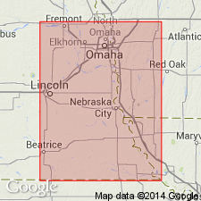
Named from exposures on Houchens Creek, in sec. 29, T. 6 N., R. 13 E., Nemaha Co., southeastern NE.
Source: US geologic names lexicon (USGS Bull. 896, p. 985); GNC KS-NE Pennsylvanian Corr. Chart, sheet 1, Oct. 1936; supplemental information from GNU records (USGS DDS-6; Denver GNULEX).

- Usage in publication:
-
- Houchens Creek limestone member
- Modifications:
-
- Revised
- AAPG geologic province:
-
- Forest City basin
Summary:
Pg. 8. Houchens Creek limestone, middle member of Hamlin shale formation of Admire group. Gray to buff, irregular lobulate-bedded limestone, weathers yellowish. Thickness 1 to 4 feet. Underlies Oaks shale member and overlies Stine shale member. Age is considered Permian (lower part of Big Blue). [Spelling changed to Houchens Creek. See also under Hamlin.]
Source: Publication; US geologic names lexicon (USGS Bull. 896, p. 985, Hamlin entry p. 902); GNC KS-NE Pennsylvanian Corr. Chart, sheet 2, Oct. 1936.

- Usage in publication:
-
- Houchen Creek limestone bed*
- Modifications:
-
- Revised
Summary:
Pg. 2273, 2274 (fig. 1). Houchen Creek limestone bed of Hamlin shale member of Janesville shale. Rank reduced to bed in Hamlin shale herein reduced to member status in Janesville shale (new). Age is Early Permian (Wolfcampian).
Source: US geologic names lexicon (USGS Bull. 1200, p. 1817).

- Usage in publication:
-
- Houchen Creek limestone bed*
- Modifications:
-
- Areal extent
- AAPG geologic province:
-
- Nemaha anticline
Summary:
Pg. 13, 64. Houchen Creek limestone bed of Hamlin Shale Member of Janesville Shale of Admire Group. Stromatolitic limestone. Overlies Stine shale bed and underlies Oaks shale bed, both of Hamlin Shale Member. Age is Late Pennsylvanian (late Gzhelian; STREPTOGNATHODUS FLEXUOSUS conodont zone), based on stratigraphic position.
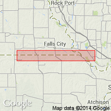
Described from measured sections in Pottawatomie County, eastern Kansas. (Locs. A13, A17, A26.)
Source: Publication.
For more information, please contact Nancy Stamm, Geologic Names Committee Secretary.
Asterisk (*) indicates published by U.S. Geological Survey authors.
"No current usage" (†) implies that a name has been abandoned or has fallen into disuse. Former usage and, if known, replacement name given in parentheses ( ).
Slash (/) indicates name conflicts with nomenclatural guidelines (CSN, 1933; ACSN, 1961, 1970; NACSN, 1983, 2005, 2021). May be explained within brackets ([ ]).

