- Usage in publication:
-
- Hot Springs formation
- Modifications:
-
- Named
- Dominant lithology:
-
- Limestone
- Shale
- AAPG geologic province:
-
- Orogrande basin
Summary:
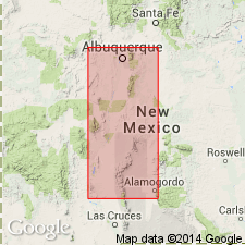
Named as lower of two formations of Mud Springs group (new) of Derry series (new) for town of Hot Springs on the Rio Grande. Type locality is section measured at west end of Whiskey Canyon and just west of westernmost box canyon, near north end of Mud Springs Mountains, in SW1/4 sec 1, T13S, R5W, Sierra Co, NM in Orogrande basin. At type is composed of dark-gray to light-gray, massive to nodular, highly cherty limestone and thick shale beds. At least six distinct limestone sequences have been recognized, but faunal evidence indicates that adjacent limestone sequences were deposited without obvious interruption. Is about 85 ft thick at type [text of report shows 85, but measured section shows 85.5 ft thick] and is essentially the same thickness over a considerable area in central NM. To south in region of Derry, is only about 24 ft thick, and is composed almost entirely of limestone. Is some areas farther north, Hot Springs overlaps onto the pre-Cambrian and there it contains considerable coarse clastics in lower portion. Fossiliferous, with large and varied fauna; most abundantly, fusulinid foraminifers. Overlies Apodaca formation of Green Canyon group (both new); underlies Cuchillo Negro formation of Mud Springs group (both new). Is of Pennsylvanian (Derry) age.
Source: GNU records (USGS DDS-6; Denver GNULEX).
For more information, please contact Nancy Stamm, Geologic Names Committee Secretary.
Asterisk (*) indicates published by U.S. Geological Survey authors.
"No current usage" (†) implies that a name has been abandoned or has fallen into disuse. Former usage and, if known, replacement name given in parentheses ( ).
Slash (/) indicates name conflicts with nomenclatural guidelines (CSN, 1933; ACSN, 1961, 1970; NACSN, 1983, 2005, 2021). May be explained within brackets ([ ]).

