- Usage in publication:
-
- Horse Hill Breccia
- Modifications:
-
- First used
- Dominant lithology:
-
- Tuff
- Breccia
- AAPG geologic province:
-
- Pedregosa basin
Summary:
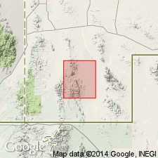
First use; intent to name not stated. Only exposure is in an area south of Cowboy Creek and east of Horse Hill [Mountain], secs 16 and 17, T31S, R17W, Walnut Wells quad, Hidalgo Co, NM in Pedregosa basin. Geologic map. Consists of heterogeneous rhyolitic pyroclastic rocks of tuff, agglomerate, and tuff breccia. Breccia is white to red with minor amounts of broken quartz and feldspar crystals; contains many foreign, angular, 1/2 to 3/4 in fragments. Matrix is cryptocrystalline. Thickness varies from 0-150 ft. Probably overlies Timberlake Fanglomerate (new); unconformably overlain by Bluff Creek Formation (new) and Young Ranch Tuff (new). Appears to be a thin remnant of early Tertiary volcanism. It probably inclined gently to the south and was mostly eroded before the deposition of younger volcanic rocks.
Source: GNU records (USGS DDS-6; Denver GNULEX).
For more information, please contact Nancy Stamm, Geologic Names Committee Secretary.
Asterisk (*) indicates published by U.S. Geological Survey authors.
"No current usage" (†) implies that a name has been abandoned or has fallen into disuse. Former usage and, if known, replacement name given in parentheses ( ).
Slash (/) indicates name conflicts with nomenclatural guidelines (CSN, 1933; ACSN, 1961, 1970; NACSN, 1983, 2005, 2021). May be explained within brackets ([ ]).

