

- Usage in publication:
-
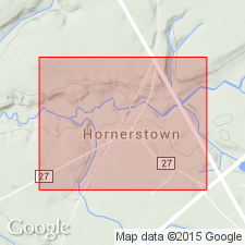
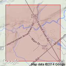
- Hornerstown marl*
- Modifications:
-
- Original reference
- Dominant lithology:
-
- Marl
- AAPG geologic province:
-
- Atlantic Coast basin
Summary:
Pg. 3. Hornerstown marl of Rancocas group. The term Hornerstown marl is here proposed to replace Sewell, which is found to be preoccupied [by Pennsylvanian unit in West Virginia]. Is basal formation of Rancocas group. Underlies Vincentown sand. Age is early Eocene.
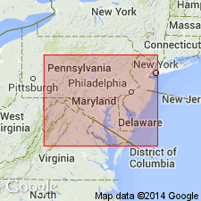
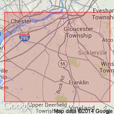
Named from occurrence at Hornerstown, Monmouth Co., east-central NJ (New Jersey coastal plain).
Source: US geologic names lexicon (USGS Bull. 896, p. 980); supplemental information from GNU records (USGS DDS-6; Reston GNULEX).
- Usage in publication:
-
- Hornerstown sand
- Modifications:
-
- Areal extent
- AAPG geologic province:
-
- Atlantic Coast basin
Summary:
Stratigraphic evidence indicates an unconformity between Cretaceous and Tertiary formations in NJ. Hornerstown rests successively from northeast to southwest on Tinton, Red Bank, and Navesink formations. In each case, the Hornerstown lies upon a weathered surface, and basal few feet contain fragments of the underlying formation.
Source: GNU records (USGS DDS-6; Reston GNULEX).
- Usage in publication:
-
- Hornerstown formation
- Modifications:
-
- Age modified
- AAPG geologic province:
-
- Atlantic Coast basin
Summary:
Formation correlated with midway stage (Paleocene) of Gulf Coast. Presence of "middle greensand" unit between Navesink (Cretaceous) and Hornerstown formation recognized, and it is suggested that this is southwestward extension of Red Bank formation (Cretaceous).
Source: GNU records (USGS DDS-6; Reston GNULEX).
- Usage in publication:
-
- Hornerstown formation
- Modifications:
-
- Age modified
- AAPG geologic province:
-
- Atlantic Coast basin
Summary:
Age of the Hornerstown is Paleocene (Danian-Landenian). Determination made on basis of foraminiferal studies. Overlies Monmouth group; underlies Vincentown formation. Report summarizes opinions of several workers.
Source: GNU records (USGS DDS-6; Reston GNULEX).
- Usage in publication:
-
- Hornerstown marl
- Modifications:
-
- Areal extent
- AAPG geologic province:
-
- Atlantic Coast basin
Summary:
Hornerstown marl lies disconformably on Navesink marl in southern NJ. In Monmouth Co. where Red Bank and Tinton formations are present, relationship may be conformable. Consists of glauconite with clay and sand; resembles parts of Navesink, but is distinguished from it by its more sandy nature. Thickness at outcrop 30 ft; average dip 30 ft per mi. Exact age uncertain; recent work on microfossils has shown formation should be regarded as Paleocene. Geographically extended into DE.
Source: GNU records (USGS DDS-6; Reston GNULEX).
- Usage in publication:
-
- Hornerstown Sand*
- Modifications:
-
- Revised
- AAPG geologic province:
-
- Atlantic Coast basin
Summary:
Name of unit changed from Marl to Sand.
Source: GNU records (USGS DDS-6; Reston GNULEX).
- Usage in publication:
-
- Hornerstown Sand*
- Modifications:
-
- Areal extent
- AAPG geologic province:
-
- Atlantic Coast basin
Summary:
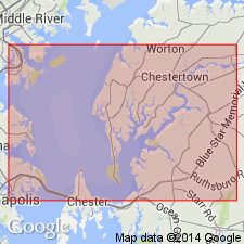
Hornerstown Sand of Rancocas Group is geographically extended into northeastern MD.
Source: GNU records (USGS DDS-6; Reston GNULEX).
- Usage in publication:
-
- Hornerstown Formation*
- Modifications:
-
- Areal extent
- AAPG geologic province:
-
- Atlantic Coast basin
Summary:
Hornerstown "is remarkable for its uniformity in composition and thickness over long distances." Unit has been traced from Raritan Bay, NJ, to eastern MD (125 mi) and is approximately 20 ft thick for the entire distance. In a measured section at Georgetown Post Office in Fredericktown, Cecil Co., the Hornerstown is 19.0 ft of fine to medium, olive-gray glauconite sand containing about 80 percent glauconite. Color is somewhat lighter at top because of weathering. Lower 2 ft contain abundant nodules of goethite. Unconformably overlies unnamed upper portion of Monmouth Group. Underlies Aquia Formation. [Apparently not assigned to Rancocas Group in this report.]
Source: GNU records (USGS DDS-6; Reston GNULEX).
- Usage in publication:
-
- Hornerstown Formation
- Modifications:
-
- Areal extent
- AAPG geologic province:
-
- Atlantic Coast basin
Summary:
Cretaceous/Tertiary boundary is within the basal portion of the Hornerstown Formation in the Inversand pit in the town of Sewell, Mantua Township, NJ. Boundary is illustrated just above the "Main Fossiliferous Layer" of the Hornerstown, which contains the last remains of Cretaceous fauna including a concentration of skeletal materials interpreted as the mass mortality layer. Geochemical investigations, however, revealed no significant differences in toxic metal levels between the Navesink and overlying Hornerstown, though previous studies of this stratigraphic interval in other areas have documented high levels of iridium.
Source: GNU records (USGS DDS-6; Reston GNULEX).
- Usage in publication:
-
- Hornerstown Formation
- Modifications:
-
- Areal extent
- AAPG geologic province:
-
- Atlantic Coast basin
Summary:
Hornerstown Formation of Rancocas Group is a grayish olive green to dusky yellowish green massive, burrowed, poorly to moderately sorted, medium to fine-grained clayey and virtually pure glauconite sand. Clay content increases downdip. Thickness ranges from 6 to 9 m. Contains a Cretaceous marine fauna at its base, but in the middle and at the top has a Tertiary assemblage. Basal fossiliferous layer has yielded a late Cretaceous avifauna according to Olson and Parris (1988). Unit extends from Raritan Bay in the northeast to the Sassafras River on the eastern shore of the Chesapeake Bay in MD. Exposures of Hornerstown are now limited largely to streambank outcrops, temporary excavations, and the single remaining marl pit in Sewell, Gloucester Co. Age is late Maastrichtian and Danian.
Source: GNU records (USGS DDS-6; Reston GNULEX).
- Usage in publication:
-
- Hornerstown Formation*
- Modifications:
-
- Age modified
- Biostratigraphic dating
- AAPG geologic province:
-
- Atlantic Coast basin
Summary:
Hornerstown Formation in NJ shown on several lithologic sections as early Paleocene age, corresponding to calcareous nannofossil zones NP 3 and 4. Report includes fossil lists and several stratigraphic/lithologic sections.
Source: GNU records (USGS DDS-6; Reston GNULEX).
- Usage in publication:
-
- Hornerstown Formation
- Modifications:
-
- Biostratigraphic dating
- AAPG geologic province:
-
- Atlantic Coast basin
Summary:
Hornerstown Formation occupies the interval from 204.2 ft to 109.1 ft in the core-hole Ken-Bf 180. Unit is considered largely, if not entirely, early Paleocene (Danian) in age. Age is bracketed by the last occurrence of Maastrichtian ostracodes at 204.2 ft and the first occurrence of OLENEOTHYRIS HARLANI (brachiopod) at about 109 ft. Described as a massive, fine to medium, locally coarse, glauconitic sand. Hornerstown is widely distributed in central and eastern Kent Co. In eastern Kent Co., unit is thinner and more clayey than elsewhere in the county. Sharply overlies Late Cretaceous Severn Formation of Monmouth Group and underlies late Paleocene Aquia Formation.
Source: GNU records (USGS DDS-6; Reston GNULEX).
- Usage in publication:
-
- Hornerstown Formation*
- Modifications:
-
- Mapped
- AAPG geologic province:
-
- Atlantic Coast basin
Summary:
The Hornerstown Formation in NJ consists of massive, extensively bioturbated, locally clayey, dark-gray to dusky-green, fine- to medium-grained, glauconite sand. Thickness is 2 to 7 m in outcrop and rarely exceeds 8 m in the subsurface. Unconformably overlies the Tinton Formation in the north, Red Bank Formation in the northwest and west-central areas, and the Navesink Formation in the west-central and southern areas. Unconformably underlies the Vincentown Formation. The Hornerstown is of early Paleocene (Danian) age.
Source: GNU records (USGS DDS-6; Reston GNULEX).
For more information, please contact Nancy Stamm, Geologic Names Committee Secretary.
Asterisk (*) indicates published by U.S. Geological Survey authors.
"No current usage" (†) implies that a name has been abandoned or has fallen into disuse. Former usage and, if known, replacement name given in parentheses ( ).
Slash (/) indicates name conflicts with nomenclatural guidelines (CSN, 1933; ACSN, 1961, 1970; NACSN, 1983, 2005, 2021). May be explained within brackets ([ ]).