


- Usage in publication:
-
- Horicon Formation
- Modifications:
-
- Original reference
- Dominant lithology:
-
- Till
- Sand
- Gravel
- AAPG geologic province:
-
- Wisconsin arch
Summary:
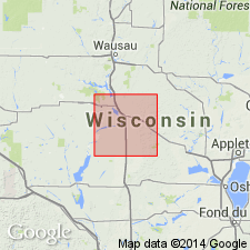
Pg. 4 (table 1); App., p. A9-1 to A9-6. Horicon Formation. Brown, reddish brown, and yellowish brown till and associated sand and gravel. Thickness 1 to 100+ m. Occurs in the Green Bay Lobe in eastern, central, and southern Wisconsin. Includes Mapleview Member (new) on west side of the Green Bay Lobe, in Langlade and Marathon Counties, and equivalent Liberty Grove Member (new) on east side, in Door County. Undivided in south-central Wisconsin. Overlies Walworth Formation (new), or bedrock, or sand and gravel. Is the surface unit in much of south-central Wisconsin, but near Green Bay underlies Kewaunee Formation (new) with abrupt contact. Age is Pleistocene (late Wisconsinan).
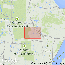
Type section: roadcut on south side of Mapleview Road, 100 m west of its intersection with Maple Road, 1.9 mi (3 km) east of WI State Highways 45/47/52 just south of Antigo, in SE/4 SW/4 SW/4 sec. 34, T. 31 N., R. [11] E., [approx. Lat. 45 deg. 07 min. 04 sec. N., Long. 89 deg. 06 min. 52 sec. W.], Mattoon 7.5-min quadrangle, Langlade Co., eastern WI.
Named from the city of Horicon, at southern edge of Horicon National Wildlife Refuge, Dodge Co.; name credited to David M. Mickelson.
Reference section (lower till): Ski Hill section, roadcut at entrance to County Ski Area from WI State Highway 52, in NW/4 NW/4 NW/4 sec. 8, T. 32 N., R. 13 E., [approx. Lat. 45 deg. 16 min. 33 sec. N., Long. 88 deg. 54 min. 08 sec. W.], Pickerel 7.5-min quadrangle, Langlade Co., eastern WI.
[Additional locality information from Syverson and others, 2011, Wisconsin lexicon of Pleistocene units, Wisconsin Geol. Nat. Hist. Survey Tech. Rpt., no. 1; supplemented from USGS historical topographic map collection TopoView, accessed on June 9, 2018.]
Source: Publication; US geologic names lexicon (USGS Bull. 1565, p. 134).
- Usage in publication:
-
- Horicon Formation
- Modifications:
-
- Revised
- AAPG geologic province:
-
- Wisconsin arch
Summary:
Keene Member is here named and assigned to the Horicon Formation in Portage County, WI. In study area Horicon now includes Keene Member, overlying Mapleview Member, and undifferentiated sands both above and below named members. Keene Member is considered to be pre-Wisconsinan.
Source: GNU records (USGS DDS-6; Reston GNULEX).
- Usage in publication:
-
- Horicon Formation
- Modifications:
-
- Areal extent
- AAPG geologic province:
-
- Wisconsin arch
Summary:
In Florence County, WI, the Copper Falls and Horicon Formations are nearly indistinguishable. An arbitrary vertical cutoff is therefore required somewhere in the broad zone of gradation between the two formations. The cutoff is here placed at the boundary between Florence and Marinette Counties. Horicon Formation is recognized in Marinette County, Copper Falls in Florence.
Source: GNU records (USGS DDS-6; Reston GNULEX).
- Usage in publication:
-
- Horicon Formation
- Modifications:
-
- Revised
- AAPG geologic province:
-
- Wisconsin arch
Summary:
The New Rome Member (Brownell, IN Attig and others, in press) is included in both the Horicon and Big Flats Formations, where it consists of silt and clay underlying the surface sand of both formations. The New Rome is assigned to the Horicon in the northeast part of the study area and eventually pinches out in Portage Co. Member thickens to the south through Wood, Juneau, and Sauk Cos. A few tens of meters of Horicon or Big Flats sand and some additional silt and clay beds too poorly known to be formally named underlie the member. The New Rome and the unnamed members above and below it were deposited at the same time as the Mapleview Member of the Horicon Formation and are therefore considered lateral equivalents.
Source: GNU records (USGS DDS-6; Reston GNULEX).
- Usage in publication:
-
- Horicon Member
- Modifications:
-
- Revised
- Dominant lithology:
-
- Till
- Sand
- AAPG geologic province:
-
- Wisconsin arch
Summary:
Pg. 5 (fig. 3), 8 (fig. 5), 12; App., p. 51, 52 (fig. A2). Horicon Member of Holy Hill Formation. Previously defined as Horicon Formation (Mickelson and others, 1984). Its former members, Mapleview, Liberty Grove, and Keene, are transferred to the Holy Hill. Occurs in the Green Bay Lobe, west of Kettle Moraine, in east-central and southeastern Wisconsin. Consists of light-yellowish-brown gravelly, clayey, silty till and stratified sand and gravel. [Age of Holy Hill Formation is Pleistocene (late Wisconsinan, approximately 18,000 to 13,000 yr B.P.), based on stratigraphic relations.]
Source: Publication.
For more information, please contact Nancy Stamm, Geologic Names Committee Secretary.
Asterisk (*) indicates published by U.S. Geological Survey authors.
"No current usage" (†) implies that a name has been abandoned or has fallen into disuse. Former usage and, if known, replacement name given in parentheses ( ).
Slash (/) indicates name conflicts with nomenclatural guidelines (CSN, 1933; ACSN, 1961, 1970; NACSN, 1983, 2005, 2021). May be explained within brackets ([ ]).