

- Usage in publication:
-
- Holy Hill Formation
- Modifications:
-
- Original reference
- Dominant lithology:
-
- Till
- AAPG geologic province:
-
- Wisconsin arch
Summary:
Pg. 5 (fig. 3), 8 (fig. 5); App., p. 50-56. Holy Hill Formation. Till, and lake and stream sediment interpreted as having been deposited by ice and meltwater associated with the Green Bay and Lake Michigan Lobes. Thickness up to 100+ m in Kettle Moraine (interlobate corridor). West of moraine (Green Bay Lobe), ranges <1 to 100+ m thick, and east of moraine (Lake Michigan Lobe), is <22 m thick. Till is yellowish-brown to brown, sandy, and contains abundant carbonate where unleached; distinguished from other tills by its color, abundant pebbles, sandy texture, and abundant carbonate. The Holy Hill includes: Horicon and New Berlin Members (previously defined as formations, see Mickelson and others, 1984); Mapleview, Liberty Grove, and Keene Members (previously defined as members of Horicon Formation); and Waubeka Member (new). [See also entries under constituent members.] Age is Pleistocene (late Wisconsinan, approximately 18,000 to 13,000 yr B.P.), based on stratigraphic relations.
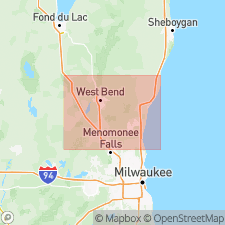
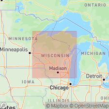
Type section: in pit at Slinger Speedway, Slinger, WI, north of County Trunk Highway AA, about 1.3 mi (2 km) north-northeast of junction of WI State Highways 60 and 144, in SE/4 SE/4 SW/4 sec. 8, T. 10 N., R. 19 E., [approx. Lat. 43 deg. 20 min. 25 sec. N., Long. 88 deg. 16 min. 38 sec. W.], Hartford East 7.5-min quadrangle, Washington Co., eastern WI.
Named from Holy Hill, a large hill with a church at crest of Kettle moraine [a few mi south of type section], in sec. 14, T. 9 N., R. 18 E., [Merton 7.5-min quadrangle], Washington Co., eastern WI; name credited to Kent M. Syverson and David M. Mickelson.
Reference sections = type sections of constituent members (alphabetical) Horicon, Keene, Liberty Grove, New Berlin, and Waubeka (see entries under constituent members).
[Additional locality information from Syverson and others, 2011, Wisconsin lexicon of Pleistocene units, Wisconsin Geol. Nat. Hist. Survey Tech. Rpt., no. 1; supplemented from USGS historical topographic map collection TopoView, USGS GNIS database, and Wisconsin Highways, www.wisconsinhighways.org; accessed on June 9, 2018.]
Source: Publication.
- Usage in publication:
-
- Holy Hill Formation
- Modifications:
-
- Overview
- AAPG geologic province:
-
- Wisconsin arch
Summary:
[Not synopsized to date. Lithology, thickness, distinguishing characteristics, contacts, sections, areal extent, age, correlations discussed.]
Pg. 4 (fig. 2), 7 (fig. 3), 8, 88-95. Holy Hill Formation. Includes (alphabetical) Horicon, Keene, Liberty Grove, New Berlin, and Waubeka Members (Mickelson and Syverson, 1997). (†Mapleview Member abandoned, is same as Horicon Member.)
Source: NA
For more information, please contact Nancy Stamm, Geologic Names Committee Secretary.
Asterisk (*) indicates published by U.S. Geological Survey authors.
"No current usage" (†) implies that a name has been abandoned or has fallen into disuse. Former usage and, if known, replacement name given in parentheses ( ).
Slash (/) indicates name conflicts with nomenclatural guidelines (CSN, 1933; ACSN, 1961, 1970; NACSN, 1983, 2005, 2021). May be explained within brackets ([ ]).