

- Usage in publication:
-
- Hobbstown formation*
- Modifications:
-
- Named
- Biostratigraphic dating
- Dominant lithology:
-
- Conglomerate
- Arkose
- AAPG geologic province:
-
- New England province
Summary:
Pg. 156 (fig. 16), 174-176, pl. 34. Hobbstown formation. Main part of Hobbstown is mostly interbedded coarse-grained arkose and conglomerate with poorly rounded pebbles and cobbles, all blue-gray, gray, dark-green, and white weathering. Arkose is fine to coarse quartz grains with 10 to 30 percent feldspar. Conglomerate is felsite, platy calcareous siltstone, and limestone cobbles. In type area includes lower conglomerate member not present elsewhere. Lower conglomerate member as much as 200 feet thick; consists of felsite and granitic pebbles ranging from fraction of an inch to several feet in diameter. Matrix is medium-grained, quartzitic, dark sandstone. Hobbstown unconformably overlies Hardwood Mountain formation (new) at some localities and basement complex at others; underlies Seboomook and Tarratine (new) formations. Age is Late Silurian to Early Devonian. Late Silurian fossils occur in a thin bed above base of lower member, but they may have been reworked from Hardwood Mountain formation. Member is at least of Tonoloway (Late Silurian) age but may be as young as lower part of Seboomook formation of New Scotland to Oriskany (Early Devonian) age. Ostracodes in lower member correlate with those in Hardwood Mountain formation. Brachiopods similar to Henryhouse and Brownsport formations (Tennessee and Oklahoma). Report includes geologic map and correlation chart.
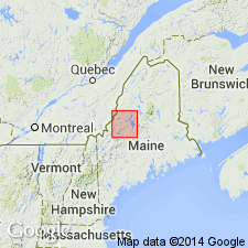
Type area: Hobbstown Twp., in northeast quarter of Spencer [Spencer Lake] 15-min quadrangle, between Hardwood and Spencer Mountains, northern Somerset Co., west-central ME. Named from Hobbstown Twp. [approx. Lat. 45 deg. 26 min. 04 sec. N., Long. 70 deg. 18 min. 46 sec. W., Spencer Lake 7.5-min quadrangle].
Source: Publication; GNU records (USGS DDS-6; Reston GNULEX); US geologic names lexicon (USGS Bull. 1350, p. 336).

- Usage in publication:
-
- Hobbstown Formation*
- Modifications:
-
- Age modified
- Biostratigraphic dating
- AAPG geologic province:
-
- New England province
Summary:
Age modified from Late Silurian and Early Devonian of Boucot (1961) to Early Devonian (late Siegenian). Sparse shelly fossils found at a few localities in the main part of the formation. Because Silurian (Pridolian?) fossils in the lower conglomeratic member might be a death assemblage derived from underlying Hardwood Mountain Formation (based on the findings of Boucot and Heath (1969)), Early Devonian (late Siegenian) age is favored.
Source: GNU records (USGS DDS-6; Reston GNULEX).
For more information, please contact Nancy Stamm, Geologic Names Committee Secretary.
Asterisk (*) indicates published by U.S. Geological Survey authors.
"No current usage" (†) implies that a name has been abandoned or has fallen into disuse. Former usage and, if known, replacement name given in parentheses ( ).
Slash (/) indicates name conflicts with nomenclatural guidelines (CSN, 1933; ACSN, 1961, 1970; NACSN, 1983, 2005, 2021). May be explained within brackets ([ ]).