

- Usage in publication:
-
- Hilliard formation
- Modifications:
-
- Original reference
- Dominant lithology:
-
- Shale
- AAPG geologic province:
-
- Green River basin
Summary:
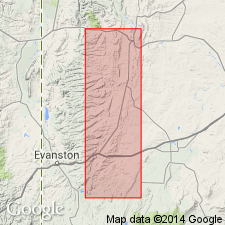
Pg. 721. Hilliard formation. Almost entirely shale, varying from drab to gray, with a few bands of sandstone. Exposed from Kemmerer west to Ham's Hill and also 1 mile north of Hilliard. Thickness 5,000 feet. Well developed near Hilliard. Overlies Frontier formation and underlies Laramie group. [Age is Late Cretaceous (Montana and Colorado).]
Source: US geologic names lexicon (USGS Bull. 896, p. 958).
- Usage in publication:
-
- Hilliard formation
- Modifications:
-
- [Principal reference]
- AAPG geologic province:
-
- Green River basin
Summary:
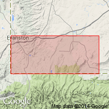
Pg. 542-544. Hilliard formation. Named from town of Hilliard, which is located on Hilliard formation. [Hilliard in NW/4 sec. 2, T. 13 N., R. 119 W., Lat. 41 deg. 08 min. 16 sec. N., Long. 110 deg. 48 min. 43 sec. W., Sulphur Creek Reservoir 7.5-min quadrangle, Uinta Co., southwestern WY]. I cite as typical section the shale beds west of Kemmerer and extending as far as east portal of Oregon Short Line tunnel [in T. 21 N., R. 116 W., Kemmerer 7.5-min quadrangle, Lincoln Co., southwestern WY]. Overlies Frontier formation and underlies Laramie. [Age is Late Cretaceous (Montana and Colorado).]
[Additional locality information from USGS GNIS database, USGS historical topographic map collection TopoView; accessed March 14, 2016.]
Source: Publication; US geologic names lexicon (USGS Bull. 896, p. 958).
- Usage in publication:
-
- Hilliard formation*
- Modifications:
-
- Areal extent
- Biostratigraphic dating
- AAPG geologic province:
-
- Green River basin
Summary:
Hilliard formation. Gray to black sandy shales and shaly sandstones, not known to contain coal of economic importance. Weathers into region of low relief. Thickness 5,500(?) to 6,800 feet. Several thick lenses of white sandstone, containing [ammonite] INOCERAMUS EXOGYROIDES, occur 3,000 to 3,800 feet above base of formation west of Frontier. Overlies Frontier formation and underlies Adaville formation. [Fossils identified by T.W. Stanton, USGS; listed on p. 71-72, figured on pls. 10, 11.] Age is Late Cretaceous (Montana and Colorado).
Source: Publication; US geologic names lexicon (USGS Bull. 896, p. 958).
- Usage in publication:
-
- Hilliard formation
- Modifications:
-
- Biostratigraphic dating
- AAPG geologic province:
-
- Central Western Overthrust
Peterson, R.H., Gauger, D.J., and Lankford, R.R., 1953, Microfossils of the Upper Cretaceous of northwestern Utah and southwestern Wyoming: Utah Geological and Mineral Survey Bulletin, no. 47, 158 p.
Summary:
Pg. 16 (fig. 4), 17-18. Hilliard formation. Near Evanston, southwestern Wyoming, Hilliard formation consists of 5,500 to 6,800 feet of gray to black sandy shales and shaly sandstones. Lenses of white sandstone 3,000 to 3,800 feet occur above base of formation. Overlies Frontier formation; underlies Adaville formation. Age is Late Cretaceous (Montana and Colarado). Microfossils (foraminifers, ostracodes) indicate the the upper part is Montana age, the middle is Niobrara(?) age, and the lower portion is Colorado age.
Source: Publication; US geologic names lexicon (USGS Bull. 1200, p. 1763).
- Usage in publication:
-
- Hilliard shale*
- Modifications:
-
- Areal extent
- AAPG geologic province:
-
- Uinta basin
Summary:
Pg. 4 (fig. 1), 9, 10. Hillard shale. Geographically extended into Daggett County, Utah, where it is 6,300 feet thick in Flaming Gorge area; underlies Blair formation and overlies Frontier formation. In Clay Basin, replaces Blair formation and intertongues with overlying Rock Springs formation.
[See also W.R. Hansen, 1965, USGS Prof. Paper 490 on geol. Flaming Gorge area, UT, CO, and WY (incl. geologic map, scale 1:48,000); available online ngmdb.usgs.gov/Prodesc/prodesc_4501.htm.]
Source: US geologic names lexicon (USGS Bull. 1200, p. 1763).
- Usage in publication:
-
- Hilliard Shale
- Modifications:
-
- Revised
- AAPG geologic province:
-
- Green River basin
Summary:
Pg. 14, 15 (fig. 2). Hilliard Shale. Includes in upper part, Hinshaw Member, lenticular sandstones and shales, about 850 feet thick, and in middle part, Shurtliff Member, alternating sandstones and shales, about 800 feet thick; both new. Overlies Frontier Formation; underlies Adaville Formation. Fossils (pelecypods and cephalopods). Age is Late Cretaceous (Niobraran).
Source: US geologic names lexicon (USGS Bull. 1350, Hinshaw entry p. 334, Shurtliff entry p. 692); GNU records (USGS DDS-6; Denver GNULEX).
- Usage in publication:
-
- Hilliard Shale*
- Modifications:
-
- Age modified
- AAPG geologic province:
-
- Green River basin
Summary:
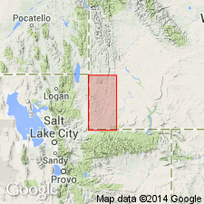
Is mapped in Lincoln and Uinta Cos, WY in western part of Greater Green River basin. Overlies Frontier Formation (undivided) or Dry Hollow Member of Frontier; underlies Lazeart Sandstone Member of Adaville Formation (lower Campanian). Consists of dark-olive-gray marine shale, siltstone, and sandy shale, containing thin tan to light-gray sandstone and limestone interbeds, particularly in upper part. Mapped units include main body of Hilliard; conglomerate of Little Muddy Creek of Royse and others (1975) in lower (but not basal) part, about 610 m maximum thickness; Shurtliff Sandstone Member intertongued in middle part of Hilliard, about 300 m thick in northern part of quadrangle and pinching out southward; and Hinshaw Member of Smith (1965) as uppermost member of Hilliard, about 260-305 m thick. Is poorly exposed; estimated minimum thickness of 1,800 m. Coniacian and Santonian (Late Cretaceous) age is indicated on basis of palynomorphs.
Source: GNU records (USGS DDS-6; Denver GNULEX).
- Usage in publication:
-
- Hilliard Shale*
- Modifications:
-
- Overview
- AAPG geologic province:
-
- Central Western Overthrust
- Uinta basin
Summary:
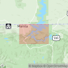
Charts 30, 73. Hilliard Shale. Recognized locally along Absaroka thrust near UT-WY State line, in Crandall Canyon area, Summit County, northeastern Utah. Lies above Frontier Formation and below Evanston Formation. Thickness up to 500 feet. Age is Late Cretaceous. Restricted from Flaming Gorge area, northeastern Utah. Rocks mapped as Hilliard by Hansen (USGS Prof. Paper 490, 1965) are reallocated to Baxter Shale (see D.A. Sprinkel, 2006, Utah Geol. Survey Open-File Rpt., no. 491DM, geol. Dutch John quadrangle, scale 1:100,000).
Source: Publication.
For more information, please contact Nancy Stamm, Geologic Names Committee Secretary.
Asterisk (*) indicates published by U.S. Geological Survey authors.
"No current usage" (†) implies that a name has been abandoned or has fallen into disuse. Former usage and, if known, replacement name given in parentheses ( ).
Slash (/) indicates name conflicts with nomenclatural guidelines (CSN, 1933; ACSN, 1961, 1970; NACSN, 1983, 2005, 2021). May be explained within brackets ([ ]).