- Usage in publication:
-
- Hilina volcanic series
- Modifications:
-
- Named
- Dominant lithology:
-
- Basalt
- AAPG geologic province:
-
- Hawaii
Summary:
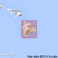
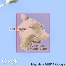
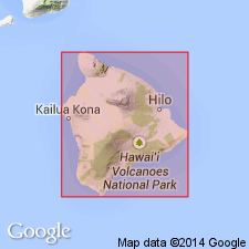
Named for Hilina Pali. Type locality: exposures 1.6 km southwest of end of Hilina Pali Road on south slope of Kilauea Volcano [19 deg 17' 00"N, 155 deg 18' 45"W, Kau Desert 7.5' quad] Island of Hawaii. Rocks were originally mapped as Pahala basalt in Kilauea, less the capping Pahala ash (Stearns and Clark, 1930). (Name Pahala now restricted to ash derived from several sources). Is composed of thin-bedded olivine basalt, aa, and pahoehoe flows ranging from 5 to 25 ft thick. Section, 1000 ft. thick is exposed in Kapukapu fault scarp. Base not exposed. Underlies 30 ft of Pahala ash at type locality. Stratigraphic chart shows Pleistocene age.
Source: GNU records (USGS DDS-6; Menlo GNULEX).
- Usage in publication:
-
- Hilina volcanic series*
- Modifications:
-
- Overview
- AAPG geologic province:
-
- Hawaii
Summary:
Name Hilina volcanic series of Stearns and Macdonald (1946, p.102) adopted for lavas underlying Pahala ash in the fault cliff, as much as 1400 ft above sea level.
Source: GNU records (USGS DDS-6; Menlo GNULEX).
- Usage in publication:
-
- Hilina volcanic series*
- Modifications:
-
- Age modified
- AAPG geologic province:
-
- Hawaii
Summary:
Exposed in windows in Puna volcanic series along lava-mantled fault scarps on south slope of Kilauea. Age changed from Pleistocene to Pleistocene(?). [no basis given]
Source: GNU records (USGS DDS-6; Menlo GNULEX).
- Usage in publication:
-
- Hilina volcanic series*
- Modifications:
-
- Age modified
- AAPG geologic province:
-
- Hawaii
Summary:
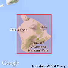
Age of Pliocene(?) and early and middle Pleistocene credited to Stearns and Macdonald (1946). These previous Pliocene age assignments herein qualified by: "... all lavas now exposed on [island of] Hawaii are probably younger than early Pleistocene because of their directions of magnetization are all normal."
Source: GNU records (USGS DDS-6; Menlo GNULEX).
- Usage in publication:
-
- Hilina Formation
- Modifications:
-
- Revised
- AAPG geologic province:
-
- Hawaii
Summary:
Named changed to Hilina Formation. Usage of "formation" for "volcanic series" here follows Code of Stratigraphic Nomenclature. Undersea portion of volcano probably composed of 1 to 4 km of overlapping pillow lavas, separated by thin (0.5 to 1 km) layer of hyaloclastite from an overlying subaerial section (0.1 to 1.5 km thick) composed of predominantly thin (2 to 4 m) flows of tholeiitic basalt. Exposed rocks divided into (ascending) Halape, Kahele, Pohakaa, and Moo Members which consist of ash horizons separated by and overlain by lava flows. Base of exposed rocks could range from 100,000 to 70,000 yr B.P. (thesis, Easton, 1978). Carbon 14 ages of 22,800 +/-340 and 22,500 yr B.P. from base of overlying Pahala Formation gives estimated minimum age.
Source: GNU records (USGS DDS-6; Menlo GNULEX).
- Usage in publication:
-
- Hilina Formation*
- Modifications:
-
- Revised
- AAPG geologic province:
-
- Hawaii
Summary:
Hilina Volcanic Series now renamed Hilina Formation [see also Easton and Garcia, 1980]. Pyroclastic units (of Easton and Garcia, 1980) separated by sequences of lava flows include (descending); (1) Moo Member, a 50-to 250-cm-thick deposit of yellow-brown ash and palagonite containing some accretionary lapilli; (2) Pohakaa Member comprising as many as 6 pyroclastic layers of vitric ash, palagonite and soil ranging from 1 to 4 m thick; (3) Kahele Member, 10- to 125-cm-thick deposit of crudely bedded red clay containing some palagonite; and (4) Halape Member, 10-50-cm-thick deposit of poorly bedded clay and palagonite Age of Pohakaa ash estimated at 50,000 to 40,000 yr B.P.
Source: GNU records (USGS DDS-6; Menlo GNULEX).
- Usage in publication:
-
- Hilina Basalt*
- Modifications:
-
- Redescribed
- Overview
- AAPG geologic province:
-
- Hawaii
Summary:
Name of unit and members formally revised to denote lithology and volcanic origin. Reference section is at Keana Bihopa from base of pali (370 m elev) to top (640 m elev) (19 deg 17' 19"N, 155 deg 18' 25"W, Kau Desert 7.5' quad) 250 m south-southwest of end of Hilina Pali Road. Is divided into (ascending) Halape, Kahele, Pohakaa, and Moo Ash Members. Reference sections also designated for members. Measured sections with descriptions of beds. Minimum age is older than 31 +/-0.9 ka obtained from Carbon 14 on charcoal roots at base of Pahala Ash (Kelley and others, 1979). Maximum age is estimated to be 100 ka based on eruption rates (Easton, 1978).
Source: GNU records (USGS DDS-6; Menlo GNULEX).
- Usage in publication:
-
- Hilina Basalt*
- Modifications:
-
- Redescribed
- Reference
- AAPG geologic province:
-
- Hawaii
Summary:
Named changed from Hilina "Formation" to Hilina "Basalt" to convey unit is composed of volcanic rocks representing shield stage. Is exposed only in fault scarps along south flank of Kilauea Volcano. Includes (ascending) Halape, Kahele, Pohakaa, and Moo Ash Members. Reference localities designated at Keana Bihopa and Puu Kapukapu. [see Easton. (1987) in this vol.]
Source: GNU records (USGS DDS-6; Menlo GNULEX).
For more information, please contact Nancy Stamm, Geologic Names Committee Secretary.
Asterisk (*) indicates published by U.S. Geological Survey authors.
"No current usage" (†) implies that a name has been abandoned or has fallen into disuse. Former usage and, if known, replacement name given in parentheses ( ).
Slash (/) indicates name conflicts with nomenclatural guidelines (CSN, 1933; ACSN, 1961, 1970; NACSN, 1983, 2005, 2021). May be explained within brackets ([ ]).

