The National Geologic Map Database is migrating to a new infrastructure. We apologize for any service disruptions during this process.
|
|---|


- Usage in publication:
-
- Hildreths Formation
- Modifications:
-
- Named
- Dominant lithology:
-
- Marble
- Sandstone
- AAPG geologic province:
-
- New England province
Summary:
Pg. 250-251. Hildreths Formation. Consists mainly of calc-silicate granulite, marble, and metasandstone. Thickness ranges form 60 to 240 m. Replaces Peru Formation of Warner (1965), which is here abandoned. Age is Devonian(?).
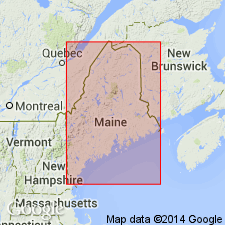
Hildreths Mill, 1.1 km west of high area along Wilton-Weld Road (ME Highway 156), southern Franklin Co., west-central Maine.
Source: US geologic names lexicon (USGS Bull. 1520, p. 138); supplemental information from GNU records (USGS DDS-6; Reston GNULEX).
- Usage in publication:
-
- Hildreths Formation
- Modifications:
-
- Revised
- AAPG geologic province:
-
- New England province
Summary:
Hildreths Formation is here assigned to Seboomook Group, which is raised in rank. Rocks at Boucot's (1961) type section of the Seboomook are designated Northeast Carry Formation, uppermost unit of the Seboomook. Also included in the Seboomook Group are Carrabassett Formation, Ironbound Mountain Formation (of Marvinney, in prep), and Day Mountain, Temple Stream, and Mount Blue Formations, all raised in rank.
Source: GNU records (USGS DDS-6; Reston GNULEX).

- Usage in publication:
-
- Hildreths Formation*
- Modifications:
-
- Age modified
- AAPG geologic province:
-
- New England province
Summary:
Age of Hildreths Formation is changed from Devonian(?) to Early Devonian.
Source: GNU records (USGS DDS-6; Reston GNULEX).

- Usage in publication:
-
- Hildreths Formation*
- Modifications:
-
- Overview
- AAPG geologic province:
-
- New England province
Summary:
Usage follows that of Pollock (1987) who assigns it to the Seboomook Group. Occurs in central Maine trough. Consists of thinly bedded calc-silicate rocks, white marble, volcaniclastic graywacke, and black, sulfidic schist. Includes separately mapped euxinic black shale member. Remnants of Hildreths occur in migmatitic gneiss of overlying Mount Blue Formation of Seboomook Group. Age is Early Devonian.
Source: GNU records (USGS DDS-6; Reston GNULEX).
For more information, please contact Nancy Stamm, Geologic Names Committee Secretary.
Asterisk (*) indicates published by U.S. Geological Survey authors.
"No current usage" (†) implies that a name has been abandoned or has fallen into disuse. Former usage and, if known, replacement name given in parentheses ( ).
Slash (/) indicates name conflicts with nomenclatural guidelines (CSN, 1933; ACSN, 1961, 1970; NACSN, 1983, 2005, 2021). May be explained within brackets ([ ]).