The National Geologic Map Database is migrating to a new infrastructure. We apologize for any service disruptions during this process.
|
|---|


- Usage in publication:
-
- Highlandcroft petrogenic cycle
- [Highlandcroft magma series]
- [Highland Croft magma series]
- Modifications:
-
- Original reference
- Dominant lithology:
-
- Diorite
- Quartz diorite
- Granodiorite
- Granite
- AAPG geologic province:
-
- New England province
Summary:
Four major periods of intrusive igneous activity have been recognized in central New Hampshire: The Highlandcroft, Oliverian, New Hampshire, and White Mountain petrogenic cycles.
The Highlandcroft cycle includes diorite, quartz diorite, granodiorite, and granite. They are younger than Partridge slate and older than Clough conglomerate; are definitely pre-Silurian, and probably late Ordovician. The Oliverian rocks are largely biotite granite; younger than [Early] Devonian but older than major period of orogeny. The New Hampshire magma series consists of diorite, quartz diorite, granodiorite, trondhjemite, and granite, younger than [Early] Devonian and essentially contemporaneous with the great period of folding. Youngest of all is White Mountain ("alkaline") magma series, which is younger than [Early] Devonian, and later than the period of orogeny.
Thus 3 of the igneous series are younger than [Early] Devonian, and to them belong 90 percent of the igneous rocks of central New Hampshire. The other 10 percent (the Highlandcroft group) is pre-Silurian, probably late Ordovician but possibly older. On 1932 geologic map of US only the White Mountain magma series is shown as Paleozoic; all others being included in pre-Cambrian. In other words, Paleozoic intrusives are much more abundant than map shows. [Billings mapped New Hampshire magma series and Highland Croft magma series over parts of Littleton and Moosilauke quadrangles in Amer. Jour. Sci., 5th ser., v. 28, Dec. 1934, p. 414.]
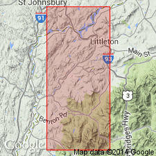
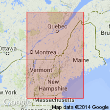
M. Billings (April 26, 1935, personal commun.) stated Highland Croft was chosen from a large farm about 1.5 mi west-northwest of Littleton, Littleton 15-min quadrangle, Ammonoosuc River region, Grafton Co., northwestern NH.
[See also Highlandcroft granodiorite.]
Source: US geologic names lexicon (USGS Bull. 896, p. 955).
- Usage in publication:
-
- Highlandcroft magma series
- Modifications:
-
- Revised
- AAPG geologic province:
-
- New England province
Summary:
Revised as Highlandcroft magma series. Includes the newly named Highlandcroft granodiorite and associated intrusives that are younger than Albee, Ammonoosuc, and Partridge formations and older than Clough, Fitch, and Littleton formations.
Source: GNU records (USGS DDS-6; Reston GNULEX).
- Usage in publication:
-
- Highland Croft magma series
- Modifications:
-
- Revised
- Areal extent
- AAPG geologic province:
-
- New England province
Summary:
Pg. 499. Highlandcroft magma series. Includes Highlandcroft granodiorite in Littleton-Moosilauke area, New Hampshire, Lost Nation quartz monzonite of Percy area, New Hampshire, and Fairlee quartz monzonite of Mount Cube quadrangle, New Hampshire-Vermont. [Age is Late Ordovician.]
Source: Publication; US geologic names lexicon (USGS Bull. 1200, p. 1759).

- Usage in publication:
-
- Highlandcroft plutonic series*
- Modifications:
-
- Revised
- AAPG geologic province:
-
- New England province
Summary:
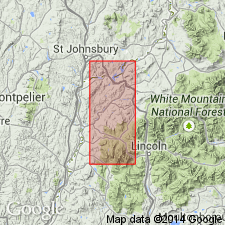
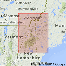
Revised as Highlandcroft plutonic series. Includes diorite, quartz diorite, granodiorite, quartz monzonite, and granite. Many are massive but locally show weak to strong secondary foliation. Rocks assigned to series are correlated chiefly on basis of lithologic similarity. Type area given as body of plutonic rocks 2 mi northwest of Littleton, Grafton Co., NH. Named from a large farm about 1.5 mi west-northwest of Littleton.
Source: GNU records (USGS DDS-6; Reston GNULEX).
- Usage in publication:
-
- Highlandcroft Plutonic Series
- Modifications:
-
- Areal extent
- AAPG geologic province:
-
- New England province
Summary:
Extended into Vermont.
Source: GNU records (USGS DDS-6; Reston GNULEX).
- Usage in publication:
-
- Highlandcroft Plutonic Series*
- Modifications:
-
- Age modified
- Areal extent
- AAPG geologic province:
-
- New England province
Summary:
Age changed to Middle or Late Ordovician. Areally extended to ME in the vicinity if Attean Pond.
Source: GNU records (USGS DDS-6; Reston GNULEX).
- Usage in publication:
-
- Highlandcroft Plutonic Suite*
- Modifications:
-
- Revised
- Age modified
- Geochronologic dating
- AAPG geologic province:
-
- New England province
Summary:
Revised as Highlandcroft Plutonic Suite. Six of its eight plutons were dated by U-Th-Pb methods. Age ranges from 453 to 443 Ma. Individual ages are (from north to south): Attean Quartz Monzonite, 443+/-4 Ma; Adamstown Granite, about 453 Ma; Highlandcroft Granodiorite, 450+/-5 Ma; these three dates support Naylor's (1969) conclusion that the Highlandcroft and Oliverian Plutonic Suites are coeval. The East Inlet pluton, located 20 km northwest of the Highlandcroft belt, yields a younger age of 430+/-4 Ma. Zircons from the Fairlee Quartz Monzonite and Lost Nation pluton (a quartz monzonite) yield scattered isotopic data; Fairlee is about 450 Ma and Lost Nation is about 440 Ma. Geologically, the Fairlee may be coeval with the East Inlet. On the basis of these ages, geologic constraints, and time-scale consideration, the age of the Highlandcroft Plutonic Suite magmatism ranges from Middle or Late Ordovician throughout at least the Early to Middle Silurian.
Source: GNU records (USGS DDS-6; Reston GNULEX).

- Usage in publication:
-
- Highlandcroft Plutonic Suite*
- Modifications:
-
- Age modified
- Geochronologic dating
- AAPG geologic province:
-
- New England province
Summary:
Age changed to Ordovician. Granite of the Adamstown pluton (Adamstown Granite of Guidotti, 1977) yields U-Pb zircon date of about 445 Ma (J.N. Aleinikoff, written commun., 1982).
Source: GNU records (USGS DDS-6; Reston GNULEX).

- Usage in publication:
-
- Highlandcroft Plutonic Suite*
- Modifications:
-
- Age modified
- AAPG geologic province:
-
- New England province
Summary:
Does not use any of the formally named parts of the Suite. Isotope age determinations indicate emplacement in the range of about 452 to 440 Ma, thus making the age Ordovician and Silurian(?) based on Ordovician-Silurian boundary age of 441 on time scale of Tucker and others (1990; also Ross and others, 1982, modified by Ross, 1992, written commun.).
Source: GNU records (USGS DDS-6; Reston GNULEX).

- Usage in publication:
-
- Highlandcroft Plutonic Suite*
- Modifications:
-
- Overview
- Age modified
- Geochronologic dating
- AAPG geologic province:
-
- New England province
Summary:
Used as Late Ordovician Highlandcroft Plutonic Suite. Generally consists of pink to green rocks containing epidote, sericite, and chlorite. Occurs as stocks metamorphosed to greenschist facies and commonly sheared. Coeval with Oliverian Plutonic Suite. Mapped as five separate map units over three individual plutons: Cambridge Black pluton of northern NH, Lost Nation pluton of northwestern NH, and Highlandcroft pluton of northwestern NH. Accompanying 1:500,000-scale map of plutons and sample localities shows the following age data (in Ma) for individual bodies of the Highlandcroft Plutonic Suite: . 1. Lost Nation pluton: 439 +/-25 U/Pb (Lyons and others, 1986); 442 +/-4 U/Pb (J.N. Aleinikoff, oral commun., 1988). 2. Highlandcroft pluton: 450 +/-5 U/Pb (Lyons and others, 1986).
Source: GNU records (USGS DDS-6; Reston GNULEX).
For more information, please contact Nancy Stamm, Geologic Names Committee Secretary.
Asterisk (*) indicates published by U.S. Geological Survey authors.
"No current usage" (†) implies that a name has been abandoned or has fallen into disuse. Former usage and, if known, replacement name given in parentheses ( ).
Slash (/) indicates name conflicts with nomenclatural guidelines (CSN, 1933; ACSN, 1961, 1970; NACSN, 1983, 2005, 2021). May be explained within brackets ([ ]).