- Usage in publication:
-
- Highbridge limestone*
- Modifications:
-
- Named
- Dominant lithology:
-
- Limestone
- AAPG geologic province:
-
- Cincinnati arch
Summary:
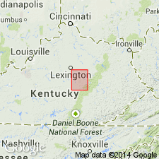
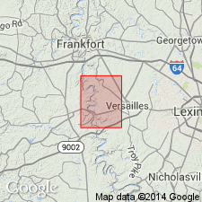
Named for exposures in Kentucky River gorge at High Bridge, Jessamine Co, KY. Consists mostly of heavy beds of fine-grained limestone of a light-blue or gray color, but frequently carrying bands of blue calcareous shale between the limestone layers. Has exposed thickness of nearly 200 ft. Is lowest exposed formation in quadrangle; overlain by Lexington limestone.
Source: GNU records (USGS DDS-6; Reston GNULEX).
- Usage in publication:
-
- Highbridge limestone
- Modifications:
-
- Revised
- AAPG geologic province:
-
- Cincinnati arch
Summary:
Highbridge limestone subdivided into (ascending) Camp Nelson, Oregon, and Tyrone substages.
Source: GNU records (USGS DDS-6; Reston GNULEX).
- Usage in publication:
-
- High Bridge group
- Modifications:
-
- Revised
- AAPG geologic province:
-
- Cincinnati arch
Summary:
Pg. 11-12. High Bridge group. [Spelling changed to conform with name of town. Labeled on early topographic maps with U.S. Postal Service spelling Highbridge.] Massive, cliff-forming limestone of Chazy and Stones River age. Includes (ascending) Camp Nelson, Oregon, and Tyrone limestones.
[On p. 12 (footnote) author states correlations have been changed in 1941 ed. of Schuchert and Dunbar's Historical Geology (John Wiley and Sons). Formations of the High Bridge placed in the Mohawkian; extend from upper Black River into lower Trenton. Camp Nelson along with the Oregon placed in upper Black River and correlated with the Lowville and Chaumont, respectively, of the New York section. The Tyrone was removed from the Lowville and placed at base of the Trenton (Rockland). In subsequent years, these correlations were adopted by most geologists; see also 1954 Correlations of the Ordovician Formations of North America, GSA Bull., v. 65.]
Source: Publication; US geologic names lexicon (USGS Bull. 1200, p. 598); GNC index card files (USGS-Reston).
- Usage in publication:
-
- Highbridge group
- Modifications:
-
- Revised
- AAPG geologic province:
-
- Cincinnati arch
Summary:
Raised in rank to Highbridge group and includes Camp Nelson, Oregon, and Tyrone limestones.
Source: GNU records (USGS DDS-6; Reston GNULEX).
- Usage in publication:
-
- High Bridge Group*
- Modifications:
-
- Revised
- AAPG geologic province:
-
- Cincinnati arch
Summary:
Designated the High Bridge Group which includes the Camp Nelson, Oregon, and Tyrone Limestones.
Source: GNU records (USGS DDS-6; Reston GNULEX).
- Usage in publication:
-
- High Bridge Group*
- Modifications:
-
- Overview
- Age modified
- AAPG geologic province:
-
- Cincinnati arch
Summary:
The High Bridge Group in Kentucky consists of (ascending) the Camp Nelson Limestone, Oregon Formation, and Tyrone Limestone. The group is 550 to 700 feet thick and is the oldest strata exposed in Kentucky. The High Bridge Group is correlative with the Stones River Group of Tennessee and underlies the Lexington Limestone. The High Bridge is of Middle Ordovician (Blackriveran to Kirkfieldian) age.
Source: GNU records (USGS DDS-6; Reston GNULEX).
For more information, please contact Nancy Stamm, Geologic Names Committee Secretary.
Asterisk (*) indicates published by U.S. Geological Survey authors.
"No current usage" (†) implies that a name has been abandoned or has fallen into disuse. Former usage and, if known, replacement name given in parentheses ( ).
Slash (/) indicates name conflicts with nomenclatural guidelines (CSN, 1933; ACSN, 1961, 1970; NACSN, 1983, 2005, 2021). May be explained within brackets ([ ]).

