The National Geologic Map Database is migrating to a new infrastructure. We apologize for any service disruptions during this process.
|
|---|


- Usage in publication:
-
- Hickory Creek shale member
- Modifications:
-
- Overview
Summary:
Pg. 93, 97. Hickory Creek shale member of Plattsburg limestone of Lansing group. Age is Late Pennsylvanian (Missouri age). [See under Merriam limestone. On p. 46 Hickory Creek shale is stated to be 0.5 to 1 foot thick.]
Source: US geologic names lexicon (USGS Bull. 896, p. 950-951); GNC KS-NE Pennsylvanian Corr. Chart, sheet 2, Oct. 1936.
- Usage in publication:
-
- Hickory Creek shale member
- Modifications:
-
- Principal reference
- AAPG geologic province:
-
- Forest City basin
Summary:
Pg. 18, 69, 71-72. Hickory Creek shale member of Plattsburg limestone of Lansing group. Plattsburg limestone divided into 3 members (descending): Spring Hill limestone member, Hickory Creek shale member, and Merriam limestone member. The Hickory Creek shale member consists of 1+/- feet of black carbonaceous shale, which to south becomes gray or yellowish and argillaceous. Locally absent, and 0.5 mi east of De Soto thickens to 20 feet. In some instances, as at south edge of sec. 29, T. 13 S., R. 23 E., the shale is overlain and underlain by a peculiar ochery, shaly limestone or calcareous shale. In such case, for convenience, the yellowish shaly layer is considered the division between the upper and lower Plattsburg. Age is Late Pennsylvanian (Missouri age).
Named from Hickory Creek near Peoria, Franklin Co., eastern KS.
Source: US geologic names lexicon (USGS Bull. 896, p. 950-951); GNC KS-NE Pennsylvanian Corr. Chart, sheet 2, Oct. 1936.

- Usage in publication:
-
- Hickory Creek shale member
- Modifications:
-
- Overview
Summary:
Hickory Creek shale member of Plattsburg limestone of Lansing group. Stated that Newell is author of this name. Thickness 0 to 40 feet. Age is Late Pennsylvanian (Missouri age).
Source: US geologic names lexicon (USGS Bull. 896, p. 950-951); GNC KS-NE Pennsylvanian Corr. Chart, sheet 2, Oct. 1936.
- Usage in publication:
-
- Hickory Creek shale member*
- Modifications:
-
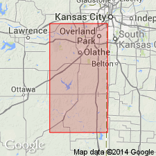
- Areal extent
Summary:
Pg. 33. Hickory Creek shale member of Plattsburg formation. Thickness in Nebraska 1 to 3 feet or more; in Kansas 1 foot in a few places to maximum locally of 15 or more. Underlies Spring Hill limestone member; overlies Merriam limestone member. Age is Late Pennsylvanian (Missourian). Type locality stated.
Type locality: in RR cut near center east side sec. 14, T. 15 S., R. 23 E., southern Johnson Co., eastern KS.
Source: US geologic names lexicon (USGS Bull. 1200, p. 1752).
For more information, please contact Nancy Stamm, Geologic Names Committee Secretary.
Asterisk (*) indicates published by U.S. Geological Survey authors.
"No current usage" (†) implies that a name has been abandoned or has fallen into disuse. Former usage and, if known, replacement name given in parentheses ( ).
Slash (/) indicates name conflicts with nomenclatural guidelines (CSN, 1933; ACSN, 1961, 1970; NACSN, 1983, 2005, 2021). May be explained within brackets ([ ]).