The National Geologic Map Database is migrating to a new infrastructure. We apologize for any service disruptions during this process.
|
|---|


- Usage in publication:
-
- Hermosa formation*
- Modifications:
-
- Incidental mention
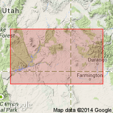
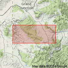
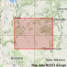
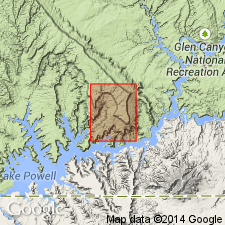
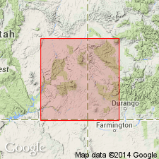
- Areal extent
- AAPG geologic province:
-
- San Juan basin
Summary:
Pg. 8. From section displayed in Animas Valley and at Rico we can assume presence of other sedimentary formations below Dolores formation (oldest exposed) in La Plata dome. These embrace Rico and Hermosa (Carboniferous), the Ouray (Devonian), and the Ignacio (Cambrian), all in apparent structural conformity.
Source: US geologic names lexicon (USGS Bull. 896, p. 945).
- Usage in publication:
-
- Hermosa formation*
- Modifications:
-
- Principal reference
- Dominant lithology:
-
- Limestone
- Shale
- Sandstone
- AAPG geologic province:
-
- San Juan basin
Summary:
Pg. 48. Hermosa formation. Tbe upper part is a complex of shales with occasional limestones; middle part is many bands of massive dark-gray limestone, often highly fossiliferous, alternating with sandstones and conglomerates; lower part is greenish-gray sandstones and shales, the latter sometimes nearly black. Thickness 1,800 feet. Underlies Rico formation and overlies Devonian limestone and quartzite. [Age is Pennsylvanian.]
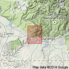
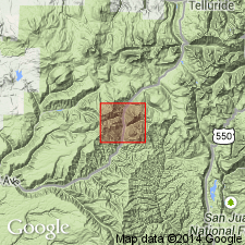
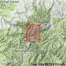
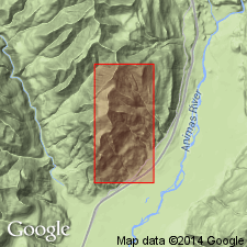
Named from Hermosa Creek, which flows into Animas River north of Durango, [Durango quadrangle, La Plata Co.], southwestern CO.
Source: US geologic names lexicons (USGS Bull. 896, p. 945; supplemental information from USGS Bull. 1200, p. 1742-1744).
- Usage in publication:
-
- Hermosa formation*
- Modifications:
-
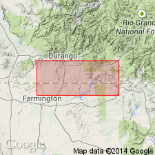
- Areal extent
- AAPG geologic province:
-
- San Juan Mountains province
Summary:
Applied Molas formation to 75 feet of Pennsylvanian strata which intervene between Hermosa formation and Ouray limestone and which are absent in area where Hermosa formation was first described.
[GNC remark (ca. 1936, US geologic names lexicon, USGS Bull. 896, p. 945): in southeastern Utah and parts of southwestern Colorado the intrusive Paradox formation intervenes below Hermosa formation and is believed by J.B. Reeside, Jr., and A.A. Baker to be younger than Molas limestone.]
Source: US geologic names lexicon (USGS Bull. 896, p. 945).
- Usage in publication:
-
- Hermosa formation
- Modifications:
-
- Principal reference
- Dominant lithology:
-
- Conglomerate
- Sandstone
- Limestone
- Shale
- AAPG geologic province:
-
- San Juan basin
Summary:
Pg. 945. Since Spencer [in Cross and Spencer, 1899] gave no specific type locality for Hermosa formation, the type section has been selected as in secs. 26 and 35, T. 37 N., R. 9 W., La Plata County, southwestern Colorado, for following reasons: (1) it is easy of access, as main highway between Durango and Silverton passes through the area; (2) total thickness (2,146 feet) is approximately same as maximum given by Spencer for the Hermosa; (3) the section is in area considered typical of the Hermosa by Spencer and is well within the area mapped as Hermosa by the Colorado Geological Survey. Fauna of typical Hermosa is of Cherokee age [Middle Pennsylvanian (Des Moines)].
Source: US geologic names lexicon (USGS Bull. 896, p. 945).
- Usage in publication:
-
- Hermosa formation
- Modifications:
-
- Revised
- AAPG geologic province:
-
- Paradox basin
- San Juan basin
Summary:
Pg. 2165-2166, 2167 (fig. 7), 2173-2174, 2188-2190. Hermosa formation. Described in Paradox salt basin, Four Corners region, Colorado and Utah. Original Hermosa included all beds from top of Rico member of Cutler formation to top of Leadville limestone. Devonian strata referred to by Spencer was actually the presently known Leadville limestone of Mississippian age. Section measured in this report is almost exactly the one designated as type section by Roth (1934, AAPG Bull., v. 18, no. 7). Hermosa of this report is restricted to clastic facies and carbonate facies that occur above Paradox here treated as a formation. Fusulind control shows carbonate facies as Wolfcamp, Virgil, Missouri, Des Moines (Marmaton, and locally Cherokee); clastic facies is Wolfcamp, Virgil, and Missouri. Top of Hermosa has been recognized, in past, in beds ranging from Wolfcamp to Des Moines in age, throughout stratigraphic interval of at least 800 feet. Inconsistent definitions of gross sections and their lithologic character without paleontologic control are responsible for this situation. Research has led to establishment of "R" datum, commonly a sandy limestone found in or near base of marine Wolfcamp series and approximately equivalent to Mendenhall sandstone at Honaker Trail, San Juan Canyon, Utah. This datum believed to be almost true time surface whose position does not vary more than 100 feet from some, as yet unidentifiable, true time-stratigraphic surface. In parts of region, this datum is exactly on top of section commonly considered to be the true Hermosa section and for purposes of regional correlation is considered to mark top of Hermosa section as chosen by Roth in type locality. "R" datum plane is approximately base of Rico transition facies here treated as basal member of Cutler formation.
Source: US geologic names lexicon (USGS Bull. 1200, p. 1742-1744).
- Usage in publication:
-
- Hermosa group
- Modifications:
-
- Revised
- AAPG geologic province:
-
- Black Mesa basin
- Paradox basin
- San Juan basin
Summary:
Pg. 31-46. Hermosa Group. In subsurface, comprises (ascending) Lime Ridge formation (new), Pinkerton Trail formation, Barker Creek zone, Paradox formation, Ismay zone, and Honaker Trail formation. [Age is Middle Pennsylvanian.]
Source: US geologic names lexicon (USGS Bull. 1200, p. 1742-1744).
- Usage in publication:
-
- Hermosa group
- Modifications:
-
- Revised
- AAPG geologic province:
-
- Black Mesa basin
- Paradox basin
- San Juan basin
Summary:
Pg. 2056. Hermosa group. Rank raised to group. Comprises (ascending) Pinkerton Trail, Paradox, and Honaker Trail (new) formations. Overlies Molas formation; underlies Cutler group. [Age is Middle Pennsylvanian.]
Source: US geologic names lexicon (USGS Bull. 1200, p. 1742-1744).
- Usage in publication:
-
- Hermosa Formation*
- Modifications:
-
- Areal extent
- AAPG geologic province:
-
- Plateau sedimentary province
Summary:
The name Upper and Middle Pennsylvanian Hermosa Formation geographically extended westward from the Paradox basin into the subsurface of Kane Co, UT, Plateau sedimentary province, where Hermosa overlies Lower Pennsylvanian Molas Formation and underlies Lower Permian Halgaito Tongue of the Cutler Formation. Hermosa consists of 498 ft of interbedded white, pink, and brown fine-grained sandstone, red, pink, and brown siltstone, red shale, white to brown limestone with algal structures and white to red chert. Columnar section. Marine deposit.
Source: GNU records (USGS DDS-6; Denver GNULEX).
- Usage in publication:
-
- Hermosa Formation*
- Modifications:
-
- Areal extent
- AAPG geologic province:
-
- Paradox basin
Summary:
When evaporite facies is present, Hermosa can be subdivided into Lower Member (carbonate facies; equivalent to Pinkerton Trail Formation of Wengerd and Matheny, 1958), Paradox Member (evaporite facies), and Upper Member (carbonate facies; equivalent to Honaker Trail Formation of Wengerd and Matheny). Study area is in Paradox basin of southeast UT and southwest CO. Lower Member (Atokan), which overlies Molas Formation (Morrowan to Atokan), is up to 400 ft thick along southwest margin of Paradox basin and thins to less than 50 ft in deepest part of basin due to lateral transition into predominately halite facies of Paradox Member. Paradox Member consists of 29 identifiable evaporite cycles and its maximum depositional thickness was probably about 7,000 ft. Some of black shales in evaporite-carbonate cycles within Paradox Member have been given informal names by petroleum industry (for example the shale in cycle 3 is also called "Gothic" and another shale at base of cycle 5 is commonly called "Chimney Rock"). Upper Member (late Desmoinesian to Virgilian age, and locally may range into the Wolfcampian) is transitional with overlying Cutler Formation; ranges in thickness from about 1,000-1,700 ft. Fig 2 shows stratigraphic nomenclature.
Source: GNU records (USGS DDS-6; Denver GNULEX).
- Usage in publication:
-
- Hermosa Group*
- Hermosa Formation*
- Modifications:
-
- Areal extent
- AAPG geologic province:
-
- Black Mesa basin
- Paradox basin
- San Juan basin
Summary:
Pg. A5 (fig. 3), A23-A28, pl. 1 (geol. map). Hermosa Group; Hermosa Formation (where group cannot be subdivided into distinct formations, pl. 1). Recognized in subsurface and surface of the Four Corners region of southwestern Colorado, northwestern New Mexico, northeastern Arizona, and southeastern Utah. Is an oil- and gas-producing unit. Conformably underlies Rico Formation (Upper? Pennsylvanian to Lower Permian; Virgilian? to Wolfcampian). Conformably overlies Molas Formation (Upper Mississippian? to Middle Pennsylvanian; Chesterian? to Atokan) [on geol. map stratigraphic range of Molas stated as Pennsylvanian]. Correlative with Madera Formation of Zuni uplift area, New Mexico. Fossils (notably algae IVANOVIA). Age is Middle to Late(?) Pennsylvanian (Atokan to Virgilian?).
Hermosa Group (text; figs. 11-14, isopach maps). Thickness about 400 to 2,800 feet on Reservation; up to 3,200 feet northwest of Reservation. Consists of (descending): (1) Honaker Trail Formation (original definition of Wengerd and Matheny, 1958), limestone and dolomite, siltstone, and sandstone, 0 to 1,200+ feet; (2) Paradox Formation, cyclic beds of evaporites and minor shale, 0 to 2,100+ feet; and (3) Pinkerton Trail Formation, limestone and minor shale, 0 to 160+ feet.
Hermosa Formation (pl. 1, not separately mapped). Described as medium- to dark-gray limestone interbedded with gray, olive, and red shale and mudstone, and with dark- to light-brown sandstone, arkose, and conglomerate. Thickness as much as 900 feet.
Source: Publication.
For more information, please contact Nancy Stamm, Geologic Names Committee Secretary.
Asterisk (*) indicates published by U.S. Geological Survey authors.
"No current usage" (†) implies that a name has been abandoned or has fallen into disuse. Former usage and, if known, replacement name given in parentheses ( ).
Slash (/) indicates name conflicts with nomenclatural guidelines (CSN, 1933; ACSN, 1961, 1970; NACSN, 1983, 2005, 2021). May be explained within brackets ([ ]).