The National Geologic Map Database is migrating to a new infrastructure. We apologize for any service disruptions during this process.
|
|---|


- Usage in publication:
-
- Herbert conglomerate
- Modifications:
-
- Original reference
- Dominant lithology:
-
- Sandstone
- Conglomerate
- AAPG geologic province:
-
- Appalachian basin
Summary:
Pg. 49-50, and under county descriptions. Herbert conglomerate. Basal member of Bonair sandstone. Consists of 40 to 150 feet of soft, light-yellow sandstone, coarse grained and in places conglomeratic. Underlies Eastland shale lentil of Bonair sandstone, and rests on Whitwell shale. [Age is Early Pennsylvanian (early Pottsville).]
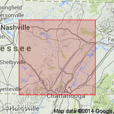
Recognized in Bledsoe, White, Van Buren, Hamilton, and Cumberland Cos., southeastern TN. Best measurement was taken on Glade Creek just north of old road from [Herbert Domain], Bledsoe Co., to Sparta crosses this stream, [Pikeville quadrangle, scale 1:125,000], southeastern TN.
Source: US geologic names lexicon (USGS Bull. 896, p. 943).
- Usage in publication:
-
- Herbert member
- Modifications:
-
- Revised
- AAPG geologic province:
-
- Appalachian basin
Summary:
Listed as Herbert member of Lee formation. [Age is Early Pennsylvanian (Pottsville).]
Source: US geologic names lexicon (USGS Bull. 1200, p. 1737-1738).

- Usage in publication:
-
- Herbert sandstone
- Modifications:
-
- Revised
- AAPG geologic province:
-
- Appalachian basin
Summary:
Chart 6 (column 17). Herbert sandstone. Pennsylvanian correlation chart shows Herbert sandstone underlying Eastland formation and overlying Whitwell [shale]. [Age is Early Pennsylvanian (Pottsville).]
Source: US geologic names lexicon (USGS Bull. 1200, p. 1737-1738).

- Usage in publication:
-
- Herbert conglomerate member[†]
- Modifications:
-
- [Abandoned]
- AAPG geologic province:
-
- Appalachian basin
Summary:
Pg. 4. Herbert conglomerate member of Bon Air sandstone. The conglomeratic phase of Newton sandstone in southern Cumberland and northern Bledsoe Counties was the type "Herbert conglomerate" erroneously considered by Nelson (1925) to be older than Newton. Shale thought to be between sandstones and named "Eastland shale" by Nelson is actually Whitwell shale; therefore, names "Herbert" and "Eastland" are discarded [abandoned].
Source: US geologic names lexicon (USGS Bull. 1200, p. 1737-1738).
For more information, please contact Nancy Stamm, Geologic Names Committee Secretary.
Asterisk (*) indicates published by U.S. Geological Survey authors.
"No current usage" (†) implies that a name has been abandoned or has fallen into disuse. Former usage and, if known, replacement name given in parentheses ( ).
Slash (/) indicates name conflicts with nomenclatural guidelines (CSN, 1933; ACSN, 1961, 1970; NACSN, 1983, 2005, 2021). May be explained within brackets ([ ]).