The National Geologic Map Database is migrating to a new infrastructure. We apologize for any service disruptions during this process.
|
|---|


- Usage in publication:
-
- Henefer formation*
- Modifications:
-
- Original reference
- Dominant lithology:
-
- Shale
- Conglomerate
- AAPG geologic province:
-
- Uinta basin
- Wasatch uplift
Summary:
Pg. 824 (table 1), 840-842, 845, pl. 1. Henefer formation. Red, pink, purple, and light-gray shales; red and gray sandstones with numerous lenses of pea and pebble conglomerate; gray, tan, brown, and red pebble and boulder conglomerate; 200-foot bed of volcanic tuff near base. Thickness 1,250 feet at Echo Dam; 10,000 feet in Harris Creek Canyon. Overlies Frontier formation; underlies Pulpit conglomerate [member] (new) of Almy conglomerate. Norwood tuff (new) is inlaid in the Henefer in Little East Canyon. Age is Early Paleocene, post-Montana or upper Montana. Probably equivalent to all or part of the Hilliard, Adaville, and Evanston.
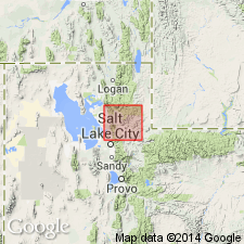
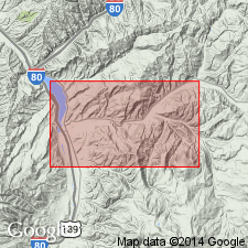
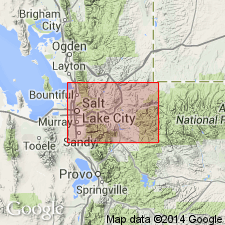
Named from exposures in Harris Creek Canyon northeast of Henefer, Summit Co., [Henefer and Devils Slide 7.5-min quadrangles], northeastern UT. From Franklin Canyon, [in T. 3 N., R. 4 E., Coalville 7.5-min quadrangle, Summit Co., UT,] westward, forms both sides of Henefer Valley to narrows of Upper Weber Canyon, [at north end of Henefer Valley, in T. 4 N., R. 4 E., Devils Slide 7.5-min quadrangle, Summit Co., UT].
[Typographical error (US geologic names lexicon, USGS Bull. 1200, p. 1733). The Henefer Formation extends westward from Franklin Canyon, not Franklin County.]
Source: Publication; US geologic names lexicon (USGS Bull. 1200, p. 1732-1733).
- Usage in publication:
-
- Henefer formation
- Modifications:
-
- Areal extent
- AAPG geologic province:
-
- Uinta basin
- Wasatch uplift
Eardley, A.J., 1951, Restudy of the type Wasatch [abs.]: Geological Society of America Bulletin, v. 62, no. 12, pt. 2, p. 1435.
Summary:
Henefer conformably underlies beds considered Almy, and is probably a lower member of the Almy.
Source: US geologic names lexicon (USGS Bull. 1200, p. 1732-1733).
- Usage in publication:
-
- Henefer formation
- Modifications:
-
- Areal extent
- AAPG geologic province:
-
- Central Western Overthrust
Summary:
Pg. 136 (chart 1), 142. Henefer formation. Frontier formation redefined. Name Henefer as originally defined is preferred to term Wanship of Williams and Madsen (1959) in restricted sense. This opinion is based on premise that upper boundary of Frontier should be placed on basis of gross lithologic character. The Henefer would then be defined as lying between the highest white sandstone of the Frontier (Upton member, new) and Echo Canyon (formerly Pulpit) conglomerate. [Age is Late Cretaceous.]
Source: US geologic names lexicon (USGS Bull. 1200, p. 1732-1733).
- Usage in publication:
-
- Henefer Formation*
- Modifications:
-
- Biostratigraphic dating
- Mapped 1:100k
- Dominant lithology:
-
- Clay
- Siltstone
- Sandstone
- Conglomerate
- AAPG geologic province:
-
- Uinta uplift
Summary:
Is Upper Cretaceous formation mapped in vicinity of Parleys Canyon syncline and Clark Canyon syncline in north-central part of map area, Summit Co, UT (Uinta uplift). Overlies upper member of Frontier Formation (Upper Cretaceous). Is overlain by Echo Canyon Conglomerate (Upper Cretaceous). Map unit described as light-gray clay, siltstone, sandstone, and conglomerate; red siltstone and clay; and gray calcareous siltstone containing a few thin lenses of coal. Beds and lenses of pebble and cobble conglomerate numerous near top. Thickness about 800 m. Palynomorphs recovered from 15 samples. Upper 200 m (7 samples) assigned to PROTEACIDITES RETUSUS palynostratigraphic zone (Coniacian-Santonian) and lower 350 m (8 samples) assigned to NYSSAPOLLENITES palynostratigraphic zone (Cenomanian-Coniacian). It is noted that there may no Cenomanian samples from the map area.
Source: GNU records (USGS DDS-6; Denver GNULEX).
For more information, please contact Nancy Stamm, Geologic Names Committee Secretary.
Asterisk (*) indicates published by U.S. Geological Survey authors.
"No current usage" (†) implies that a name has been abandoned or has fallen into disuse. Former usage and, if known, replacement name given in parentheses ( ).
Slash (/) indicates name conflicts with nomenclatural guidelines (CSN, 1933; ACSN, 1961, 1970; NACSN, 1983, 2005, 2021). May be explained within brackets ([ ]).