

- Usage in publication:
-
- Helderberg Group*
- Modifications:
-
- Revised
- AAPG geologic province:
-
- Appalachian basin
Summary:
Pg. 2 (fig. 1), 34-35, 36 (fig. 11), 55-57, 65-67, pl. 1. Minisink Limestone included in Helderberg Group in New Jersey and Pennsylvania. Age is Early Devonian.
Source: Changes in stratigraphic nomenclature, 1967 (USGS Bull. 1274-A, p. A9).
- Usage in publication:
-
- Helderberg Group
- Modifications:
-
- Revised
- AAPG geologic province:
-
- Appalachian basin
Summary:
Newly named Bald Hill Bentonite Beds (A,B,C) have been identified within Helderberg strata in PA, NY, MD, WV, and VA. Beds A and B occur within the New Scotland Formation in PA and WV and within the correlative Corriganville Limestone in MD. Bed C occurs near the base of the overlying Mandata in all three states. In NY, Beds A, B, and C occur within the middle member of the Kalkberg Limestone. Bed A is presumably equivalent to Rickard's (1962) Kalkberg bentonite.
Source: GNU records (USGS DDS-6; Reston GNULEX).
- Usage in publication:
-
- Helderberg Limestone*
- Modifications:
-
- Areal extent
- AAPG geologic province:
-
- Appalachian basin
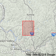
Summary:
Helderberg Limestone accepted for use in subsurface in vicinity of Sissonville quad, Kanawha, Jackson, and Putnam Cos, WV.
Source: GNU records (USGS DDS-6; Reston GNULEX).

- Usage in publication:
-
- Helderberg Group*
- Modifications:
-
- Biostratigraphic dating
- AAPG geologic province:
-
- Appalachian basin
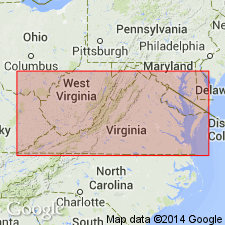
Summary:
The Helderberg Group in the northern VA, northeastern WV, and western MD is of latest Silurian (Pridolian) and Early Devonian (Lochkovian) age based on conodont biostratigraphy. The Silurian-Devonian boundary occurs in the upper part of the Keyser Limestone. The Helderberg Group in this area consists of (ascending) the Keyser, New Creek, and Licking Creek Limestones.
Source: GNU records (USGS DDS-6; Reston GNULEX).
- Usage in publication:
-
- Helderberg Group
- Modifications:
-
- Overview
- Areal extent
- AAPG geologic province:
-
- Appalachian basin
Summary:
Helderberg Group in the Catawba syncline is composed of 1 m of Clifton Forge Sandstone Member(?) of Keyser Formation and 8 m of Rocky Gap Sandstone consisting of calcitic, cross-bedded, shoaling marine sandstones containing some poorly preserved marine body fossils. Unconformably overlies the Silurian "Keefer" Sandstone (used informally here.) Age is Early Devonian only in this area.
Source: GNU records (USGS DDS-6; Reston GNULEX).
For more information, please contact Nancy Stamm, Geologic Names Committee Secretary.
Asterisk (*) indicates published by U.S. Geological Survey authors.
"No current usage" (†) implies that a name has been abandoned or has fallen into disuse. Former usage and, if known, replacement name given in parentheses ( ).
Slash (/) indicates name conflicts with nomenclatural guidelines (CSN, 1933; ACSN, 1961, 1970; NACSN, 1983, 2005, 2021). May be explained within brackets ([ ]).