- Usage in publication:
-
- Hazel Patch sandstone
- Modifications:
-
- Informally named
- AAPG geologic province:
-
- Appalachian basin
Summary:
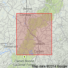
The Hazel Patch sandstone of the Breathitt Formation is informally named in this report for outcrops near Hazel Patch in Laurel Co., KY. Overlies and underlies 5 to 8 m of dark, silty, carbonaceous shale. Thickness ranges from 15 to 40 m in the type area. Unit contains a wide variety of rhythmic bedding. Previously interpreted as a series of distributary channels based on the coarse-grained, cross-bedded facies found at the type, but new exposures along I-75 reveal large sections of a sheet-form, finer grained, ripple-dominated facies. The Hazel Patch is divided into five lithofacies: cross-bedded, swaly to even-bedded, even-bedded scour-fill, ripple-bedded, and inclined heterolithic scour-fill. Present study supports interpretation of tidal currents and waves as the dominant sedimentary process during deposition.
Source: GNU records (USGS DDS-6; Reston GNULEX).

- Usage in publication:
-
- Hazel Patch sandstone
- Modifications:
-
- Areal extent
- AAPG geologic province:
-
- Appalachian basin
Summary:
Corr. chart. Hazel Patch sandstone (informal, unranked) in Grundy Formation of Breathitt Group. Sandstone. Recognized in eastern Kentucky, between informal Molus shale member above and Dave Branch shale member below. Capped by Splash Dam (Gray Hawk, Mine Fork) coal bed. Age is Early Pennsylvanian (Westphalian; Morrowan). [Peppers (1996, GSA Memoir 188, p. 9, pl.) placed the Splash Dam (Gray Hawk) coal in upper part of Westphalian A, RADIIZONATES ALIGERENS (RA) miospore assemblage zone of western Europe.]
[Hazel Patch Sandstone Member of Grundy Formation of Breathitt Group recognized in Licking River and Southwestern districts, eastern KY. See Chesnut, 1997 (revised Oct. 12, 1999), Stratigraphy of the coal-bearing strata of the Eastern Kentucky coal field, available online through the Kentucky Geol. Survey (http://www.uky.edu/KGS/coal/coalcorrel.htm).]
Source: Publication.
For more information, please contact Nancy Stamm, Geologic Names Committee Secretary.
Asterisk (*) indicates published by U.S. Geological Survey authors.
"No current usage" (†) implies that a name has been abandoned or has fallen into disuse. Former usage and, if known, replacement name given in parentheses ( ).
Slash (/) indicates name conflicts with nomenclatural guidelines (CSN, 1933; ACSN, 1961, 1970; NACSN, 1983, 2005, 2021). May be explained within brackets ([ ]).

