The National Geologic Map Database is migrating to a new infrastructure. We apologize for any service disruptions during this process.
|
|---|


- Usage in publication:
-
- Haystack gypsum
- Modifications:
-
- Named
- Dominant lithology:
-
- Gypsum
- AAPG geologic province:
-
- South Oklahoma folded belt
Summary:
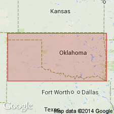
Named as a unit (one of 6 named units) in the Greer division for exposures on Haystack Creek, in vicinity of Haystack Butte, and on North and Elm Forks, Greer Co, OK in the South Oklahoma folded belt province. Consists of a ledge of white to grayish massive gypsum with a few bands of gypsiferous sandstone. Overlain and underlain by unnamed red clay shale of the Greer. The ledge is often cut by joints that separate into rectangular blocks. Varies from 18 to 25 ft thick. Permian age.
Source: GNU records (USGS DDS-6; Denver GNULEX).
- Usage in publication:
-
- Haystack gypsum member†
- Modifications:
-
- Abandoned
Summary:
Haystack gypsum member of Greer formation presumably abandoned, because Greer formation is abandoned in this report. For the so-called "eastern area" of the Greer, the name Cloud Chief formation is proposed. It is shown that the rocks in the "western area" of the Greer belong to Blaine, Dog Creek, Whitehorse, and Cloud Chief (new) [Chaney, Kaiser, Haystack, Cedartop, Collingsworth, and Mangum, formerly members of the Greer, are presumably also abandoned.] The report area--southwestern OK--includes all or parts of 10 counties east, northeast, north, northwest and west of the Wichita Mountains, S. Oklahoma folded belt province and Anadarko basin. The new classification of the Permian of this area is as follows (ascending): Duncan sandstone (new), Chickasha formation (new), Blaine gypsum (revised), Dog Creek shale (rank raised), Whitehorse sandstone (rank raised), Day Creek dolomite (rank raised), Cloud Chief formation (new), and Quartermaster formation (revised). All of these units are stratigraphic equivalents of the Double Mountain, the uppermost Permian division of TX. Geologic map. Of Permian age.
Source: GNU records (USGS DDS-6; Denver GNULEX).
- Usage in publication:
-
- Haystack Gypsum Bed
- Modifications:
-
- Revised
- AAPG geologic province:
-
- Palo Duro basin
- Anadarko basin
- South Oklahoma folded belt
Summary:
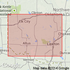
Reduced in stratigraphic rank from member of Blaine Formation and reassigned as a bed of Elm Fork Member (first used) of Blaine Formation of El Reno Group. Is usually the basal bed of the Elm Fork, except in areas on south flank of Anadarko basin along the Kiowa-Washita Co line and in the southeast half of the Hollis basin in Jackson Co and southern parts of Greer and Harmon Cos where the Gypsum Creek Dolomite Bed (first published use) is the basal bed of the Elm Fork. Cross section. Measured sections. Is 16.6 ft thick at Elm Fork type where it consists of a lower and upper white fine crystalline gypsum separated by a tan fine crystalline dolomite. Ranges between 10.4 to 16 ft thick. Consists of one gypsum bed at some localities. Sections also measured in Greer Co (S. Oklahoma folded belt province), Harmon and Jackson Cos (Palo Duro basin), and Beckham Co (Anadarko basin). Underlies unnamed gray to red-brown shale of Elm Fork. Permian age.
Source: GNU records (USGS DDS-6; Denver GNULEX).
For more information, please contact Nancy Stamm, Geologic Names Committee Secretary.
Asterisk (*) indicates published by U.S. Geological Survey authors.
"No current usage" (†) implies that a name has been abandoned or has fallen into disuse. Former usage and, if known, replacement name given in parentheses ( ).
Slash (/) indicates name conflicts with nomenclatural guidelines (CSN, 1933; ACSN, 1961, 1970; NACSN, 1983, 2005, 2021). May be explained within brackets ([ ]).