


- Usage in publication:
-
- Haystack Mountains Formation*
- Modifications:
-
- Named
- Dominant lithology:
-
- Sandstone
- Shale
- AAPG geologic province:
-
- Green River basin
Summary:
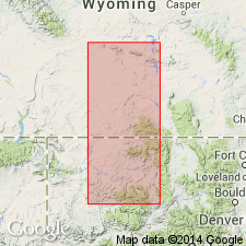
Named for Haystack Mountains W1/2 Ts 22-23N, R86W, Carbon Co, WY. Type section measured in NE1/4 NE1/4 sec 22, NE1/4 sec 23, and SE1/4 SE1/4 sec 14, T22N, R86W, Sinclair 7 1/2 min quad, Carbon Co. Divided into Tapers Ranch Sandstone Member (new, at base), lower unnamed member, O'Brien Spring Sandstone Member (new), middle unnamed member, Hatfield Sandstone Member (adopted), and upper unnamed member. Is a widespread unit recognized in the Great Divide, Washakie, Hanna, and Carbon basins, and on flanks of Rawlins uplift, all in Greater Green River basin. Consists of thick marine sandstones, deposited in nearshore and offshore environments interbedded with thick marine shales deposited in deeper water environments. Sandstones are yellow gray, very fine to fine grained, very thin to thin bedded, and commonly burrowed; they are as much as 275 ft thick. Shales are gray to dark gray; they contain fossiliferous concretions which may be rusty weathering, ironstone, limestone, or argillaceous sandstone. Ranges from 850 ft (at Hatfield dome) to 2,544 ft at type section. Conformably overlies Steele Shale, and conformably underlies Allen Ridge Formation. Reference section established and measured at SE1/4 sec 36, T25N, R84W, Carbon Co, where all members are present and where section is 2,265 ft thick.
Source: GNU records (USGS DDS-6; Denver GNULEX).
- Usage in publication:
-
- Haystack Mountains Formation*
- Modifications:
-
- Revised
- Biostratigraphic dating
- AAPG geologic province:
-
- Green River basin
Summary:
Divided at Point of Rocks, Sweetwater Co, at Espy Ranch and Wild Cow Creek, Carbon Co, WY, Greater Green River basin, into: Deep Creek Sandstone Member, at base (revised) (adopted); Hatfield Sandstone Member; and an upper unnamed part. Deep Creek and Hatfield separated by Espy Tongue (adopted) of Steele Shale. Is of Late Cretaceous, Campanian age. Ranges from BACULITES MACLEARNI into B. PERPLEXUS zone. Correlation with Mancos Shale of CO shown. Underlies Allen Ridge Formation.
Source: GNU records (USGS DDS-6; Denver GNULEX).
For more information, please contact Nancy Stamm, Geologic Names Committee Secretary.
Asterisk (*) indicates published by U.S. Geological Survey authors.
"No current usage" (†) implies that a name has been abandoned or has fallen into disuse. Former usage and, if known, replacement name given in parentheses ( ).
Slash (/) indicates name conflicts with nomenclatural guidelines (CSN, 1933; ACSN, 1961, 1970; NACSN, 1983, 2005, 2021). May be explained within brackets ([ ]).