The National Geologic Map Database is migrating to a new infrastructure. We apologize for any service disruptions during this process.
|
|---|


- Usage in publication:
-
- Hawi volcanic series
- Modifications:
-
- Named
- Dominant lithology:
-
- Volcanics
- AAPG geologic province:
-
- Hawaii
Summary:
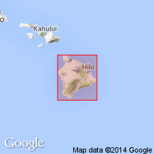
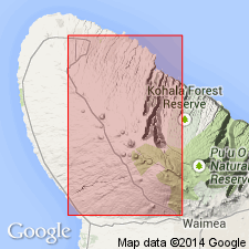
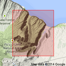
Named for town of Hawi. Type section in quarry of Kohala Sugar Company, .5 mi east of Hawi in Kumakua Gulch, Kohala Volcano [20 deg 15' 30"N, 155 deg 49' 18"W, Hawi 7.5' quad], Island of Hawaii. Covers summit area and part of slopes of Kohala Mountains. Composed largely of oligoclase andesite (mugearite) and some trachyte in dikes. Individual flows are as much as 150 ft thick. May attain total thickness of 500 ft near the summit. Measured section under Pacific Sugar Mill near Kukuihaele is 140.6+ ft thick. Overlies with erosional unconformity and locally conformably Pololu volcanic series (new). Overlain by Pahala ash and overlapped by lavas of Hamakua volcanic series. Map shows Pleistocene age.
Source: GNU records (USGS DDS-6; Menlo GNULEX).
- Usage in publication:
-
- Hawi volcanic series*
- Modifications:
-
- Overview
- AAPG geologic province:
-
- Hawaii
Summary:
On northeast side of Kohala Volcano unconformably overlies eroded basalts of Pololu volcanic series. On west, south. and north slopes there may be local unconformities but generally Hawi conformably overlies Polulu volcanic series.
Source: GNU records (USGS DDS-6; Menlo GNULEX).
- Usage in publication:
-
- Hawi volcanic series*
- Modifications:
-
- Age modified
- AAPG geologic province:
-
- Hawaii
Summary:
Younger than Pololu volcanic series and older than part of upper member of Hamakua volcanic series and Pahala ash. Canyons 3,000 ft deep were eroded by streams into Pololu lavas before eruption of Hawi lavas. No fossils. Assigned Pleistocene age.
Source: GNU records (USGS DDS-6; Menlo GNULEX).
- Usage in publication:
-
- Hawi volcanic series*
- Modifications:
-
- Geochronologic dating
- AAPG geologic province:
-
- Hawaii
Summary:
K-Ar ages on whole rock samples from Hawi Volcanic Series: trachyte (collected 0.7 mi southwest of Puu Loa) ranged from 0.149 +/-0.006 to 0.135 +/-0.005 Ma; hawaiite (collected 0.85 mi west-northwest of Puu Loa) ranged from 0.166 +/-0.005 to 0.144 +/-0.003 Ma; and hawaiite (collected 0.4 mi northwest of Waiaka) ranged from 0.203 +/-0.009 to 0.190 +/-0.009 Ma.
Source: GNU records (USGS DDS-6; Menlo GNULEX).
- Usage in publication:
-
- Hawi Volcanic Series*
- Modifications:
-
- Geochronologic dating
- AAPG geologic province:
-
- Hawaii
Summary:
K-Ar ages on three samples from Hawi Volcanic Series yielded 0.196 +/-0.007 Ma, 0.153 +/-0.007 Ma, and 0.140 +/-0.004 Ma
Source: GNU records (USGS DDS-6; Menlo GNULEX).
- Usage in publication:
-
- Hawi Volcanic Series*
- Modifications:
-
- Geochronologic dating
- AAPG geologic province:
-
- Hawaii
Summary:
K-Ar ages on nine samples of mugearite from Hawi Volcanic Series yielded 0.25 +/-0.01 Ma to 0.059 +/-0.001 Ma. This is "minimum estimate".
Source: GNU records (USGS DDS-6; Menlo GNULEX).
- Usage in publication:
-
- Hawi Formation
- Modifications:
-
- Revised
- AAPG geologic province:
-
- Hawaii
Summary:
Name changed from Hawi Volcanic Series to Hawi Formation to conform with Code of Stratigraphic Nomenclature (Henderson and others, 1980)
Source: GNU records (USGS DDS-6; Menlo GNULEX).

- Usage in publication:
-
- Hawi Volcanics*
- Modifications:
-
- Revised
- AAPG geologic province:
-
- Hawaii
Summary:
Name changed to Hawi Volcanics (formerly Hawi Volcanic Series of Stearns and Macdonald, 1946) to reflect its lithology. Is Pleistocene age on basis of K-Ar determinations.
Source: GNU records (USGS DDS-6; Menlo GNULEX).
For more information, please contact Nancy Stamm, Geologic Names Committee Secretary.
Asterisk (*) indicates published by U.S. Geological Survey authors.
"No current usage" (†) implies that a name has been abandoned or has fallen into disuse. Former usage and, if known, replacement name given in parentheses ( ).
Slash (/) indicates name conflicts with nomenclatural guidelines (CSN, 1933; ACSN, 1961, 1970; NACSN, 1983, 2005, 2021). May be explained within brackets ([ ]).