The National Geologic Map Database is migrating to a new infrastructure. We apologize for any service disruptions during this process.
|
|---|


- Usage in publication:
-
- Hartville formation*
- Modifications:
-
- Original reference
- Dominant lithology:
-
- Limestone
- Sandstone
- Shale
- AAPG geologic province:
-
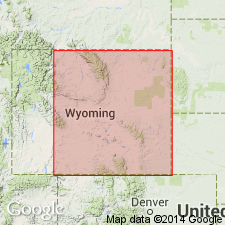
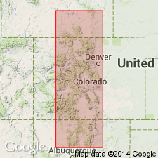
- Denver basin
Summary:
Hartville formation. Massive gray limestone, some beds containing chert nodules, with occasional beds of white, gray, buff, and red sandstone, composes most of formation. In lower part red shale and gray limestone; at base 50 feet of red quartzite streaked with white. Total thickness 650 feet. Conformably underlies Opeche formation and unconformably overlies Guernsey formation. Contains Pennsylvanian fossils in upper part and Mississippian fossils in lower part.
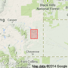
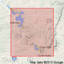
[Mapped over large area at and around Hartville, Hartville uplift, Hartville quadrangle (scale 1:125,000), Platte Co., southeastern WY.]
Source: US geologic names lexicon (USGS Bull. 896, p. 920).
- Usage in publication:
-
- Hartville formation
- Modifications:
-
- Age modified
- Biostratigraphic dating
- AAPG geologic province:
-
- Denver basin
Summary:
Reported results of a detailed lithologic, faunal, and correlation study of Hartville formation, which they divided into 6 unnamed units, the upper one of which they concluded is probably Permian; the next underlying 4 fossiliferous units are certainly Pennsylvanian, while the stratigraphic relations of basal unit suggest it is lower Pennsylvanian.
Source: US geologic names lexicon (USGS Bull. 896, p. 920).
- Usage in publication:
-
- Hartville formation
- Modifications:
-
- Not used
- AAPG geologic province:
-
- Denver basin
Summary:
Pg. 2-5. Hartville formation. Condra and Reed (1935, Nebraska Geol. Survey Paper, no. 9) subdivided the Hartville into six divisions (I-VI, descending). These divisions are herein named: Fairbank formation (VI), Reclamation group (V), Round top group (IV), Hayden group (III), Meek group and Wendover group (II), Broom Creek group and Cassa group (I). Nomenclature problems of Hartville uplift discussed. Term Minnelusa has priority over Hartville. [Age is Pennsylvanian to Permian.]
Source: US geologic names lexicon (USGS Bull. 1200, p. 1694-1695).
- Usage in publication:
-
- Hartville formation*
- Modifications:
-
- Age modified
- AAPG geologic province:
-
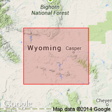
- Powder River basin
- Denver basin
Summary:
Mapped in Converse and Niobrara Cos, WY, Powder River basin and in Platte Co, WY, Denver basin. Thickness ranges from 850-1050 ft; a zone of thinning trends northwest across western part of area. Oil is produced at Lance Creek field, 20 mi north of study area, from sands in Hartville named (descending) Converse, Leo, Joss, and Bell sands. Though Hartville has been divided into six divisions by previous workers, not all could be separately mapped within Glendo area. Unconformably overlies Guernsey formation; underlies Opeche shale. No fossils were found in Division VI (lowest part of Hartville), however, based on its relation to underlying Guernsey and to overlying fossil zones of Division V, it is probable that Hartville is as old as very early Pennsylvanian or late [sic] Mississippian age; Division VI is probably a correlative of Bell sandstone in Lance Creek area and of Darwin sandstone member of Amsden formation in central and western WY. Fossils in overlying Division V, which may be as old as Mississippian, include brachiopods, trilobites, conodonts, corals, bryozoans, and fusulinids. Fossils in uppermost part of Hartville (Division I) could be as young as Permian. Isopach map; composite stratigraphic section. Assigned Mississippian? to Permian? age.
Source: GNU records (USGS DDS-6; Denver GNULEX).
- Usage in publication:
-
- Hartville formation
- Modifications:
-
- Areal extent
- AAPG geologic province:
-
- Powder River basin
Summary:
Hartville formation. In subsurface, uses modified version of nomenclature of Condra and others, 1940 (Nebraska Geol. Survey Bull., no. 13). [Informally] subdivided into (descending): Permian (Wolfcampian) Division I, Cassa and Broom Creek groups; Pennsylvanian (Virgilian to Morrowan) Division II, Meek-Wendover groups, and Division III, Hayden group; Pennsylvanian (Virgilian to Morrowan) Division IV, Roundtop group, and Division V, Reclamation group; and Late Mississippian(?) (Chesterian?) Division VI, Fairbank formation. Age is Permian
Extended in subsurface to east side of Powder River basin, eastern Wyoming. Subdivided into 5 parts, using a modified version of the nomenclature of Condra and others (1940, Nebraska Geol. Survey Bull., no. 13), in ascending order: Fairbank formation (Division VI), Reclamation and Roundtop groups (Divisions V and IV), Hayden and [/]Meek-Wendover groups (Divisions III and II), Broom Creek group (Division I) and Cassa group (Division I).
Broom Creek and Cassa groups assigned to the Permian (Wolfcampian), based on correlation with the upper division of Casper formation in the Laramie Mountains, and because the lithology is typical of the Permian in Wyoming. Underlying parts of the formation are assigned to the Pennsylvanian (Virgilian to Morrowan), except for the Fairbank at the base, which may include rocks of Late Mississippian (Chesterian) age.
[The use of a hyphen between undifferentiated [groups] is not considered proper notation (CSN, 1933).]
Source: Modified from GNU records (USGS DDS-6; Denver GNULEX).
- Usage in publication:
-
- Hartville formation*
- Modifications:
-
- Overview
- AAPG geologic province:
-
- Denver basin
Summary:
A karst terrane is recognized at top of the Guernsey formation at Guernsey Dam, Platte Co, WY in the Denver basin. Deep solution channels present in the upper Guernsey. A massive to irregularly bedded red sandstone lies on and fills the channels. The red unit is thought to be Division VI of the Hartville formation. The age of the unit is based on its stratigraphic position above the Lower Mississippian Guernsey and below base of Division V of the Hartville which has forams and invertebrates of very late Mississippian or very early Pennsylvanian age. This karst terrane and the overlying red residuum were formed extensively in the Rocky Mountain area from northern NM to MT. In southwest and central CO, the red residuum is assigned to the Molas formation of Pennsylvanian age. The age of the karst and of Division VI is Late Mississippian. The upper part of Division VI may be Early Pennsylvanian.
Source: GNU records (USGS DDS-6; Denver GNULEX).
- Usage in publication:
-
- Hartville Formation*
- Modifications:
-
- Age modified
- AAPG geologic province:
-
- Powder River basin
Summary:
Shown on correlation chart to be no older than Morrow age (Early Pennsylvanian) in area of Hartville uplift which includes Powder River and Denver basins. Age shown to range from Morrow to Virgil (Early to Late Pennsylvanian). Uppermost (Permian) part not shown.
Source: GNU records (USGS DDS-6; Denver GNULEX).
- Usage in publication:
-
- Hartville Formation*
- Modifications:
-
- Revised
- AAPG geologic province:
-
- Denver basin
Summary:
Basal sandstone assigned to Darwin Sandstone Member as the basal member of Hartville in Hartville area, Platte Co, WY in the Denver basin. Darwin is assigned to the Casper Formation from Fremont Canyon, Natrona Co in Wind River basin to northern Laramie Range, Converse Co in Powder River basin. Only lower or Pennsylvanian part of Hartville studied.
Source: GNU records (USGS DDS-6; Denver GNULEX).
For more information, please contact Nancy Stamm, Geologic Names Committee Secretary.
Asterisk (*) indicates published by U.S. Geological Survey authors.
"No current usage" (†) implies that a name has been abandoned or has fallen into disuse. Former usage and, if known, replacement name given in parentheses ( ).
Slash (/) indicates name conflicts with nomenclatural guidelines (CSN, 1933; ACSN, 1961, 1970; NACSN, 1983, 2005, 2021). May be explained within brackets ([ ]).