The National Geologic Map Database is migrating to a new infrastructure. We apologize for any service disruptions during this process.
|
|---|


- Usage in publication:
-
- Harrodsburg limestone
- Modifications:
-
- Named
- Dominant lithology:
-
- Limestone
- AAPG geologic province:
-
- Cincinnati arch
Summary:
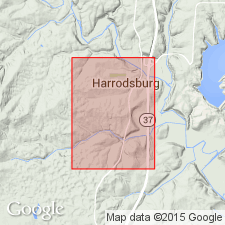
Named Harrodsburg limestone. Composed of limestone, shale, geodes, and chert. Mollusks common in lower part, upper part mostly comminuted bryozoans. Thickness varies from 60 to 90 ft. Underlain by Knobstone formation; overlain by Bedford oolitic limestone. Typically developed in southern Monroe Co., IN.
Source: GNU records (USGS DDS-6; Reston GNULEX).
- Usage in publication:
-
- Harrodsburg limestone
- Modifications:
-
- Revised
- AAPG geologic province:
-
- Cincinnati arch
Summary:
Harrodsburg limestone divided into two parts: Lower Harrodsburg and Upper Harrodsburg. Lower Harrodsburg divided into 3 members: Ramp Creek, Leesville, and Guthrie Creek, ascending. The Lower Harrodsburg is very impure and variable, characterized by numerous geodes, much chert, and irregularly spaced crinoidal layers. The Upper Harrodsburg is fairly pure limestone, in places highly crystalline and often quite fossiliferous. The Lower Harrodsburg is 25-40 ft thick, Upper Harrodsburg is 30-50 ft thick. Harrodsburg is underlain by Borden group, overlain by Salem limestone. Crops out in southern Indiana.
Source: GNU records (USGS DDS-6; Reston GNULEX).
- Usage in publication:
-
- Harrodsburg limestone
- Modifications:
-
- Revised
- AAPG geologic province:
-
- Cincinnati arch
Summary:
Harrodsburg limestone extended into Kentucky. Lower Harrodsburg division of Stockdale (1929), which consists of the very thin Guthrie Creek and Leesville members and the thicker Ramp Creek Member in Indiana, is removed from the Harrodsburg and combined with the Edwardsville formation (the upper formation of the Borden group) to form the Muldraugh formation of the Borden group. Change is made because the Edwardsville in Kentucky becomes much more limy and siliceous and like the Ramp Creek, which is considerably different from the Upper Harrodsburg of Stockdale (1929). Upper Harrodsburg called Harrodsburg limestone (restricted) in Kentucky.
Source: GNU records (USGS DDS-6; Reston GNULEX).

- Usage in publication:
-
- Harrodsburg Limestone
- Modifications:
-
- Revised
- AAPG geologic province:
-
- Cincinnati arch
Summary:
Harrodsburg Limestone revised in Indiana. Basal Ramp Creek Member of Stockdale (1929) removed from Harrodsburg and placed in underlying Muldraugh Formation. Remaining Harrodsburg consists of Leesville and Guthrie Creek Members of Lower Harrodsburg and Upper Harrodsburg, all of Stockdale (1929). Harrodsburg Limestone becomes basal formation of newly named Sanders Group.
Source: GNU records (USGS DDS-6; Reston GNULEX).
- Usage in publication:
-
- Harrodsburg Limestone*
- Modifications:
-
- Revised
- AAPG geologic province:
-
- Cincinnati arch
Summary:
Harrodsburg Limestone redefined to include strata Stockdale (1939) included in the Harrodsburg limestone (restricted) and the upper part of the Muldraugh Formation. It corresponds closely with the Harrodsburg Limestone as recognized by the Indiana Geological Survey in southern Indiana which includes the Upper Harrodsburg (division) and the upper two (Guthrie Creek and Leesville Members) of three members of the Lower Harrodsburg (division), all of Stockdale (1929). The Harrodsburg in the quadrangle is light-olive-gray to very light-gray, clastic, coarse to very coarse-grained, medium bedded, cross-bedded limestone with locally abundant crinoid columnals and brachiopod valves; contains abundant glauconite (?) grains and scattered quartz geodes as much as 6 inches in diameter; chert layers (silicified limestone) several inches thick occur in lower part. Underlain by Muldraugh member of Borden Formation; overlain by Salem Limestone.
Source: GNU records (USGS DDS-6; Reston GNULEX).
- Usage in publication:
-
- Harrodsburg Limestone*
- Modifications:
-
- Revised
- AAPG geologic province:
-
- Cincinnati arch
Summary:
Harrodsburg Limestone as used by Stockdale (1939) redefined for use in Kentucky. Guthrie Creek and Leesville Members removed from top of Muldraugh Formation and returned to base of Harrodsburg from which they had been removed by Stockdale (1939). Ramp Creek Member is retained in the Muldraugh Formation. The revision is made because the Guthrie Creek and Leesville are recognizable in northwest-central Kentucky and the Leesville is more like the upper part of the Harrodsburg than the Muldraugh.
Source: GNU records (USGS DDS-6; Reston GNULEX).
- Usage in publication:
-
- Harrodsburg Member
- Modifications:
-
- Areal extent
- AAPG geologic province:
-
- Illinois basin
Summary:
Harrodsburg Member (upper of 2) of Ullin Limestone mapped in south-southeastern Illinois. Consists of light-gray limestone composed of crinoid ossicles, light-gray to almost white chalky matrix and a variable proportion of spary calcite cement. The chalky matrix is largely fine-grained fossil detritus mainly bryozoan material. Thickness varies greatly; as much as 270 ft thick. Underlain by Ramp Creek Member of Ullin Limestone; overlain by Salem Limestone.
Source: GNU records (USGS DDS-6; Reston GNULEX).
- Usage in publication:
-
- Harrodsburg Limestone
- Modifications:
-
- Overview
- AAPG geologic province:
-
- Cincinnati arch
- Illinois basin
Summary:
Harrodsburg Limestone as recognized by the Indiana Geological Survey consists of the originally defined unit of Hopkins and Seibenthal (1896) minus the basal Ramp Creek Member of Stockdale (1929). It includes the Leesville and Guthrie Creek Members of the Lower Harrodsburg and the Upper Harrodsburg, all of Stockdale (1929).
Source: GNU records (USGS DDS-6; Reston GNULEX).
- Usage in publication:
-
- Harrodsburg Limestone*
- Modifications:
-
- Overview
- AAPG geologic province:
-
- Illinois basin
Summary:
Used as Mississippian (Valmeyeran) Harrodsburg Limestone of Sanders Group. Authors follow usage of Droste and Carpenter (1990, State of Indiana Department of Natural Resources, Geological Survey Bulletin 62.)
Source: GNU records (USGS DDS-6; Reston GNULEX).
For more information, please contact Nancy Stamm, Geologic Names Committee Secretary.
Asterisk (*) indicates published by U.S. Geological Survey authors.
"No current usage" (†) implies that a name has been abandoned or has fallen into disuse. Former usage and, if known, replacement name given in parentheses ( ).
Slash (/) indicates name conflicts with nomenclatural guidelines (CSN, 1933; ACSN, 1961, 1970; NACSN, 1983, 2005, 2021). May be explained within brackets ([ ]).