The National Geologic Map Database is migrating to a new infrastructure. We apologize for any service disruptions during this process.
|
|---|


- Usage in publication:
-
- Hall Stream Member
- Modifications:
-
- Mapped 1:250k
- Dominant lithology:
-
- Grit
- Schist
- Amphibolite
- AAPG geologic province:
-
- New England province
Summary:
Mapped as Hall Stream member of Gile Mountain formation. Highly feldspathic grit, probably of volcanic origin and feldspathic chlorite-ankerite schist and amphibolite. Unit is uppermost member of Gile Mountain. Age is Early Devonian.
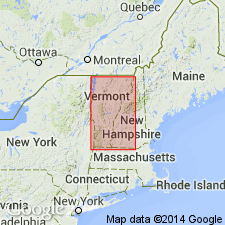
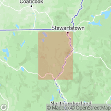
Occurs northeast of Nulhegan River, [Averill 15-min quadrangle, Essex Co., northeasternmost VT].
[Typographical error on map: the name should be Halls Stream.]
Source: Publication; US geologic names lexicon (USGS Bull. 1200, p. 1650-1651); GNU records (USGS DDS-6; Reston GNULEX).
- Usage in publication:
-
- Halls Stream Grits [unranked]
- Modifications:
-
- Principal reference
- Mapped 1:62.5k
- Dominant lithology:
-
- Grits
- AAPG geologic province:
-
- New England province
Summary:
Pg. 24, 25, 27, pl. 1 (geol. map). Halls Stream Grits [unranked] in Giles Mountain Formation. Name Halls Stream applied to grits that occur in lenses in Gile Mountain Formation in Averill area, Vermont and New Hampshire [not mapped in New Hampshire]. Do not appear to be related to Sherbrooke grits, hence name Sherbrooke not applicable in area. Halls Stream volcanics also used in report. Age is Early Devonian.
[Type area]: excellent outcrops along eastern slopes of Halls Stream valley about 3.5 mi north of Beecher Falls (Essex Co., northeastern VT), north of VT-NH State line and along the International border, [in area around Lat. 45 deg. 03 min. N., Long. 71 deg. 30 min., western edge Pittsburg 7.5-min quadrangle, Coos Co., northern NH]. Name credited to Prof. James B. Thompson, Jr., Harvard Univ.
Source: Publication; US geologic names lexicon (USGS Bull. 1350, p. 316).

- Usage in publication:
-
- grit lenses at Halls Stream (informal)
- Modifications:
-
- Mapped 1:250k
- Dominant lithology:
-
- Grits
- AAPG geologic province:
-
- New England province

- Usage in publication:
-
- grits at Halls Stream (informal)
- Modifications:
-
- Mapped 1:250k
- Dominant lithology:
-
- Grits
- AAPG geologic province:
-
- New England province
Summary:
grits at Halls Stream (informal) in Ironbound Mountain Formation. Thick-bedded feldspathic volcaniclastic grit and interbedded gray slate. Exposed in northern New Hampshire. Equivalent to Grenier Ponds Member of Ironbound Mountain Formation in western Maine. Age is Early Devonian.
Source: Publication.
For more information, please contact Nancy Stamm, Geologic Names Committee Secretary.
Asterisk (*) indicates published by U.S. Geological Survey authors.
"No current usage" (†) implies that a name has been abandoned or has fallen into disuse. Former usage and, if known, replacement name given in parentheses ( ).
Slash (/) indicates name conflicts with nomenclatural guidelines (CSN, 1933; ACSN, 1961, 1970; NACSN, 1983, 2005, 2021). May be explained within brackets ([ ]).