

- Usage in publication:
-
- Gypsum Spring member
- Modifications:
-
- Named
- Dominant lithology:
-
- Gypsum
- Limestone
- Shale
- Sandstone
- AAPG geologic province:
-
- Wind River basin
Summary:
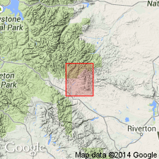
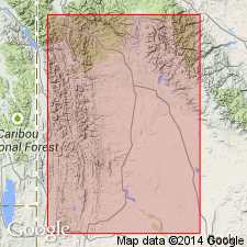
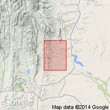
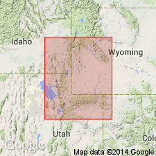
Named as upper member of Chugwater formation for a gypsum spring on Red Creek, southeastern Washakie Range, Fremont Co, WY in Wind River basin. No type locality designated. A section measured in sec 36, T7N, R4W, sec 1, T6N, R4W, and sec 6, T6N, R3W on east side of Red Creek described. At that locality the member is 181 ft 6 in thick and composed of interbedded white, massive gypsum, crinkled, gypsiferous, white to thinly laminated limestone, red to gray shale, and white to pink sandstone. Overlies Popo Agie member (rank changed). Is older than Sundance formation. Of Triassic age. Geologic map.
Source: GNU records (USGS DDS-6; Denver GNULEX).
- Usage in publication:
-
- Gypsum Spring formation
- Modifications:
-
- Areal extent
- Overview
- AAPG geologic province:
-
- Powder River basin
- Williston basin
- Bighorn basin
- Wind River basin
Summary:
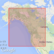
Shows usage and correlation in WY and western SD. Represents basal deposits of transgressive sea; may not be same age throughout its extent and may represent much more time at one locality than at another. Considers that rocks assigned to Gypsum Spring formation by USGS parties in Bighorn basin of WY are identical to Piper formation of eastern MT and that they include more than type Gypsum Spring as defined by Love (1939; 1945). Gypsum Spring of type area in central WY represents only basal Middle Jurassic and correlates with lower member of Gypsum Spring, as employed by USGS parties in MT and parts of Bighorn basin of WY. Because beds equivalent to type Gypsum Spring in MT are not mappable, name Piper is employed in that state for beds hereto called Gypsum Spring.
Source: GNU records (USGS DDS-6; Denver GNULEX).
- Usage in publication:
-
- Gypsum Spring formation
- Modifications:
-
- Areal extent
- Overview
- Revised
- AAPG geologic province:
-
- Williston basin
Summary:
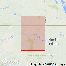
Extended name into eastern MT, western ND, and southeastern Saskatchewan. Includes a lower member consisting primarily of evaporites, and an upper member consisting primarily of limestones. Correlated with Gypsum Spring formation as identified in Black Hills by Imlay (1947), and by Mapel and Bergendahl (1956). Correlative with Nesson formation as defined by Nordquist (1955), and with the upper part of Watrous formation and lower part of Gravelbourg formation [in southern Saskatchewan]. Overlain conformably by Piper or Sundance formation; overlies Jura-Triassic red beds. Middle Jurassic in age. [Additional details given in Francis, D. R., 1957, American Association of Petroleum Geologists Bulletin, v. 41, no. 3, p. 378-382, 383 (fig. 7), 384 (fig. 8).]
Source: GNU records (USGS DDS-6; Denver GNULEX).
- Usage in publication:
-
- Gypsum Spring formation*
- Modifications:
-
- Revised
- AAPG geologic province:
-
- Williston basin
- Powder River basin
Summary:
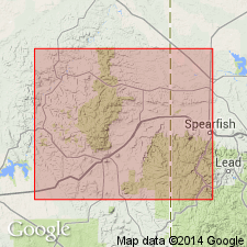
Crops out sporadically for a distance of about 150 mi along the western and northern flanks of the Black Hills in northeastern WY and west-central SD [in Powder River and Williston basins]. About 125 ft thick at its northwesternmost exposure 10 mi northeast of Hulett, WY, where it consists of a lower sequence of massive gypsum and red claystone about 75 ft thick, and an upper sequence of interbedded light-gray limestone and red and gray claystone about 50 ft thick. The two parts of the formation are not facies of one another as suggested by Imlay (1947). Middle Jurassic in age.
Source: GNU records (USGS DDS-6; Denver GNULEX).
- Usage in publication:
-
- Gypsum Spring formation
- Modifications:
-
- Revised
- AAPG geologic province:
-
- Green River basin
Summary:
A 20-25 ft thick sandstone that is buff to tan to red, soft, poorly consolidated and readily eroded, formerly assigned to the Nugget sandstone as its upper member or to the "Nugget pay", is removed from the Nugget and reassigned to the overlying Gypsum Spring formation. Individual grains in the sandstone appear to be reworked Nugget. The name Kendall sandstone member is applied to this basal member for a locality in Sublette Co, WY in the Greater Green River basin. Assigned to the Jurassic.
Source: GNU records (USGS DDS-6; Denver GNULEX).
- Usage in publication:
-
- Gypsum Spring Member*
- Modifications:
-
- Revised
- Areal extent
- AAPG geologic province:
-
- Green River basin
Summary:
Name Gypsum Spring extended into Fort Hill quad, Greater Green River basin, reduced in stratigraphic rank from Gypsum Spring Formation to Gypsum Spring Member, and assigned to Twin Creek Limestone as its basal member. Gypsum Spring was formerly designated member A of Twin Creek by Imlay (1950). Is the basal, brick-red mudstone and light-gray limestone breccia. Overlies Nugget Sandstone. Underlies the unnamed thin-bedded, locally sandy, dark-gray, argillaceous limestone, calcareous siltstone, and calcareous claystone of the upper part of Twin Creek, a unit that also includes massive, oolitic, and coquinoid limestone. Of Middle Jurassic age.
Source: GNU records (USGS DDS-6; Denver GNULEX).
- Usage in publication:
-
- Gypsum Spring Member*
- Modifications:
-
- Revised
- Overview
- AAPG geologic province:
-
- Yellowstone province
- Snake River basin
- Green River basin
- Wasatch uplift
- Uinta basin
- Uinta uplift
Summary:
Crops out in the same general area as the rest of Twin Creek Limestone in southeast ID, western WY, and north-central UT except that easternmost known exposure is northeast of Oakley, UT in NE1/4 sec 1, T1S, R6E. Occurs in Yellowstone province, Snake River basin, Greater Green River basin, Wasatch uplift, Uinta basin, and Uinta uplift. Thickness varies; averages 75 ft thick in western WY to 400 ft in Blackfoot Mountains, ID; thickens west from a few ft at west end of Uintas to 200 ft near Devils Slide, Wasatch Mountains. Basal contact is of red siltstone and soft yellow sandstone on hard quartzitic sandstone of Nugget Sandstone. Upper contact is a change from soft red, pink, or gray siltstone to oolitic or sandy, dense limestone of Sliderock Member (new) of Twin Creek. Four measured sections described; two illustrate eastern lithology; two demonstrated western lithology. Cross sections. Abundant fossils (crinoids and echinoids). Probably middle Bajocian, or Middle Jurassic age. Correlation chart. Is a shallow-water marine deposit.
Source: GNU records (USGS DDS-6; Denver GNULEX).

- Usage in publication:
-
- Gypsum Spring Member*
- Modifications:
-
- Areal extent
- Overview
- Age modified
- AAPG geologic province:
-
- Snake River basin
- Wasatch uplift
- Yellowstone province
- Uinta basin
- Uinta uplift
Summary:
Is the basal member of the Twin Creek Limestone. Unconformably overlies Nugget Sandstone in the western areas in Snake River basin, ID, Yellowstone province, WY, and on Wasatch uplift, UT. Unconformably overlies Glen Canyon Sandstone on Uinta uplift, UT. Unconformably underlies Sliderock Member of Twin Creek in Snake River basin, ID, Yellowstone province, WY, Wasatch uplift, Uinta uplift, and Uinta basin, UT. Wedges out between Oakley, Summit Co, UT, Uinta uplift, and the Duchesne River, Duchesne Co, UT, Uinta basin. Its early to middle Bajocian age, formerly middle Bajocian only, assigned on basis of presence of late Bajocian ammonites in the overlying Sliderock. Regional correlation, thicknesses, and general lithology given on correlation charts.
Source: GNU records (USGS DDS-6; Denver GNULEX).

- Usage in publication:
-
- Gypsum Spring Formation*
- Modifications:
-
- Areal extent
- AAPG geologic province:
-
- Powder River basin
Summary:
Identified locally in the subsurface of the Powder River basin in MT and WY where it overlies Chugwater Formation and underlies Sundance Formation unconformably. Of Middle Jurassic age. [This nomenclature shown on 22 cross sections in this OC series.]
Source: GNU records (USGS DDS-6; Denver GNULEX).
For more information, please contact Nancy Stamm, Geologic Names Committee Secretary.
Asterisk (*) indicates published by U.S. Geological Survey authors.
"No current usage" (†) implies that a name has been abandoned or has fallen into disuse. Former usage and, if known, replacement name given in parentheses ( ).
Slash (/) indicates name conflicts with nomenclatural guidelines (CSN, 1933; ACSN, 1961, 1970; NACSN, 1983, 2005, 2021). May be explained within brackets ([ ]).