

- Usage in publication:
-
- Gunter sandstone
- Modifications:
-
- Original reference
- Dominant lithology:
-
- Sandstone
- AAPG geologic province:
-
- Ozark uplift
Summary:
Pg. 26. Gunter sandstone. Fine- to coarse-grained sandstone, in places siliceous, in places quartzitic, 0 to 18 feet thick; the 3rd sandstone of Swallow. Unconformably overlies Proctor limestone; conformably underlies Gasconade limestone in Miller County, central Missouri. Age is Cambrian and Ordovician. Report includes geologic map.
[GNC remark (btw. 1903 and 1930, US geologic names lexicon, USGS Bull. 896, p. 891): Subsequently the lower 35 to 235 feet of Gasconade formation was, for faunal reasons, split off from the Gasconade and named Van Buren formation. The Gunter is now included in the Van Buren.]
Source: US geologic names lexicon (USGS Bull. 896, p. 891); supplemental information from GNU records (USGS DDS-6; Denver GNULEX).
- Usage in publication:
-
- Gunter sandstone member
- Modifications:
-
- Revised
- AAPG geologic province:
-
- Ozark uplift
Summary:
Gunter sandstone member of Gasconade formation. In Morgan County, Missouri, assigned to Gasconade formation as lower member. Thickest near Proctor, 25 feet in outcrop, 35 feet in subsurface. Unconformably overlies Proctor limestone; underlies unnamed magnesian limestone member of Gasconade. Age is probably Cambrian. Report includes generalized section, geologic map.
Source: Modified from GNU records (USGS DDS-6; Denver GNULEX).
- Usage in publication:
-
- Gunter sandstone member
- Modifications:
-
- Revised
- AAPG geologic province:
-
- Ozark uplift
Summary:
Pg. 148. Gunter sandstone member of Van Buren formation. Ulrich has questioned vigorously the propriety of using Gunter for the basal sandstones of next younger beds [Van Buren] above the Eminence in southeast Missouri, on grounds they are not of same age as the Gunter of type section at Hahatonka [Gunter or Hahatonka Springs, Camden Co., central Missouri]. Since these beds are basal deposit of an encroaching sea, over an eroded landmass, it is to be presumed they are not everywhere of exactly same age, any more than, for example, the basal beds of the St. Peter. That these sands do, however, mark the base of a single encroachment of the sea, seems to writer to be rather clearly established. This seems to be borne out by nearly continuous tracing in deep wells in which typical Van Buren residues are recovered from just above a sandstone that occupies stratigraphic position of the Gunter. It is believed the usage of Gunter for the sandstone lying between the Eminence (including Proctor) and the Van Buren is quite justified in southeast Missouri.
Source: US geologic names lexicon (USGS Bull. 896, p. 891).
- Usage in publication:
-
- Gunter formation
- Modifications:
-
- Revised
- Areal extent
- AAPG geologic province:
-
- Wisonsin arch
Summary:
Pg. 111 (fig. 2), 116-117. Gunter formation. Geographically extended into Illinois. Formation consists principally of argillaceous, silty, finely glauconitic greenish-gray to cream chalky dolomite which contains fine muscovite flakes and is slightly sandy in lower 2.75 feet. Thickness about 10.25 feet. Overlies Trempealeau; underlies Oneota. Lower Ordovician. Exposures confined to quarry near Rochelle, Lee County, and to prospect pit and ravine in Ogle County.
Source: US geologic names lexicon (USGS Bull. 1200, p. 1635).
- Usage in publication:
-
- Gunter formation
- Modifications:
-
- Revised
- AAPG geologic province:
-
- Wisconsin arch
Summary:
Fig. 3. Gunter formation. Shown on chart as formation in Prairie du Chien group. Age is Early Ordovician.
Source: US geologic names lexicon (USGS Bull. 1200, p. 1635).
- Usage in publication:
-
- Gunter member
- Modifications:
-
- Revised
- AAPG geologic province:
-
- Ozark uplift
Summary:
Pg. 57-59. Gunter member of Gasconade formation. Unconformably overlies Eminence formation; conformable with overlying nonsandy dolomites of Gasconade. Consists of sandstone and sandy dolomite. Average thickness 25 to 30 feet; maximum 50 feet in localized area. Missouri Geol. Survey no longer uses Van Buren as formational name because unit is only locally distinctive. In parts of Kansas and Oklahoma, recognized in subsurface as member of Arbuckle group.
Source: US geologic names lexicon (USGS Bull. 1200, p. 1635).
- Usage in publication:
-
- Gunter Sandstone Member
- Modifications:
-
- Overview
Summary:
(Paleozoic Era; [Cambrian through Mississippian Systems] by E.D. Goebel, p. 13.) Gunter Sandstone Member of Gasconade Dolomite. This member, present at base of the Gasconade, is a sandy dolomite.
Source: Publication.

- Usage in publication:
-
- Gunter Sandstone Member
- Modifications:
-
- Overview
Summary:
Pg. 21, 23 (fig. 5), 24, 25. Gunter Sandstone Member of Gasconade Dolomite. A persistent medium-grained, quartzose sandstone, 25 to 30 feet thick in lowermost part of Gasconade. Becomes a thinner arenaceous (sandy) dolomite to east and west. Locally includes a pebble conglomerate at base (pebbles from underlying Eminence Dolomite). Corresponds to †Moreau sandstone of Keyes (1894), Roubidoux sandstone of Gallaher (1900), †3rd sandstone of Swallow (1855), and probably †Cole Camp sandstone of Winslow (1894). Overlies Eminence Dolomite across much of the state. Underlies "lower Gasconade," which is generally coarsely crystalline and may have up to 50 percent chert by volume; in some areas, the lower part of the "lower Gasconade" is separately identified as the "Van Buren." Age is Early Ordovician (Canadian; Ibexian); considered base of Ordovician in Missouri.
See also: 1991, Missouri Dept. Nat. Res. Rpt. Inv., no. 70, p. 24; 2001, Missouri Dept. Nat. Res. Rpt. Inv., no. 73, p. 50, 51, 122-123.
Source: Publication.

- Usage in publication:
-
- Gunter Sandstone Member*
- Modifications:
-
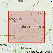
- Areal extent
- AAPG geologic province:
-
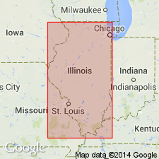
- Illinois basin
- Ozark uplift
Summary:
In subsurface of St. Louis area, Missouri and Illinois, Gunter Sandstone Member included in Gasconade Dolomite. Age is Early Ordovician (Canadian).
Source: Modified from GNU records (USGS DDS-6; Reston GNULEX).
- Usage in publication:
-
- Gunter Sandstone Member*
- Modifications:
-
- Areal extent
- AAPG geologic province:
-
- Ozark uplift
- Illinois basin
Summary:
Gunter Sandstone Member occurs sporadically in southern Illinois basin. In Missouri, assigned to Gasconade Dolomite as basal member, and in Illinois and Kentucky, assigned to Oneota Dolomite of Knox Group as basal member. Age is Early Ordovician (Canadian).
Source: Modified from GNU records (USGS DDS-6; Reston GNULEX).
For more information, please contact Nancy Stamm, Geologic Names Committee Secretary.
Asterisk (*) indicates published by U.S. Geological Survey authors.
"No current usage" (†) implies that a name has been abandoned or has fallen into disuse. Former usage and, if known, replacement name given in parentheses ( ).
Slash (/) indicates name conflicts with nomenclatural guidelines (CSN, 1933; ACSN, 1961, 1970; NACSN, 1983, 2005, 2021). May be explained within brackets ([ ]).