The National Geologic Map Database is migrating to a new infrastructure. We apologize for any service disruptions during this process.
|
|---|


- Usage in publication:
-
- Gulf series*
- Modifications:
-
- Named
- Dominant lithology:
-
- Limestone
- Shale
- Sand
- AAPG geologic province:
-
- Ouachita folded belt
- Strawn basin
- Fort Worth syncline
- East Texas basin
Summary:
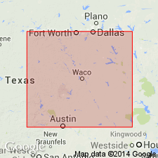
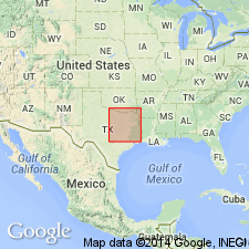
Named as series for its development along the coastal plain of the Gulf of Mexico [now called Gulf of America]. Described as seen by R. T. Hill from east to west along the line of the Texas Pacific Railway from Van Zandt Co. to a point 8 mi west of Arlington, Texas. "This [Timber Creek group] and all strata above it in Texas are a continuation of the Alabama, Tennessee, Mississippi and Arkansas Cretaceous and Tertiaries, to which I give the name of Gulf series" (p. 300). As shown on the geologic section on page 296 and the table on pages 298-299, Hill subdivided his Gulf series in descending order as follows: Basal Tertiaries (Marine Tertiary), Navarro beds, Dallas limestone, Eagle Ford shales, and Timber Creek group. Includes Middle Cretaceous and Upper Cretaceous strata. No discussion of the included Basal Tertiaries other than noting their occurrence between Van Zandt Co. and Elmo, Texas. Unconformably overlies the Comanche series (Lower Cretaceous). [The "marine Tertiaries," which Hill originally included in his Gulf series, are currently assigned to the Paleocene Midway Group.]
[Gulf of Mexico renamed Gulf of America (U.S. Board on Geographic Names per Presidential Executive Order 14172, issued January 20, 2025, and Department of Interior's Secretarial Order 3423, issued Feb. 7, 2025).]
Source: GNU records (USGS DDS-6; Denver GNULEX).
- Usage in publication:
-
- Gulf series*
- Modifications:
-
- Overview
- AAPG geologic province:
-
- Ouachita folded belt
Summary:
Is Upper Cretaceous series confined to the regions of Eastern Cross Timbers and Black Prairie [generally, Ouachita tectonic belt province]. Rests unconformably on Lower Cretaceous Comanche series and may be divided into five formations: Woodbine, the lowest (north of Brazos River), consists of ferruginous sands and clays; Eagle Ford, characterized by bituminous clays; Austin chalk, a conspicuous formation; Taylor marl, consists of marly clay; and Navarro formation (new), composed of unindurated beds of glauconitic sands, clays, and a little chalk. As a whole, is known to correspond with the Upper Cretaceous of Meek and Hayden section of the Northwest. The three lower formations--Woodbine, Eagle Ford, and Austin--are in a general way the equivalents of Dakota and Colorado divisions, while Taylor marl and Navarro beds, occupying the stratigraphic place of Pierre and Fox Hills formations, in a manner correspond to Montana division.
Source: GNU records (USGS DDS-6; Denver GNULEX).
For more information, please contact Nancy Stamm, Geologic Names Committee Secretary.
Asterisk (*) indicates published by U.S. Geological Survey authors.
"No current usage" (†) implies that a name has been abandoned or has fallen into disuse. Former usage and, if known, replacement name given in parentheses ( ).
Slash (/) indicates name conflicts with nomenclatural guidelines (CSN, 1933; ACSN, 1961, 1970; NACSN, 1983, 2005, 2021). May be explained within brackets ([ ]).