The National Geologic Map Database is migrating to a new infrastructure. We apologize for any service disruptions during this process.
|
|---|


- Usage in publication:
-
- Guilmette formation*
- Modifications:
-
- Original reference
- Dominant lithology:
-
- Dolomite
- Limestone
- Sandstone
- AAPG geologic province:
-
- Great Basin province
Summary:
Pg. 421-432. Guilmette formation. Chiefly dolomite but contains a number of thick limestone beds and several lenticular brownish sandstones. The most characteristic dolomite is a fine-grained rock, dark to medium gray on fresh fracture, weathering lighter shades of gray and containing numerous vugs almost completely filled with white coarsely crystalline dolomite. Also contains striking dark dolomites filled with fragments of tubular corals. Thickness 890 to 1,200 feet. Is unconformably overlain by Madison limestone (Early Mississippian), and unconformably overlies Simonson dolomite.
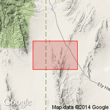
Named from exposures in Guilmette Gulch, [western flank Deep Creek Mountains, in T. 9 S., R. 18 W.], in southern part of Gold Hill 15-min quadrangle [1955 ed.], Gold Hill district, Tooele Co., western UT.
[See also Nolan's USGS Prof. Paper 177, 1935.]
Source: US geologic names lexicon (USGS Bull. 896, p. 888).
- Usage in publication:
-
- Guilmette formation
- Modifications:
-
- Contact revised
- AAPG geologic province:
-
- Great Basin province
Summary:
Upper contact revised. Guilmette Formation conformably underlies the newly named Late Devonian Cove Fort Quartzite. Overlies Middle Devonian Simonson Dolomite. Mapped (geologic map) on east side of White Sage Flat west of the Cove Fort Quartzite, Millard Co, UT in the Great Basin province. Is 570 ft thick. Consists predominantly of dark-gray medium-crystalline dolomite. Has Middle Devonian fossil near base. Assigned to the Middle Devonian.
Source: GNU records (USGS DDS-6; Denver GNULEX).
- Usage in publication:
-
- Guilmette Formation
- Modifications:
-
- Contact revised
- AAPG geologic province:
-
- Great Basin
Summary:
Upper contact revised in the Windermere Hills of Elko Co, NV, Great Basin province in that Guilmette Formation underlies the newly named Kinderhookian-age Tripon Pass Limestone. Contact placed between thin-bedded platy calcisiltite of the Tripon Pass and massive cliff-forming limestone of the Guilmette. The contact is probably a disconformity. Guilmette is of Devonian age.
Source: GNU records (USGS DDS-6; Denver GNULEX).
- Usage in publication:
-
- Guilmette Formation*
- Modifications:
-
- Areal extent
- AAPG geologic province:
-
- Great Basin province
Summary:
Red Warrior Limestone abandoned. Its rocks reassigned, in the Star Range, Beaver Co, UT in the Great Basin province, to the lower part of the Upper Devonian Pinyon Peak Limestone, the Devonian Sevy Dolomite, Simonson Dolomite, and Guilmette Formation, and to the Silurian Laketown Dolomite. [Of Devonian age.]
Source: GNU records (USGS DDS-6; Denver GNULEX).
- Usage in publication:
-
- Guilmette Formation*
- Modifications:
-
- Mapped 1:24k
- Dominant lithology:
-
- Limestone
- Sandstone
- Dolomite
- AAPG geologic province:
-
- Great Basin province
Summary:
Is Devonian formation mapped in northern part of the Mountain Home Range in western Millard Co, southwestern UT (Great Basin province). Is oldest bedrock unit mapped in study area. Is overlain by Pilot Shale (Lower Mississippian and Upper Devonian). Three map units are shown in order to better delineate structures above the Mountain Home thrust fault. Correlation of these units with other areas is not certain enough to allow formal names to be employed here. Upper limestone member (Famennian)--Bluish-gray, thin-bedded, shaly limestone with some thick-bedded, ledge-forming beds; commonly forms low ledges and slopes beneath Pilot Shale slope; may include calcareous sandstone beds near the base; Biller (1976) correlates this unit with the West Range Limestone of Pioche area, NV; member is 80-120 m thick. Sandstone member (Frasnian?)--Sandstone, light brownish gray, weathers pinkish gray, fine grained, dolomitic, includes 20 percent interbeds of sandy dolomite, thin to medium bedded, forms ledgy slope; conspicuous light band on aerial photos; thickness 40 m. Lower member (Frasnian)--Undivided dolomite, limestone, and sandstone; dolomite is interbedded with about 10 sandstone or quartzite beds as much as 3 m thick in upper 170 m below which limestone and dolomite are nearly equal and fewer sandstone beds are found; dolomite beds are mostly dark to medium gray, coarsely crystalline and often show relict ghost fossils; Stromatoporoid "spaghetti" beds are common in both limestone and dolomite beds; unit forms ledge and slope topography, more ledges than slopes; about 400 m thick; base not exposed.
Source: GNU records (USGS DDS-6; Denver GNULEX).

- Usage in publication:
-
- Guilmette Formation*
- Modifications:
-
- Mapped 1:24k
- Dominant lithology:
-
- Limestone
- Sandstone
- Dolomite
- AAPG geologic province:
-
- Great Basin province
Summary:
Is Upper (Famennian and Frasnian) and Middle? (Givetian?) Devonian formation mapped in southern part of the Mountain Home Range in western Millard and Beaver Cos, southwestern UT (Great Basin province). Overlies Simonson Dolomite (Middle Devonian). Is overlain by Pilot Shale (Lower Mississippian and Upper Devonian). Locally subdivided into three members (map units) to better delineate structures above the Mountain Home thrust fault. Undivided Guilmette is at least 500 m thick. Upper member (Famennian)--Bluish-gray, thin bedded, shaly limestone with some thick-bedded, ledge-forming beds; commonly forms low ledges and slopes beneath Pilot Shale slope; locally includes calcareous sandstone beds near the base; Biller (1976) correlated this unit with the West Range Limestone of Pioche area, NV; member is about 80 m thick. Sandstone member (Frasnian?)--Sandstone, light brownish gray, weathers pinkish gray, fine grained, dolomitic, includes 20 percent interbeds of sandy dolomite, thin- to medium-bedded, forms ledgy slope; thickness 40 m. Lower member (Frasnian and Givetian?)--Undivided dolomite, limestone, and sandstone; upper 170 m of member is dolomite with approximately 10 sandstone or quartzite beds that are as much as 3 m thick; lower part of member consists of limestone and dolomite with few sandstone beds; dolomite is mostly dark- to medium-gray, coarsely crystalline and commonly shows relict fossils; Stromatoporoid "spaghetti" beds are common in both limestone and dolomite beds; unit forms ledge-and-slope topography, with more ledges than slopes; more than 200 m thick; base not exposed.
Source: GNU records (USGS DDS-6; Denver GNULEX).
- Usage in publication:
-
- Guilmette Formation*
- Modifications:
-
- Revised
- AAPG geologic province:
-
- Great Basin province
Summary:
Indian Ranch Tongue named as upper tongue of Guilmette. Indian Ranch occurs within Goshute Creek quad, White Pine Co, NV, Great Basin province and is equivalent to West Range Limestone. Correlation chart; measured section. At type Indian Ranch, Guilmette consists of lower tongue (175 m thick) and Indian Ranch (151 m thick); here "lower tongue" of lower member of Pilot Shale occurs between lower tongue of Guilmette and Indian Ranch; lower tongue of Guilmette overlies Simonson Dolomite and Indian Ranch unconformably underlies Joana Limestone. Lowermost part of lower tongue is Givetian (Middle Devonian) age; remainder of lower tongue is Frasnian (Late Devonian) age. Indian Ranch is Famennian (Late Devonian) age.
Source: GNU records (USGS DDS-6; Denver GNULEX).
For more information, please contact Nancy Stamm, Geologic Names Committee Secretary.
Asterisk (*) indicates published by U.S. Geological Survey authors.
"No current usage" (†) implies that a name has been abandoned or has fallen into disuse. Former usage and, if known, replacement name given in parentheses ( ).
Slash (/) indicates name conflicts with nomenclatural guidelines (CSN, 1933; ACSN, 1961, 1970; NACSN, 1983, 2005, 2021). May be explained within brackets ([ ]).