The National Geologic Map Database is migrating to a new infrastructure. We apologize for any service disruptions during this process.
|
|---|


- Usage in publication:
-
- Guild Mine Member*
- Modifications:
-
- Named
- Dominant lithology:
-
- Dacite
- Quartz latite
- Tuff
- AAPG geologic province:
-
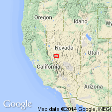
- Great Basin province
Summary:
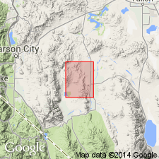
Named as member of Mickey Pass Tuff. Type area: exposures 2 km southwest of Guild Place mines, Singatse Range, Lyon Co, NV, Consists of brown, pink, and lavender strongly welded, crystal-rich cooling unit of dacite, quartz latite, and rhyolite ash-flow tuff. Thickness 790 m with range from 520 to 790 m. Unconformably overlies unnamed early Tertiary rocks; underlies Weed Heights Member or intervening unnamed units of Mickey Pass Tuff. Mapped as units 1, 2, and 3. Age is Oligocene.
Source: GNU records (USGS DDS-6; Menlo GNULEX).
- Usage in publication:
-
- Guild Mine Member*
- Modifications:
-
- Reference
- Geochronologic dating
- AAPG geologic province:
-
- Great Basin province
Summary:
Guild Mine Member (of Proffett and Proffett, 1976) basal member of Mickey Pass Tuff of Benton Spring Group, adopted. Overlies lavas of Giroux Valley, or Mesozoic rocks; underlies Weed Heights Member. Two reference localities designated at 1) l.6 km north of Todd Mountain, north of Nevada Hwy 23, southeast flank of Gabbs Range, 2) northeast-trending fault block in southern Gillis Range about 3.2 km northwest of Kincaid Gold Mill and 3.2 km north of U.S. Hwy 95. In the Singatse Range, the Guild Mine is a 550 m thick rhyodacite. Two dates have been obtained: 25.3 and 28.0 m.y.--Oligocene age.
Source: GNU records (USGS DDS-6; Menlo GNULEX).
For more information, please contact Nancy Stamm, Geologic Names Committee Secretary.
Asterisk (*) indicates published by U.S. Geological Survey authors.
"No current usage" (†) implies that a name has been abandoned or has fallen into disuse. Former usage and, if known, replacement name given in parentheses ( ).
Slash (/) indicates name conflicts with nomenclatural guidelines (CSN, 1933; ACSN, 1961, 1970; NACSN, 1983, 2005, 2021). May be explained within brackets ([ ]).