- Usage in publication:
-
- Guaje Member*
- Modifications:
-
- Original reference
- Dominant lithology:
-
- Pumice
- Tuff
- AAPG geologic province:
-
- San Juan basin
Summary:
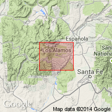
Pg. 18 (fig. 8), 47-48, pl. 1. Guaje Member of Bandelier Tuff of Tewa Group. Composed of unconsolidated white rhyolitic lump pumice or lapilli tuff. Thickness 25 feet at type locality; 57 feet at hole 19.6.17.234 in Los Alamos Canyon. Unconformably underlies Otowi Member (new). Wedges out between underlying basaltic rock of Chino Mesa and overlying Otowi Member in area between White Rock and Totavi. Rests unconformably on all older rocks with which it is in contact. In northeastern part of area, overlies Puye Conglomerate or local patches of old alluvium. Overlies pyroxene and andesite unit of Tschicoma Formation in subsurface. Age is Pleistocene.
Type section (typical section): on north side of high hill on south side of Guaje Canyon, in SE/4 NW/4 SE/4 sec. 4, T. 19 N., R. 7 E., [Puye 7.5-min quadrangle], Santa Fe Co., north-central NM. Named from Guaje Canyon. Also well exposed in workings of White Eagle Mine (pumice mine) on ridge north of Guaje Canyon, [in N/2 sec. 4, T. 19 N., R. 7 E., Puye 7.5-min quadrangle, Santa Fe Co., north-central NM]. Exposed almost continuously along Puye Escarpment and in deep canyons in northeastern part of area.
Source: US geologic names lexicon (USGS Bull. 1350, p. 311).
- Usage in publication:
-
- Guaje Member*
- Modifications:
-
- Geochronologic dating
- Paleomagnetics
- AAPG geologic province:
-
- San Juan basin
Summary:
Informal upper and lower members of Bandelier Tuff (following usage of Smith and Bailey, 1966) dated by K-Ar method on anorthoclase and sanidine samples taken in Valles caldera, Jemez Mountains, Sandoval Co, NM in San Juan basin. Lower member--called the Otowi Member, and underlying Guaje Member by Griggs (1964)--dated on sanidine as 1.4 m.y. old. [Note that the author uses "lower member", not "Guaje Member", as geologic name--however, Guaje is inferred.] Upper member--called the Tshirege Member by Griggs (1964 --dated on anorthoclase and sanidine as 1.0 m.y. old. Has reversed magnetic polarity. Is of early Pleistocene age.
Source: GNU records (USGS DDS-6; Denver GNULEX).
- Usage in publication:
-
- Guaje Pumice Bed*
- Modifications:
-
- Revised
- AAPG geologic province:
-
- San Juan basin
Summary:
Bandelier Tuff of Tewa Group, previously divided informally into "upper" and "lower" members, revised and divided into two new formal members: 1) Otowi Member (at base), whose lower contact is extended to include the basal pumice fall, Guaje Member of Griggs--which is here reduced in rank to Guaje Pumice Bed--and overlying unnamed ash-flow units (Otowi Member of Griggs); and 2) Tshirege Member (at top), which includes a basal pumice fall, named Tsankawi Pumice Bed (new), and the overlying unnamed ash-flow units (Tshirege Member of Griggs). Ash-flow units not formally named in either member. Is in Jemez Mountains, Sandoval Co, NM in San Juan basin. Is of Pleistocene age.
Source: GNU records (USGS DDS-6; Denver GNULEX).
- Usage in publication:
-
- Guaje Pumice Bed*
- Modifications:
-
- Paleomagnetics
- AAPG geologic province:
-
- San Juan basin
Summary:
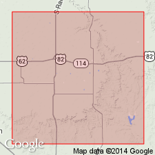
A rhyolite volcanic ash bed about 1 ft thick is exposed in a roadcut along TX Hwy 193 in upper part of sequence of lower Pleistocene sedimentary deposits at type locality of Blanco Formation about 37 mi northeast of Lubbock, TX, in Permian basin. This ash has chemical and petrographic characteristics matching the rhyolite air-fall tephra (Pleistocene Guaje Pumice Bed of Otowi Member of Bandelier Tuff) that immediately underlies unnamed ash flows of Otowi in the Jemez Mountains of northern NM, in San Juan basin. Composition of glass phase of the ash matches that of Guaje for all major elements (except K and Na). Paleomagnetic measurements indicate that the ash has reverse remanent magnetization. Sanidine from Guaje Pumice Bed and its genetically related overlying ash-flow sheet in Jemez Mountains has been K-Ar dated at about 1.4 m.y. by Doell and others (1968). Correlation of the ash bed near Mount Blanco, TX, with the Guaje has implications concerning the duration of the well-known Blancan Land Mammal age.
Source: GNU records (USGS DDS-6; Denver GNULEX).
- Usage in publication:
-
- Guaje Pumice Bed*
- Modifications:
-
- Geochronologic dating
- Age modified
- AAPG geologic province:
-
- Estancia basin
- Palo Duro basin
- Permian basin
- San Juan basin
Summary:
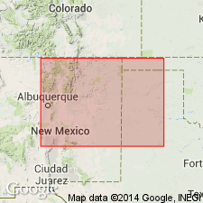
Pg. 38 (fig. 11), 39 (table 10), 40 (table 11). Guaje Pumice Bed of Otowi Member of Bandelier Tuff. Reported K-Ar ages of Doell and others (GSA Mem. 116, 1968) are recalculated using new decay constants of Steiger and Jager (1977). Age is 1.4 +/-0.04 Ma; overlying ash flows, 1.48 +/-0.04 Ma and 1.52 +/-0.09 Ma.
Notable localities in eastern Jemez Mountains, north-central NM, and southern High Plains, eastern NM and panhandle of TX (Bernalillo, DeBaca, and Santa Fe Cos., NM, and Crosby and Lubbock Cos., TX).
Source: Publication.
For more information, please contact Nancy Stamm, Geologic Names Committee Secretary.
Asterisk (*) indicates published by U.S. Geological Survey authors.
"No current usage" (†) implies that a name has been abandoned or has fallen into disuse. Former usage and, if known, replacement name given in parentheses ( ).
Slash (/) indicates name conflicts with nomenclatural guidelines (CSN, 1933; ACSN, 1961, 1970; NACSN, 1983, 2005, 2021). May be explained within brackets ([ ]).

