

- Usage in publication:
-
- Grover gravel*
- Modifications:
-
- Named
- Dominant lithology:
-
- Gravel
- Sand
- Clay
- AAPG geologic province:
-
- Illinois basin
- Ozark uplift
Summary:
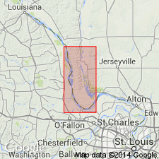
Named for Grover, St. Louis Co., eastern MO. Previously called Lafayette gravel, a name not deemed suitable because of careless application in many regions, gravels were too readily correlated with other gravels far outside the study area, and resulting miscorrelations and confusion brought about conflicting age evidence. Although gravels don't extend continuously from type locality near Grover to area of this report in IL, study of lithologic character and of peneplained surface on which they lie shows correlation with deposits in Calhoun Co., IL. Best exposure is in south center T44N, R3W, 2 mi west of Grover in quarry face 150 ft long. Consists of poorly sorted gravel, sand, and clay in varying proportions. Thickness ranges from a thin veneer up to about 30 ft, commonly from 2 to 5 ft in IL. Everywhere lies on old upland surface (Calhoun peneplain) and hence may rest unconformably over all formations truncated by that peneplain; specifically overlies Burlington, Pottsville, and McLeansboro formations in these two quads. Overlain by Pleistocene (late Sangamon) loess. Age is late Miocene based on age of completion of Calhoun peneplain (some time after end of Cretaceous) and a necessary time interval after gravel deposition and before Pleistocene development of intermediate postmature upland surface and deep trenching (probably the whole Pliocene epoch). Report includes geologic map, cross sections, and measured sections.
Source: GNU records (USGS DDS-6; Reston GNULEX).

- Usage in publication:
-
- Grover Gravel
- Modifications:
-
- Age modified
- AAPG geologic province:
-
- Illinois basin
Summary:
Grover Gravel has long been interpreted as Tertiary, generally Pliocene. Rubey (1952) considered it Miocene because of amount of erosion that had taken place after it was deposited, and because gravel appears to be displaced more than 100 ft by movement along Cap au Gres Faulted Flexure in Calhoun Co. Large quartzite boulders in gravel may be early Pleistocene. Because definitive faunal evidence is unavailable, Grover Gravel is classified as Pliocene and Pleistocene in age.
Source: GNU records (USGS DDS-6; Reston GNULEX).

- Usage in publication:
-
- Grover Gravel*
- Modifications:
-
- Age modified
- AAPG geologic province:
-
- Illinois basin
- Ozark uplift
Summary:
Grover Gravel is Miocene or Pliocene in age.
Source: GNU records (USGS DDS-6; Reston GNULEX).
For more information, please contact Nancy Stamm, Geologic Names Committee Secretary.
Asterisk (*) indicates published by U.S. Geological Survey authors.
"No current usage" (†) implies that a name has been abandoned or has fallen into disuse. Former usage and, if known, replacement name given in parentheses ( ).
Slash (/) indicates name conflicts with nomenclatural guidelines (CSN, 1933; ACSN, 1961, 1970; NACSN, 1983, 2005, 2021). May be explained within brackets ([ ]).