- Usage in publication:
-
- Gros Ventre formation*
- Modifications:
-
- Original reference
- Dominant lithology:
-
- Shale
- Limestone
- AAPG geologic province:
-
- Yellowstone province
- Green River basin
Summary:
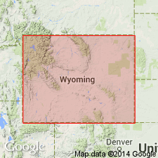
Gros Ventre formation. Greenish and gray calcareous shales, with gray, striped conglomeratic and oolitic limestones, separating overlying Gallatin limestone (as restricted by Hague and his associates) from underlying Flathead quartzite. Contains Middle Cambrian fossils. [Gives typical detailed section (which foots 796 feet) on west slope of Doubletop Peak, in Gros Ventre Range, where overlying Gallatin limestone and underlying Flathead quartzite are both present.]
Source: US geologic names lexicon (USGS Bull. 896, p. 883).
- Usage in publication:
-
- Gros Ventre formation
- Modifications:
-
- Revised
- AAPG geologic province:
-
- Wind River basin
- Yellowstone province
Summary:
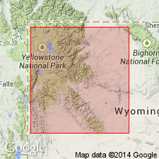
Pg. 119-123, 129, 132, 134. Gros Ventre formation. In northwestern Wyoming comprises lower shale division, Death Canyon member (new), and upper shale division. Thickness 675 feet. Overlies Flathead formation; underlies Gallatin formation. [Age is Middle Cambrian.]
Source: US geologic names lexicon (USGS Bull. 1200, p. 1621-1622).
- Usage in publication:
-
- Gros Ventre member
- Modifications:
-
- Revised
- AAPG geologic province:
-
- Bighorn basin
- Wind River basin
Summary:
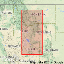
Pg. 1096-1098, 1101 (fig. 3), 1103. Gros Ventre member of Depass formation. Rank reduced to member status in Depass formation (redefined). Overlies Flathead sandstone member. Underlies Maurice member of Boysen formation (new). Thickness 300 feet. [Age is Middle Cambrian (Albertan).]
Source: US geologic names lexicon (USGS Bull. 1200, p. 1621-1622).
- Usage in publication:
-
- Gros Ventre group
- Modifications:
-
- Revised
- AAPG geologic province:
-
- Yellowstone province
- Green River basin
- Bighorn basin
- Wind River basin
Summary:
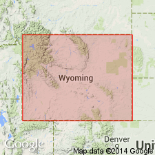
Gros Ventre formation raised to group rank and its members raised to formation rank in a footnote on Chart II. Includes (ascending): Wolsey shale, Death Canyon limestone, and Park shale. The lower two formations are of Albertan age; the Park is mostly Albertan and at top early Dresbachian age. Gros Ventre overlies Flathead sandstone and underlies Dunoir limestone (rank raised) of Gallatin group (rank raised). This nomenclature is used from the Yellowstone province and Greater Green River basin of western WY east to the western Bighorn basin. The equivalent of the Gros Ventre in the Wind River basin is the newly named Buck Spring formation. In the eastern Bighorn and western Powder River basin, Gros Ventre is designated as an undivided formation. Gros Ventre apparently not divisible east of Death Canyon pinchout in the Bighorn basin.
Source: GNU records (USGS DDS-6; Denver GNULEX).
- Usage in publication:
-
- Gros Ventre Formation*
- Modifications:
-
- Overview
- AAPG geologic province:
-
- Wind River basin
Summary:
On the south side of the Washakie Range in northwestern part of the Wind River basin, Fremont Co, WY, where the Death Canyon Limestone Member is recognized, the Gros Ventre can be separated into the Wolsey Shale Member at the base, the Death Canyon in the middle, and the Park Shale Member at the top. The Wolsey is 107 ft thick, the Death Canyon is 219 ft thick, and the Park is 421 ft thick. The three members can be recognized as far as Bull Lake Canyon in sec 9, T2S, R3W. To the south and east, the Gros Ventre is not divided. Lithologic character changes to fine-grained sandstone, siltstone, and a few beds of shale along south margin of basin. Thickness decreases from 512 ft in Sweetwater Canyon (secs 27 and 28, T29N, R97W), southern Fremont Co to 287 ft (east) in Rattlesnake Hills (sec 24, T33N, R88W), Natrona Co. Overlies Flathead Sandstone; contact conformable and interfingering. Underlies Gallatin Limestone; contact is conformable to erosional unconformity. Cross sections. Of middle and late Middle Cambrian age. Base is younger to east due to interfingering with Flathead.
Source: GNU records (USGS DDS-6; Denver GNULEX).
For more information, please contact Nancy Stamm, Geologic Names Committee Secretary.
Asterisk (*) indicates published by U.S. Geological Survey authors.
"No current usage" (†) implies that a name has been abandoned or has fallen into disuse. Former usage and, if known, replacement name given in parentheses ( ).
Slash (/) indicates name conflicts with nomenclatural guidelines (CSN, 1933; ACSN, 1961, 1970; NACSN, 1983, 2005, 2021). May be explained within brackets ([ ]).

