The National Geologic Map Database is migrating to a new infrastructure. We apologize for any service disruptions during this process.
|
|---|


- Usage in publication:
-
- Grizzly quartzite
- Modifications:
-
- Areal extent
- Dominant lithology:
-
- Quartzite
- AAPG geologic province:
-
- Sierra Nevada province
Summary:
Pg. 370-394. Grizzly quartzite, 400 feet thick. Oldest formation in Taylor[s]ville region. Tentatively assigned to Silurian(?). Is older than Montgomery limestone, of Niagara age [Silurian].
[Named from exposures on eastern and northeastern slopes of Grizzly Mountains, Plumas Co., Taylorsville region, northern CA.]
Source: US geologic names lexicon (USGS Bull. 896, p. 881-882).
- Usage in publication:
-
- Grizzly formation*
- Modifications:
-
- Redescribed
- Age modified
- AAPG geologic province:
-
- Sierra Nevada province
Summary:
(and 1892 prelim. proof-sheet ed. of USGS Lassen Peak folio). Grizzly formation. Within area represented on map it is composed chiefly of slates, but in Mount Grizzly, near Taylor[s]ville, where the formation has greatest development, there are, besides slates, both quartzite and limestone. The last is of special interest in being Silurian, the oldest fossiliferous rock yet discovered in California. [The limestone is Montgomery limestone, of Silurian (Niagaran) age, which is now treated as a distinct formation, overlying Grizzly formation.]
Source: US geologic names lexicon (USGS Bull. 896, p. 881-882).
- Usage in publication:
-
- Grizzly formation*
- Modifications:
-
- Principal reference
- Adopted
- Dominant lithology:
-
- Quartzite
- Shale
- AAPG geologic province:
-
- Sierra Nevada province
Summary:
Grizzly formation. Gray well-defined but thin-bedded quartzite overlain by lentils of [Montgomery] limestone, and interstratified with shaly, often siliceous slate (argillite) having irregular cleavage. The beds of quartzite range in thickness from 5 to about 20 feet and run out into shale in a short distance. The shale beds are generally thicker than the quartzite, and for most part greenish gray to drab, although sometimes black and more or less flinty, but not much altered. The lighter-colored shales are often sandy and constitute prevailing portion of the formation, although beds of well-marked quartzite are usually present and frequently predominate. The coarser beds of quartzite are near base of formation and are about 200 feet thick. Thickness of formation 400 to 1,000 feet. On eastern slope of Grizzly Mountains, near northern end, quartzite prevails immediately beneath a lentil of [Montgomery] limestone, but north of Montgomery Creek shales occupy the corresponding position, and as the section does not continue below the tunnel it does not disclose the coarser beds lying at bottom of Grizzly quartzite horizon. In places is overlain conformably by Montgomery limestone but in most places is unconformably overlain by Taylorsville formation. Rests on ancient metarhyolite.
Source: US geologic names lexicon (USGS Bull. 896, p. 881-882).

- Usage in publication:
-
- Grizzly formation*
- Modifications:
-
- Overview
- AAPG geologic province:
-
- Sierra Nevada province
Summary:
Grizzly formation. Age is Silurian(?) (may be Ordovician). Since Grizzly formation underlies Montgomery limestone, of Niagaran age, it may be either Silurian or Ordovician.
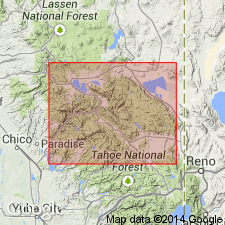
Named from exposures on eastern and northeastern slopes of Grizzly Mountains, Taylorsville region, Plumas Co., northern CA.
Source: US geologic names lexicon (USGS Bull. 896, p. 881-882).
- Usage in publication:
-
- Grizzly Formation*
- Modifications:
-
- Age modified
- Biostratigraphic dating
- AAPG geologic province:
-
- Sierra Nevada province
Summary:
Grizzly is discontinuous and has been mapped in about six places in Sierra City and Emigrant Gap 15' quads. Age is Late Devonian based on presence of late Frasnian to Famennian conodonts (Hanson, unpub. thesis, 1983) and Frasnian corals and gastropods in unit. Geologic section shows Grizzly Formation underlies Sierra Buttes Formation in Dugan Pond area and middle Yuba River area. Megafossil locality in Grizzly Formation indicated on section.
Source: GNU records (USGS DDS-6; Menlo GNULEX).
- Usage in publication:
-
- Grizzly Formation*
- Modifications:
-
- Principal reference
- AAPG geologic province:
-
- Sierra Nevada province
Summary:
Grizzly Formation is oldest formation in Taylorsville sequence. Principal reference locality is designated as exposures on Grizzly Mountain, sec.14 T25N R10E, Taylorsville 7.5' quad [Plumas Co, CA]. Consists of discontinuous epiclastic unit composed primarily of conglomerate, sandstone, and pelite, that lies unconformably on Shoo Fly Complex and grades upwards abruptly into Sierra Buttes Formation.
Source: GNU records (USGS DDS-6; Menlo GNULEX).
For more information, please contact Nancy Stamm, Geologic Names Committee Secretary.
Asterisk (*) indicates published by U.S. Geological Survey authors.
"No current usage" (†) implies that a name has been abandoned or has fallen into disuse. Former usage and, if known, replacement name given in parentheses ( ).
Slash (/) indicates name conflicts with nomenclatural guidelines (CSN, 1933; ACSN, 1961, 1970; NACSN, 1983, 2005, 2021). May be explained within brackets ([ ]).