The National Geologic Map Database is migrating to a new infrastructure. We apologize for any service disruptions during this process.
|
|---|


- Usage in publication:
-
- Grimsby sandstone
- Modifications:
-
- Revised
- AAPG geologic province:
-
- Appalachian basin
Summary:
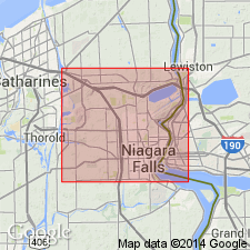
Author lists the following subdivisions of Medina formation (restricted to "Upper Medina" or Albion sandstone) in Niagara Gorge (descending): Thorold sandstone, Grimsby sandstone ("name proposed by M.Y. Williams in paper read before the Geological Society of America, January, 1914"), Cabot Head shale, Manitoulin beds, and Whirlpool sandstone.
Source: GNU records (USGS DDS-6; Reston GNULEX).
- Usage in publication:
-
- Grimsby sandstone
- Modifications:
-
- Named
- Dominant lithology:
-
- Sandstone
- AAPG geologic province:
-
- Appalachian basin
Summary:
This is first published definition of the Grimsby sandstone. Author states that it consists of 6 ft of gray shale underlain by thick-bedded mottled red and gray sandstone 50 ft thick in Niagara Gorge. Overlain by Thorold sandstone and underlain by Cabot Head shale.
Source: GNU records (USGS DDS-6; Reston GNULEX).

- Usage in publication:
-
- Grimsby Sandstone
- Modifications:
-
- First used
- Dominant lithology:
-
- Dolostone
- AAPG geologic province:
-
- Appalachian basin
Summary:
At Niagara Falls, NY, Artpark Phosphate Bed occurs at the base of the Grimsby Sandstone and overlies an unnamed sandstone above the Power Glen Shale. At the north end of Niagara Gorge, CAN, the Artpark Phosphate Bed is described as a distinct, meter-thick phosphatic sandy dolostone lying between the middle and upper Cabot Head Shale. Age is Llandoverian. [Artpark to be formally named by Brett, in press.]
Source: GNU records (USGS DDS-6; Reston GNULEX).

- Usage in publication:
-
- Grimsby Sandstone, Formation
- Modifications:
-
- Revised
- AAPG geologic province:
-
- Appalachian basin
Summary:
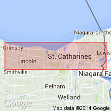
The revised base of the Grimsby Sandstone of the Medina Group is now drawn at the base of the white quartzarenite (Devils Hole Sandstone of Duke, in press) below the Artpark Phosphate Bed, or where the sandstone in not preserved, at the base of the Artpark. The green to reddish shales and thin sandstones overlying the Artpark were previously assigned to the Power Glen and are now included in the Grimsby. Depositional environments of the Grimsby include very shallow shelf to lower and mid-tidal flat settings. In the Hamilton area, the Grimsby interval retains its red coloration, but consists mainly of marine mudstones, sandstones, and thin hematitic bryozoan-rich limestones and is frequently designated as the upper part of the Cabot Head Formation.
Source: GNU records (USGS DDS-6; Reston GNULEX).
- Usage in publication:
-
- Grimsby Formation
- Modifications:
-
- Overview
- AAPG geologic province:
-
- Appalachian basin
Summary:
The Medina Group comprises 11 facies, which can be organized into three facies associations. The previously defined color-based formations do not conform with lithic correlations except for the Whirlpool and Manitoulin. A formal major revision is being proposed by Brett and others (in press) and Duke and others (in press). The newly revised Medina Group will include the Whirlpool Sandstone at its base (virtually unchanged), the overlying Jolley Cut Formation (a tentative renaming of the Manitoulin), the Balls Falls Formation (new), the Art Park Phosphate Beds (new), the Devils Hole Formation (new), the Grimsby Formation (revised--see Brett and others, 1991), the Power Glen Formation (revised), the Thorold Formation (revised), the Cambria Formation (new), and the Kodak Formation (resurrected). The Medina unconformably overlies Queenston Shale; unconformably underlies Clinton Group.
Source: GNU records (USGS DDS-6; Reston GNULEX).
- Usage in publication:
-
- Grimsby Formation*
- Modifications:
-
- Revised
- Redescribed
- Dominant lithology:
-
- Sandstone
- Siltstone
- Shale
- Conglomerate
- AAPG geologic province:
-
- Appalachian basin
Summary:
The Grimsby Formation of the Medina Group is revised to include the uppermost beds formerly (Rickard, 1975) included in the Power Glen Shale. The lowest beds of the revised Grimsby are named the Artpark Phosphate Bed. The Grimsby consists of interbedded red and green sandstone, siltstone, and shale, and tends to be more argillaceous toward the base. The matrix of the Artpark Phosphate Bed and the basal 5 to 10 ft of the Grimsby is typically intensely burrowed greenish-gray and maroon shale. Fossils are common in the basal beds and include pelecypods, cephalopods, ostracodes, bryozoans, and brachiopods. The remainder of the Grimsby consists of red and white mottled, fine- to medium-grained sandstone and conglomerate interbedded with shale. The ratio of sandstone to shale increases upward to the contact with the overlying Thorold Sandstone. Thickness is 56 to 72 ft. Overlies the Devils Hole Sandstone with a sharp contact, underlies the Thorold Sandstone with a sharp contact. Unit can be traced from Rochester, NY, to Hamilton, Ont, CAN. The Grimsby is of Early Silurian age, probably early Llandoverian based on correlation with the Brassfield Limestone of the Midcontinent. [Report uses Early and Late Silurian time scale of Harland and others (1982).]
Source: GNU records (USGS DDS-6; Reston GNULEX).
For more information, please contact Nancy Stamm, Geologic Names Committee Secretary.
Asterisk (*) indicates published by U.S. Geological Survey authors.
"No current usage" (†) implies that a name has been abandoned or has fallen into disuse. Former usage and, if known, replacement name given in parentheses ( ).
Slash (/) indicates name conflicts with nomenclatural guidelines (CSN, 1933; ACSN, 1961, 1970; NACSN, 1983, 2005, 2021). May be explained within brackets ([ ]).