The National Geologic Map Database is migrating to a new infrastructure. We apologize for any service disruptions during this process.
|
|---|


- Usage in publication:
-
- Greybull sand
- Modifications:
-
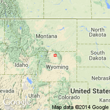
- Areal extent
- Dominant lithology:
-
- Sandstone
- AAPG geologic province:
-
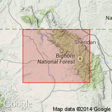
- Bighorn basin
Summary:
Upper sandstone of Cloverly formation is locally called Dakota or Greybull sand. It closely resembles Dakota sandstone. Is disconformably overlain by "Rusty Beds," 75 to 125 feet thick, which form basal part of Lower Benton shale. [This may not be first appearance in print of drillers' term Greybull sand, but it seems to be the first appearance of the term in a stratigraphy report.]
Source: US geologic names lexicon (USGS Bull. 896, p. 878).
- Usage in publication:
-
- Greybull sand*
- Modifications:
-
- Revised
- AAPG geologic province:
-
- Bighorn basin
Summary:
Table opp. p. 166; Pg. 167, 168. Greybull sand. At type locality of Cloverly formation, near Cloverly, Wyoming, about 15 miles northeast of Basin, Bighorn County, Wyoming, the Cloverly formation, according to N.H. Darton (USGS Prof. Paper 51, p. 52, 1906), consists of 113 feet of strata, a detailed section of which is here given. Upper 20 feet (light-buff or tan-colored sandstone) constitutes Greybull sand, which carries oil and gas in Greybull field and water in Lamb anticline and Torchlight dome. The Greybull sand is overlain by Thermopolis shale (new). Age is Cretaceous. Report includes chart showing history of nomenclature.
[According to GNU records (USGS DDS-6; Denver GNULEX, Dec. 17, 1991), Greybull is present only in subsurface in the Basin area, Big Horn Co., WY (Bighorn basin).]
Source: US geologic names lexicon (USGS Bull. 896, p. 878); supplemental information from GNU records (USGS DDS-6; Denver GNULEX).
- Usage in publication:
-
- Greybull sandstone member*
- Modifications:
-
- Revised
- AAPG geologic province:
-
- Bighorn basin
Summary:
Pg. 19. Greybull sandstone member of Cloverly formation. Defined base of Thermopolis shale and top of Cloverly formation as top of Greybull sandstone member and stated that Thermopolis shale [of Colorado age] included the "rusty beds" [20 to 100 feet thick] described by Washburne in USGS Bull. 340, p. 350, 1908] as basal member of Colorado formation in Bighorn basin, Wyoming.
Source: US geologic names lexicon (USGS Bull. 896, p. 878).

- Usage in publication:
-
- Greybull sandstone member
- Modifications:
-
- Overview
- AAPG geologic province:
-
- Bighorn basin
Summary:
In USGS Prof. Paper 149, p. 64, 1927, W.T. Lee included in his Greybull sandstone member of Cloverly formation the "rusty beds" assigned to Thermopolis shale by D.F. Hewett and C.T. Lupton in 1917.
Subsequent work in Elk Basin field led committee on geologic names of USGS to sanction the transfer of the "rusty beds" to Cloverly formation, as indicated on Wyoming correlation chart compiled by the secretary and dated April 1925. Geologists working in other fields, however, continued to identify Greybull sandstone as top member of Cloverly formation and did not discriminate the so-called "rusty beds," but their equivalents, if present, appear to have been included in Thermopolis shale, as the thicknesses of Greybull sandstone given range from 0 to 40 feet. In correlation chart (pl. 2) of USGS Prof. Paper 149, a thickness of 100+/- feet is assigned to Greybull sandstone member at Greybull, Wyoming, and a thickness of 53 to 60 feet at Thermopolis, Wyoming, and Greybull sandstone member of Greybull section is described (p. 64) as consisting of "many layers of rusty brown sandstone and shale which grade upward into Thermopolis shale." It is quite apparent that the 100+/- feet mentioned includes at least a part of the "rusty beds" in Greybull sandstone. In a previous report by A.J. Collier (USGS Bull. 711-D, 1920), the Greybull sandstone of Thermopolis region is described as a massive sandstone 25 feet thick, and the "rusty beds" are not mentioned. The present [ca. 1938] practice of USGS is to include the "rusty beds" in Thermopolis shale and treat Greybull sandstone as top member of Cloverly formation, in Bighorn basin, Elk Basin, and other areas in southern Montana where it has been recognized. (See USGS Bull. 822, 1931, p. 23-28.) Whether this sandstone is = Dakota sandstone (Upper Cretaceous) or is an older sandstone of [Early] Cretaceous age has not been determined.
Source: US geologic names lexicon (USGS Bull. 896, p. 878).
- Usage in publication:
-
- Greybull sandstone member*
- Modifications:
-
- Revised
- AAPG geologic province:
-
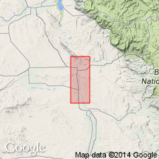
- Powder River basin
Summary:
Pg. 44, 45. Greybull sandstone member of Cloverly formation. In upper part of Cloverly formation which is here considered to be [Early] Cretaceous in age. Underlies "rusty beds" here included in Cloverly. Report includes geologic map, columnar section, measured sections.
Source: US geologic names lexicon (USGS Bull. 1200, p. 1613).
- Usage in publication:
-
- Greybull sandstone member
- Modifications:
-
- Not used
- AAPG geologic province:
-
- Powder River basin
Summary:
Pg. 7-8, 15-16. Greybull sandstone member of Cloverly formation. Term Greybull sandstone member (Hewett and Lupton, 1917, USGS Bull. 656) has been applied to some sandstone beds in this general section. Inasmuch as type locality was not designated accurately, it is not now possible to ascertain whether term referred only to channel sandstones in upper part of Cloverly or to sandstone beds at base of rusty beds, or to some of each. Term Greybull should not be used beyond confines of Greybull oil field where originally it was informally applied to an oil sand.
Source: US geologic names lexicon (USGS Bull. 1200, p. 1613).

- Usage in publication:
-
- Greybull sandstone member
- Modifications:
-
- Not used
Summary:
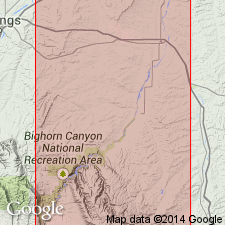
Not used in area between Red dome, Carbon County, Montana, southward into Hyattville area, Big Horn County, Wyoming (Bighorn basin). Rocks previously assigned to the Greybull sandstone member of the Cloverly are reassigned to the newly named Sykes Mountain formation. This paper thus revises the upper contact of the Cloverly.
Source: GNU records (USGS DDS-6; Denver GNULEX).
For more information, please contact Nancy Stamm, Geologic Names Committee Secretary.
Asterisk (*) indicates published by U.S. Geological Survey authors.
"No current usage" (†) implies that a name has been abandoned or has fallen into disuse. Former usage and, if known, replacement name given in parentheses ( ).
Slash (/) indicates name conflicts with nomenclatural guidelines (CSN, 1933; ACSN, 1961, 1970; NACSN, 1983, 2005, 2021). May be explained within brackets ([ ]).