- Usage in publication:
-
- Grenola formation
- Modifications:
-
- Original reference
- Dominant lithology:
-
- Limestone
- Shale
- AAPG geologic province:
-
- Cherokee basin
- Salina basin
- Nemaha anticline
- Forest City basin
- Chautauqua platform
Summary:
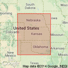
Grenola formation. The Neva limestone and certain beds below it are here described as a formation, to which the name Grenola is applied, from Grenola, Elk County, Kansas. Dr. R.C. Moore, Director of Kansas Geological Survey, concurs in erection of this new formation, but has not advised regarding its name. It represents a calcareous marine cycle, lying between arenaceous shale formations. It is erected on basis of its faunal and lithologic zones, which are widely persistent. It has 3 lines of outcrop in southeastern Nebraska and for most of distance across east-central Kansas, beyond which it is exposed in a single line of outcrops to beyond Arkansas Valley in Oklahoma. Deep-well records show it is deeply buried and widespread in western Kansas and eastern Colorado. It is underlain by Roca shale and overlain by Eskridge shale. It contains more limestone than shale, and therefore contrasts with underlying Roca and overlying Eskridge. It has distinct persistent faunal zones, which is unlike the Eskridge and Roca formations. [Fossils: mollusks, pelecypods, brachiopods, gastropods, bryozoans, forams, crinoids, echinoids.] It is the same as the Dunlap limestone of Kirk (Univ. Kansas Geol. Survey, v. 1, p. 81, 1896). It is here divided into following members (descending): Neva limestone, Salem Point shale, Burr limestone, Legion shale, and Sallyards limestone, all of which are present in type section. Combined thickness of the 5 members is 40 feet or more. Report includes measured sections.
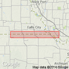
Type locality: ravines and creeks north and south of Hwy 160, 4 to 5 mi west of Grenola, Elk Co., eastern KS. All 5 members present. Named from town of Grenola.
"Co-type locality" designated as cuts on US Hwy 40, southwest of Manhattan, Riley Co., eastern KS.
Source: US geologic names lexicon (USGS Bull. 896, p. 876-877); supplemental information from GNU records (USGS DDS-6; Denver GNULEX).

- Usage in publication:
-
- Grenola formation
- Modifications:
-
- Revised
- AAPG geologic province:
-
- Forest City basin
Summary:
Pg. 7-8. Grenola formation of Council Grove group. Thickness 30 to 40 feet. Divided into (descending) Neva limestone, Salem Point shale, Burr limestone, Legion shale, and Sallyards limestone. Overlies Roca shale formation and underlies Eskridge shale formation. The Kansas Geol. Survey correlates Legion shale and Sallyards limestone with Roca shale formation. Age is considered Permian (lower part of Big Blue).
Source: Publication; US geologic names lexicon (USGS Bull. 896, p. 876-877); GNC KS-NE Pennsylvanian Corr. Chart, sheet 2, Oct. 1936.

- Usage in publication:
-
- Grenola formation
- Modifications:
-
- Revised
Summary:
Pg. 50. Grenola formation. Underlies Eskridge shale, overlies Roca shale (top part of Elmdale shale of old classification), and corresponds to Neva limestone of old classification. In revised classification it is divided into (descending) Neva limestone [restricted], Salem Point shale, and Burr limestone. [Moore also transferred these rocks to Permian. This change in Permian-Pennsylvanian boundary has not been considered by the USGS for its publications [ca. 1938].]
Source: US geologic names lexicon (USGS Bull. 896, p. 876-877); GNC KS-NE Pennsylvanian Corr. Chart, sheet 2, Oct. 1936.

- Usage in publication:
-
- Grenola limestone*
- Modifications:
-
- Revised
Summary:
Pg. 47-48. Grenola limestone of Council Grove group. Redefined in accordance with usage of Nebraska Geol. Survey to include strata between base of Sallyards limestone and top of Neva limestone. As thus redefined, includes (ascending) Sallyards limestone, Legion shale, Burr limestone, Salem Point shale, and Neva limestone members. Underlies Eskridge shale; overlies Roca shale. Thickness 38 to 48 feet. Age is Early Permian (Wolfcamp).
Source: US geologic names lexicon (USGS Bull. 1200, p. 1612).
For more information, please contact Nancy Stamm, Geologic Names Committee Secretary.
Asterisk (*) indicates published by U.S. Geological Survey authors.
"No current usage" (†) implies that a name has been abandoned or has fallen into disuse. Former usage and, if known, replacement name given in parentheses ( ).
Slash (/) indicates name conflicts with nomenclatural guidelines (CSN, 1933; ACSN, 1961, 1970; NACSN, 1983, 2005, 2021). May be explained within brackets ([ ]).

