

- Usage in publication:
-
- Green Hill member*
- Modifications:
-
- Named
- Dominant lithology:
-
- Limestone
- Shale
- AAPG geologic province:
-
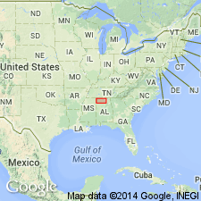
- Black Warrior basin
Summary:
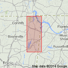
Pride Mountain formation named in Colbert Co., AL, and subdivided into seven members (ascending): Alsobrook, Tanyard Branch (new), Wagnon (new), Southward Spring sandstone, Sandfall (new), Mynot sandstone (new) and Green Hill (new). Green Hill member is light-brownish-gray oolitic thick-bedded limestone in lower part and olive-gray thin-bedded calcareous shale in upper part. Basal limestone is equivalent to upper limestone of Southward Bridge formation of Morse (1928). Upper shale is equivalent to the lower part of the Forest Grove formation of Morse (1928). These strata were referred to by Butts (1926) as the Golconda formation. Maximum thickness about 80 ft near Mingo, MS. Thins to 30 ft or less in Colbert Co., AL. Thickness only 20 ft at type locality. Underlies Hartselle sandstone. Contact is poorly exposed, but evidence suggests an unconformity of a least local extent. Age is Late Mississippian.
Source: GNU records (USGS DDS-6; Reston GNULEX).
- Usage in publication:
-
- Green Hill Member
- Modifications:
-
- Overview
- AAPG geologic province:
-
- Black Warrior basin
Summary:
Green Hill Member is uppermost interval of the Pride Mountain Formation. Fossiliferous limestones and shales in the lower portions are well exposed behind the dam of a pond that occupied the confluence of Rocky Quarry Branch and Maudlin Branch in Tishomingo State Park, MS, NE1/4SE1/4NE1/4 sec. 25, T5S, R10E. Lower limestone interval contains numerous crinoid fragments, productids, and bryozoans, and the shales contain trace fossils. Basal limestone is up to 5 ft thick, and is overlain by a sequence of calcareous shale, siltstone, and very thin intervals of thinly bedded sandstone. The shales and siltstones are locally calcareous and fossiliferous with bryozoans, brachiopods, bivalves, and gastropods. Age is Late Mississippian (Chesterian).
Source: GNU records (USGS DDS-6; Reston GNULEX).
For more information, please contact Nancy Stamm, Geologic Names Committee Secretary.
Asterisk (*) indicates published by U.S. Geological Survey authors.
"No current usage" (†) implies that a name has been abandoned or has fallen into disuse. Former usage and, if known, replacement name given in parentheses ( ).
Slash (/) indicates name conflicts with nomenclatural guidelines (CSN, 1933; ACSN, 1961, 1970; NACSN, 1983, 2005, 2021). May be explained within brackets ([ ]).