- Usage in publication:
-
- Granite Pass Granite*
- Modifications:
-
- Named
- Dominant lithology:
-
- Granite
- AAPG geologic province:
-
- Mojave basin
Summary:
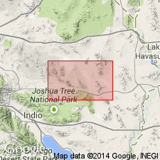
Unit is named the Granite Pass Granite of the Iron Mountains Intrusive Suite (new) for Granite Pass between the Iron and Granite Mountains in to southeastern part of the Sheep Hole Mountains 30' x 60' quad, San Bernardino Co., CA. Widely exposed in the southern Iron Mountains and northern Granite Mountains as the Granite Pass pluton. Coarse-grained, porphyritic muscovite-biotite monzogranite to granodiorite. Alkali-feldspar phenocrysts 1-4 cm long. Two facies: 1) equigranular facies--medium-grained muscovite-biotite granodiorite, and 2) muscovite-garnet granite facies --muscovite -rich, medium-grained monzogranite to granodiorite; locally garnet-bearing. Intrudes the Danby Lake Granite Gneiss (new). Age is Late Cretaceous.
Source: GNU records (USGS DDS-6; Menlo GNULEX).
For more information, please contact Nancy Stamm, Geologic Names Committee Secretary.
Asterisk (*) indicates published by U.S. Geological Survey authors.
"No current usage" (†) implies that a name has been abandoned or has fallen into disuse. Former usage and, if known, replacement name given in parentheses ( ).
Slash (/) indicates name conflicts with nomenclatural guidelines (CSN, 1933; ACSN, 1961, 1970; NACSN, 1983, 2005, 2021). May be explained within brackets ([ ]).

