The National Geologic Map Database is migrating to a new infrastructure. We apologize for any service disruptions during this process.
|
|---|


- Usage in publication:
-
- granite Gap granite
- Modifications:
-
- Named
- Dominant lithology:
-
- Granite
- AAPG geologic province:
-
- Southwestern Basin-and-Range region
Summary:
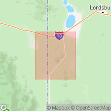
Named from exposures at Granite Gap where Hwy 80 crosses the Peloncillo Range, sec 31, T25S, R20W, Hidalgo Co, NM in Southwestern Basin-and-Range region. Type area not stated. Geologic map included. Is the oldest unit in report. Unconformably underlies Bolsa quartzite. Crops out on main ridge of Peloncillo Mountains, near Granite Gap, and in low hills south of the gap. Forms soft, easily erodible exposures and more resistant exposures. Is a holocrystalline, equigranular, medium-grained, light-pink to gray granite. Is dominantly anhedral quartz and subhedral orthoclase, and orthoclase is slightly in excess of quartz. Locally the granite is coarse grained and has feldspar crystals as much as 2 cm in diameter. Age is presumed to be Precambrian.
Source: GNU records (USGS DDS-6; Denver GNULEX).
For more information, please contact Nancy Stamm, Geologic Names Committee Secretary.
Asterisk (*) indicates published by U.S. Geological Survey authors.
"No current usage" (†) implies that a name has been abandoned or has fallen into disuse. Former usage and, if known, replacement name given in parentheses ( ).
Slash (/) indicates name conflicts with nomenclatural guidelines (CSN, 1933; ACSN, 1961, 1970; NACSN, 1983, 2005, 2021). May be explained within brackets ([ ]).