

- Usage in publication:
-
- Graneros shale*
- Modifications:
-
- Original reference
- Dominant lithology:
-
- Shale
- AAPG geologic province:
-
- Denver basin
- Anadarko basin
- Las Animas arch
Summary:
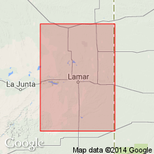
Pg. 564. Graneros shale. Name suggested by R.C. Hills. Laminated argillaceous or clayey gray shales with very little limy or sandy material. Thickness 200 to 210 feet. Bottom formation of Benton group in Arkansas Valley region, Colorado. Underlies Greenhorn limestone and overlies Dakota group.
Named from Graneros Creek [in Walsenburg quadrangle, Pueblo Co.], CO.
Source: US geologic names lexicon (USGS Bull. 896, p. 856).
- Usage in publication:
-
- Graneros shale*
- Modifications:
-
- Revised
- AAPG geologic province:
-
- Powder River basin
Summary:
Pg. 79-84, table. Graneros shale of Colorado group. In Osage oil field, Weston County, Wyoming, Graneros comprises about 1,000 feet of shale in which the following members can be distinguished (descending): Belle Fourche shale, 560 feet; Mowry shale, 150 feet; Nefsy shale (new), 25 to 50 feet; Newcastle sandstone, 40 to 60 feet; and Skull Creek shale, 200 feet. Overlies Dakota sandstone and underlies Greenhorn limestone. Age is Late Cretaceous.
Source: US geologic names lexicon (USGS Bull. 1200, p. 1570-1571); supplemental information from GNU records (USGS DDS-6; Denver GNULEX).

- Usage in publication:
-
- Graneros shale*
- Modifications:
-
- Overview
Summary:
Graneros shale of Colorado group. Recognized in eastern Colorado and Wyoming, southeastern Montana, South Dakota, Nebraska, Kansas, and northeastern New Mexico. Age is Late Cretaceous.
The Niobrara and Benton are not now [ca. 1938] treated as groups, the broader term Colorado group, which includes them both, being considered the more useful group name. Where the Niobrara deposits and Benton deposits are not subdivided, they are called Niobrara limestone and Benton shale, respectively.
Source: US geologic names lexicon (USGS Bull. 896, p. 856).
- Usage in publication:
-
- Graneros formation
- Modifications:
-
- Revised
- AAPG geologic province:
-
- Williston basin
Summary:
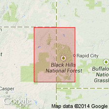
Pg. 3-6, chart facing p. 10. Graneros formation. In Butte County, South Dakota, comprises lower unit, 250 to 300 feet thick, of dark shale, with sandstone at top that is believed to be Newcastle; middle unit, or Mowry, 250 feet thick; upper unit, about 600 feet thick, of dark shales, with limestone ledge (about 200 feet below top) herein named Middle Creek limestone. Overlies Fall River (Dakota) sandstone; underlies Greenhorn limestone. Age is Cretaceous.
Source: US geologic names lexicon (USGS Bull. 1200, p. 1570-1572); supplemental information from GNU records (USGS DDS-6; Denver GNULEX).
- Usage in publication:
-
- Graneros shale
- Modifications:
-
- Revised
- AAPG geologic province:
-
- Chadron arch
- Williston basin
- Powder River basin
Summary:
Graneros shale. Newcastle sandstone, formerly regarded as member of Graneros shale, is herein assigned to Lower Cretaceous. Table 1 shows restricted Graneros shale comprises (ascending) Mowry shale and Belle Fourche shale in Black Hills area.
Source: US geologic names lexicon (USGS Bull. 1200, p. 1570-1572).
- Usage in publication:
-
- Graneros shale
- Modifications:
-
- Not used
- AAPG geologic province:
-
- Las Vegas-Raton basin
Summary:
Cretaceous System in area of this report [northwestern Mora County, New Mexico] is represented by Dakota sandstone and Benton formation; the Benton consists of Graneros shale, Greenhorn limestone, and Carlile shale equivalents.
Source: US geologic names lexicon (USGS Bull. 1200, p. 1570-1572).

- Usage in publication:
-
- Graneros shale*
- Graneros formation
- Graneros shale member*
- Modifications:
-
- Areal extent
- AAPG geologic province:
-
- Anadarko basin
- Chadron arch
- Central Kansas uplift
- Williston basin
- Powder River basin
- San Juan basin
Summary:
ADDITIONAL REFERENCES FOR THE GRANEROS (1940-1960):
Source: US geologic names lexicon (USGS Bull. 1200, p. 1570-1571); supplemental information from GNU records (USGS DDS-6; Denver GNULEX).
- Usage in publication:
-
- Graneros Shale*
- Modifications:
-
- Principal reference
- Revised
- Biostratigraphic dating
- Dominant lithology:
-
- Shale
- Bentonite
- Limestone
- Siltstone
- AAPG geologic province:
-
- Denver basin
Summary:
Pg. 5 (table 1), 7-14, 29-31. Graneros Shale. At type locality, Gilbert's (1896) Graneros Shale is restricted to the lower, chiefly dark-gray shale. Includes (descending) Ostrea beloiti bed, marker bentonite bed, upper fossiliferous unit, Thatcher Limestone Member, and lower barren unit. Thickness 114 feet. Overlies Dakota Sandstone. Underlies Lincoln Limestone Member of Greenhorn Limestone; contact placed at top of 1-foot-thick, dark-gray, calcareous shale bed above the dark-gray limestone with coquina of oysters (bed 69). In southwestern Kansas and at the Model anticline in southeastern Colorado, contact between Graneros and Greenhorn placed at base of hard finely banded thin-bedded limestone (absent from Pueblo area) 10 to 13 feet above marker bentonite bed. Age is Late Cretaceous (Cenomanian). Ammonites from the Thatcher and overlying part suggest middle and late Cenomanian (e.g., 3-fold division of Thomel, 1965), or late Cenomanian (e.g., 2-fold division of Spath, 1926, Wright and Wright, 1951).
Principal reference section: at Rock Canyon anticline, a few mi west of Pueblo, in SW/4 sec. 30, T. 20 S., R. 65 W., and in NW/4 NE/4 sec. 36, T. 20 S., R. 66 W., Pueblo Co., CO.
Source: Publication; Changes in stratigraphic nomenclature, 1973 (USGS Bull. 1395-A, p. A18-A19).
- Usage in publication:
-
- Graneros Shale*
- Modifications:
-
- Biostratigraphic dating
- AAPG geologic province:
-
- Denver basin
Summary:
Pg. 7, 26 (table 2). Graneros Shale. In southeastern Colorado, the ammonoid TARRANTOCERAS SELLARDSI (Adkins) is found in skeletal limestone near top of Graneros Shale (Cobban and Scott, 1972, p. 7, 64-65, pl. 10, figs. 1-11; text fig. 25) [= bed 69 in Rock Canyon section (Graneros principal reference section)]. Here the species, recorded as T. ROTATILE, is associated with mollusks INOCERAMUS RUTHERFORDI Warren, OSTREA BELOITI Logan, DESMOCERAS (PSEUDOUHLIGELLA) sp., ACANTHOCERAS AMPHIBOLUM Morrow, BORISSIAKOCERAS sp., and TURRILITES ACUTUS AMERICANUS Cobban and Scott. North of Colorado, T. SELLARDSI becomes scarce, and only an occasional specimen has been collected from limestone concretions near the top of the Belle Fourche Shale in eastern Wyoming (fig. 1, loc. 19). Age is middle Cenomanian (ACANTHOCERAS AMPHIBOLUM zone; ACANTHOCERAS AMPHIBOLUM AMPHIBOLUM into lower ACANTHOCERAS AMPHIBOLUM FALLENSE subzone).
Source: Publication.
For more information, please contact Nancy Stamm, Geologic Names Committee Secretary.
Asterisk (*) indicates published by U.S. Geological Survey authors.
"No current usage" (†) implies that a name has been abandoned or has fallen into disuse. Former usage and, if known, replacement name given in parentheses ( ).
Slash (/) indicates name conflicts with nomenclatural guidelines (CSN, 1933; ACSN, 1961, 1970; NACSN, 1983, 2005, 2021). May be explained within brackets ([ ]).