

- Usage in publication:
-
- Grandeur member*
- Grandeur tongue*
- Modifications:
-
- Original reference
- Dominant lithology:
-
- Limestone
- Dolomite
- AAPG geologic province:
-
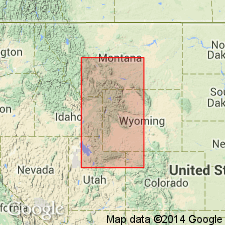
- Wasatch uplift
Summary:
[Credited to T.M. Cheney and others, p. 3 (fig. 1), 12-17, 36-37, pls. 2, 3.] Grandeur member of Park City formation; Grandeur tongue of Park City formation. Defined as the interbedded carbonate rock, cherty carbonate rock, carbonitic sandstone, and carbonitic siltstone that overlie Weber quartzite in Utah, Wells formation (restricted) in Idaho, Tensleep sandstone in Wyoming, and Quadrant formation in Montana. Underlies Meade Peak phosphatic shale member (new) of Phosphoria. Thickness at type locality about 280 feet. Present at all outcrops of Park City formation in Uinta Mountains except east of Lake Fork on south flank and ranges in thickness from featheredge to about 350 feet. Fossils (see section by J.S. Williams, p. 36-37). Age is Early Permian.
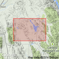
Type section: about 1 mi southwest of Grandeur Peak, in sec. 36, T. 1 S., R. 1 E., on north side and near mouth of Mill Creek Canyon, Salt Lake Co., UT.
Source: US geologic names lexicon (USGS Bull. 1200, p. 1563).
- Usage in publication:
-
- Grandeur Member*
- Modifications:
-
- Revised
- Reference
- Dominant lithology:
-
- Limestone
- Dolomite
- Phosphorite
- Chert
- AAPG geologic province:
-
- Wasatch uplift
Summary:
Overlies the newly named Kessler Canyon Formation, upper formation of the Oquirrh Group (rank raised). Reference section designated and measured east of fork in Coon Canyon, north side of NW1/4 NW1/4 sec 14, T2S, R3W, Salt Lake Co, UT on the Wasatch uplift where it overlies Kessler Canyon Formation (new) of Oquirrh Group (rank raised) and underlies an unnamed conglomerate. Recognized with units of the Rogers Canyon sequence. Is 760 ft thick at the reference section. Is exposed discontinuously along eastern front of Oquirrh Mountains. No outcrops west of Garfield fault. Consists of thin- to medium-bedded, gray-tan, fine- to coarse-grained, arenaceous limestone, dolomite, and dolomitic limestone interspersed with thin shale, argillaceous limestone, phosphorite, chert, orthoquartzite, and calcareous sandstone as partings, lenses, and layers. Abundant fossils listed (bryozoans, crinoids, brachiopods, gastropods) of late Leonard, Early Permian age. Columnar sections.
Source: GNU records (USGS DDS-6; Denver GNULEX).
- Usage in publication:
-
- Grandeur Tongue
- Modifications:
-
- Revised
- AAPG geologic province:
-
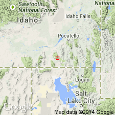
- Snake River basin
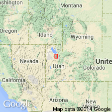
- Great Basin province
Summary:
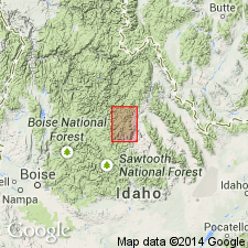
Revised in that it overlies Heydlauff Sandstone (a new name) between Heydlauff and Saeger Canyons, Oneida Co, ID in Great Basin province and Power Co, ID in Snake River basin. Assigned to Permian Park City Formation.
Source: GNU records (USGS DDS-6; Denver GNULEX).
- Usage in publication:
-
- Grandeur Tongue*
- Modifications:
-
- Revised
- AAPG geologic province:
-
- Great Basin province
Summary:
Grandeur Tongue of Park City Formation revised in that it overlies a newly named unit, the Trappers Creek Formation in southeastern part of Cassia Mountains, Cassia Co, ID in the Great Basin province. Forms steep to gentle slopes. Underlies Meade Peak Phosphatic Shale Member of Phosphoria Formation. Is present only in southeast part of Cassia Mountains and on a ridge east of Trout Creek in this report. Is 152-183 m thick. Has abundant fossil debris (brachiopod fragments, crinoid ossicles). NEOSTREPTOGNATHODUS SULCOPLICATUS zone occurs near middle of Grandeur. Contains early late Leonardian, Early Permian conodont faunas. Deposited in a high-energy shallow-water environment.
Source: GNU records (USGS DDS-6; Denver GNULEX).
- Usage in publication:
-
- Grandeur Member*
- Modifications:
-
- Age modified
- Biostratigraphic dating
- AAPG geologic province:
-
- Snake River basin
- Wasatch uplift
Summary:
Is upper member of Park City Formation in Caribou Co (Wasatch uplift) and Bingham Co (Snake River basin), southeastern ID. Underlies Meade Peak Phosphatic Shale Member of Phosphoria Formation. Age refined to Roadian (Leonardian) on basis of conodont biostratigraphy. NEOSTREPTOGNATHODUS SULCOPLICATUS Zone (Roadian) identified in Grandeur and lowermost part of Meade Peak. Roadian Stage, Leonardian Series of Early Permian age.
Source: GNU records (USGS DDS-6; Denver GNULEX).
- Usage in publication:
-
- Grandeur Member*
- Modifications:
-
- Areal extent
- AAPG geologic province:
-
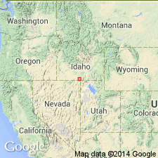
- Idaho Mountains province
Summary:
Present in southern Beaverhead Mountains on the ID-MT border and in the Lemhi Range, Lemhi Co, ID in the Idaho Mountains province. Outcrops of Grandeur Member of Park City Formation in Railroad Canyon are the northernmost exposures of Permian rocks in the Beaverheads. Name applied to rocks 75 m thick composed of very light gray to medium light gray, very fine to fine grained dolomite, dolomitic limestone and limestone above the Gallagher Peak Member of the Snaky Canyon Formation. Top in Railroad Canyon cut by thrust fault. Of Early Permian age. Generalized columnar diagram.
Source: GNU records (USGS DDS-6; Denver GNULEX).
For more information, please contact Nancy Stamm, Geologic Names Committee Secretary.
Asterisk (*) indicates published by U.S. Geological Survey authors.
"No current usage" (†) implies that a name has been abandoned or has fallen into disuse. Former usage and, if known, replacement name given in parentheses ( ).
Slash (/) indicates name conflicts with nomenclatural guidelines (CSN, 1933; ACSN, 1961, 1970; NACSN, 1983, 2005, 2021). May be explained within brackets ([ ]).