The National Geologic Map Database is migrating to a new infrastructure. We apologize for any service disruptions during this process.
|
|---|


- Usage in publication:
-
- Grand Canyon Supergroup*
- Modifications:
-
- Revised
- AAPG geologic province:
-
- Southern Rocky Mountain region
Summary:
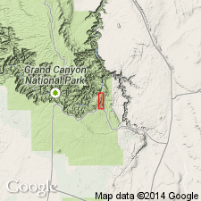
The Precambrian Grand Canyon Series of Walcott (1894) consists of three major distinct units: Unkar Group at base, Nankoweap Formation, and Chuar Group. Series is redesignated as Grand Canyon Supergroup in conformance with the ASC, art. 9e. Unconformably overlies Vishnu Schist. Unconformably underlies Tapeats Sandstone. Geologic maps.
Source: GNU records (USGS DDS-6; Denver GNULEX).
- Usage in publication:
-
- Grand Canyon Supergroup*
- Modifications:
-
- Revised
- AAPG geologic province:
-
- Southern Rocky Mountain region
Summary:
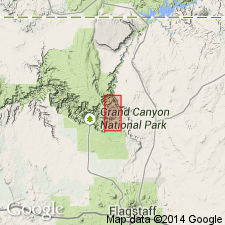
Is a Proterozoic unit in Grand Canyon area, northern AZ in the Southern Rocky Mountain region. Revised in that Sixtymile Formation removed from the Chuar Group and considered as the upper formation of the supergroup unassigned to a group. Chuar restricted to the lower two formations--the Galeros (base) and Kwagunt (top). Stratigraphic figures; cross section.
Source: GNU records (USGS DDS-6; Denver GNULEX).
- Usage in publication:
-
- Grand Canyon Supergroup*
- Modifications:
-
- Age modified
- Paleomagnetics
- Overview
- AAPG geologic province:
-
- Southern Rocky Mountain region
Summary:
Age changed from Middle Proterozoic to Middle and Late Proterozoic. Consists of Middle Proterozoic Unkar Group and Nankoweap Formation, and Late Proterozoic Chuar Group and Sixtymile Formation. Ranges from 3,546 to 4,143 m thick. Deposited with few breaks between 1,250 and 825 Ma. Bounded by "greatest unconformity" at contact of base of supergroup with Vishnu Schist and by "great unconformity" at contact of top of supergroup with Tapeats Sandstone. Lower unconformity marks an approx 425 Ma hiatus. Upper unconformity marks an approx 230 Ma hiatus. Known only from exposures in Southern Rocky Mountain region in eastern and central parts of Grand Canyon of northern AZ; full section of supergroup preserved only at eastern end. Paleomagnetic correlations can be made with Apache Group and Troy Quartzite of central AZ, Uinta Mountain Group of UT and CO, Belt Supergroup of MT, Keweenawan Supergroup of MI, MN, WI, and Sibley Series of Lake Superior region, and Mackenzie Mountains Supergroup of NW, CN. Paleomagnetic data shows that the supergroup almost entirely post-dates accumulation of the Belt. The only permissible paleomagnetic correlation and temporal overlap is between the uppermost normal polarity part of the Pilcher Quartzite at top of Belt and upper part of Bass Limestone. Columnar section.
Source: GNU records (USGS DDS-6; Denver GNULEX).
- Usage in publication:
-
- Grand Canyon Supergroup*
- Modifications:
-
- Overview
- AAPG geologic province:
-
- Southern Rocky Mountain region
Summary:
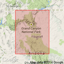
In northern AZ, Southern Rocky Mountain region, Middle-Late Proterozoic boundary is at unconformity between Nankoweap and overlying Chuar Group, both of Grand Canyon Supergroup. Although boundary is placed at unconformity, no appreciable structural disturbance is recognized in Grand Canyon rocks. Nominal age of boundary is 900 Ma. Boundary separates Middle Proterozoic redbed rocks from overlying early Late Proterozoic rocks that record a time of flourishing of plankters and a general suppression of red beds. Middle-Late Proterozoic boundary previously (Elston, 1979, USGS Prof. Paper 1092; Elston, McKee, 1982) drawn to correspond with Grand Canyon-Mackenzie Mountains orogeny at top of Grand Canyon Supergroup to which nominal age of 800 Ma was assigned; this disturbance now is considered to separate early from late Late Proterozoic rocks. Middle and Late Proterozoic age.
Source: GNU records (USGS DDS-6; Denver GNULEX).
- Usage in publication:
-
- Grand Canyon Supergroup*
- Modifications:
-
- Paleomagnetics
- AAPG geologic province:
-
- Southern Rocky Mountain region
Summary:
Comparison made of paleomagnetic poles and polar paths of Middle Proterozoic rocks of Hazel Formation of Van Horn area, TX (Southwestern Basin-and-Range region) with Middle Proterozoic rocks elsewhere in North America. Changes in direction of apparent polar wander are interpreted to reflect plate interactions and collisions responsible for episodes of deformation on the craton. Folding phases in Van Horn and Adirondack Mountain regions are relatable to 5 direction changes of polar wander between about 1,200 and about 1,000 Ma. Hazel accumulated during an episode of south-to-north thrust faulting that has been identified as belonging to Grenville Orogeny. Hazel is a 1,500 ft thick, moderately to little deformed, purple-red, fine- to coarse-grained sandstone above Allamoore Formation and beneath Carrizo Mountain Group; is similar to Dox Sandstone, Unkar Group, Grand Canyon Supergroup of AZ (Southern Rocky Mountain region) in lithology and in lack of metamorphism. The lower, lower middle, upper parts of Hazel have normal polarity directions. Three poles from Hazel describe a short, north-south trending trace that appears to have rotated about 30 deg clockwise with respect to apex and upper part of descending leg of Unkar loop. A 30 deg counterclockwise vertical-axis rotation brings Hazel into general coincidence with upper part, middle member of Dox, and with middle and early late Keweenawan poles from Lake Superior region.
Source: GNU records (USGS DDS-6; Denver GNULEX).
For more information, please contact Nancy Stamm, Geologic Names Committee Secretary.
Asterisk (*) indicates published by U.S. Geological Survey authors.
"No current usage" (†) implies that a name has been abandoned or has fallen into disuse. Former usage and, if known, replacement name given in parentheses ( ).
Slash (/) indicates name conflicts with nomenclatural guidelines (CSN, 1933; ACSN, 1961, 1970; NACSN, 1983, 2005, 2021). May be explained within brackets ([ ]).