

- Usage in publication:
-
- Gothic formation
- Modifications:
-
- Named
- Dominant lithology:
-
- Shale
- Sandstone
- Siltstone
- Limestone
- Conglomerate
- AAPG geologic province:
-
- Piceance basin
Summary:
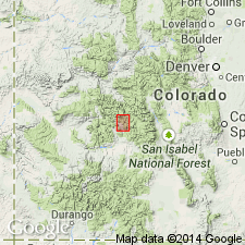
Named for exposures (type section) on ridge separating Copper Creek and Virginia basin, east of Gothic (abandoned), Ts12 and 13N, R86W, Gunnison Co, CO, Piceance basin. Formerly part of Maroon formation. Geologic map; cross section; measured section; nomenclature chart. Is 1,486+ ft thick at type where lower contact intrusive with White Rock stock. Stratigraphic lower contact is Belden shale (black shale and black limestone) with Gothic (buff sandstone, shale or conglomerate), arbitrarily placed at base of lowest prominent sandstone. Top arbitrarily placed at base of color change to red (Maroon). Stratigraphic upper contact Gothic (green, buff, gray sandstone or shale) with restricted Maroon (coarse-grained red feldspathic sandstone, red shale, and white limestone pebble conglomerate). Locally overlain unconformably by Entrada sandstone. Consists of: 1) red, green, gray to black, thin-bedded, micaceous shale; some beds calcareous; 2) buff, very fine, fine-, medium-, coarse-grained to conglomeratic, quartz and feldspar sandstone; some beds thin-bedded, massive, cross-bedded; 3) gray, buff, purple, black, thin to irregularly bedded, micaceous, noncalcareous siltstone, gray to black fossiliferous, locally cherty, limestone; 4) conglomerate of igneous, quartz, and feldspar pebbles. Predominantly sandstone and siltstone. Ranges 451+-1,763+ ft thick; thins northeast. Several bioherms. Des Moinesian fauna (fusulinids) listed.
Source: GNU records (USGS DDS-6; Denver GNULEX).
- Usage in publication:
-
- Gothic formation
- Modifications:
-
- Areal extent
- AAPG geologic province:
-
- Piceance basin
- Eagle basin
Summary:
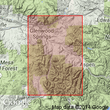
Crops out continuously from Glenwood Springs south to Carbondale. Recognized southward to its type section on Copper Creek at several measured sections. Sections measured: 1) 965+ ft thick at Heuschkel Ridge, T11S, R88W; and 2) 331+ ft thick at Thompson Creek, T8S, R88W, Pitkin Co, CO, Eagle basin, described in detail. Shown on cross section at Glenwood Springs, Dry Park Ranch, and Marion Creek, Garfield Co, Piceance basin, at Coal Creek, Pitkin Co, Eagle basin, and at Schofield Park, Gunnison Co, Piceance basin. Belden formation beneath "restricted" to limestone and shale. Lower Gothic contact placed at base of lowest prominent sandstone. Upper contact with Maroon formation chosen where rocks are predominately red. Where intertonguing takes place between Gothic and Maroon, the upper contact is chosen at the point of dominance of red color (Maroon). Unnamed gypsiferous strata interbedded with limestones of Gothic. Contains a Desmoinesian fauna.
Source: GNU records (USGS DDS-6; Denver GNULEX).
- Usage in publication:
-
- Gothic Formation
- Modifications:
-
- Revised
- AAPG geologic province:
-
- Piceance basin
- Eagle basin
Summary:
Study area is in the Elk Mountains near Crested Butte, Gunnison Co, CO, Piceance basin, to Aspen, Pitkin Co, CO, Eagle basin. Divided into Taylor River Limestone Member (new), unnamed interval, Brush Creek Limestone Member (new), Crystal River Siltstone Member (new), Hot Springs Conglomerate Member (new), Jack's Cabin Limestone Member (new), and unnamed interval. Measured sections of type localities of new members. The new members are mappable locally in the Carbondale-Crested Butte region. Index map shows distribution. The coarse conglomeratic arkose and marine limestones of near shore origin change to finer grained sediments (siltstone, mudstone) basinward. Some gypsum locally. Overlies Belden Formation. Contact with overlying Maroon Formation placed at change from dominantly gray and brown beds of Gothic to red beds of Maroon. Color change is the only practical marker. Is transitional basinward with the Eagle Valley Formation. Ranges from 1,500 to 2,000 ft thick. Collections of fusulinids date Gothic as Atokan and early Desmoinesian.
Source: GNU records (USGS DDS-6; Denver GNULEX).
For more information, please contact Nancy Stamm, Geologic Names Committee Secretary.
Asterisk (*) indicates published by U.S. Geological Survey authors.
"No current usage" (†) implies that a name has been abandoned or has fallen into disuse. Former usage and, if known, replacement name given in parentheses ( ).
Slash (/) indicates name conflicts with nomenclatural guidelines (CSN, 1933; ACSN, 1961, 1970; NACSN, 1983, 2005, 2021). May be explained within brackets ([ ]).