

- Usage in publication:
-
- Goose Egg formation
- Modifications:
-
- Original reference
- Dominant lithology:
-
- Shale
- Siltstone
- Limestone
- Gypsum
- AAPG geologic province:
-
- Denver basin
- Wind River basin
Summary:
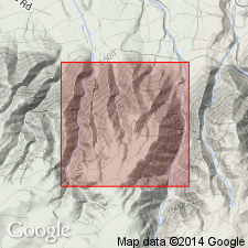
Pg. 3-10. Goose Egg formation. Sequence of interbedded red to ocher shales and siltstone, thin limestones, gypsums, and limestone breccias. Unconformably overlies Tensleep, Casper, Hartville, or Minnelusa formations; conformably underlies Chugwater or Spearfish formations. At typical exposure, near Goose Egg Post Office, unit is 380 feet thick; overlies Casper formation and underlies Chugwater formation. Known to be facies of Dinwoody and Phosphoria formations of western Wyoming. Middle Permian and Lower Triassic.
Measured section near Goose Egg Post Office, in NW/4 sec. 12, T. 32 N., R. 81 W., Goose Egg 7.5-min quadrangle (c.f.), Natrona Co., central WY, shows that formation comprises (descending):
shale and siltstone, 10 feet;
limestone and sandstone, 18 feet, represents Little Medicine tongue of Dinwoody;
shale and siltstone, 48 feet;
purple to gray limestone, 6 feet, represents feather-edge of Ervay tongue of Phosphoria;
gypsum with interbedded limestone, 98 feet;
shale and siltstone, 40 feet;
gray to purple limestone, 22 feet, represents Forelle tongue of Phosphoria;
shale and siltstone, 58 feet, represents Glendo shale of central and eastern Wyoming;
gray fossiliferous limestone, 10 feet, represents Minnekahta tongue of Phosphoria; and
shale and siltstone, 70 feet, represents Opeche shale of central and eastern Wyoming.
[On p. 9-10, authors state that in sections where the Little Medicine, Ervay, Forelle, Glendo, Minnekahta, and Opeche, can be differentiated, they may be treated as members of the Goose Egg. The Little Medicine tongue of the Dinwoody may be designated as the uppermost member of the Goose Egg. Where the Ervay is absent or cannot be differentiated, the interval between the Forelle and Little Medicine may be called Freezeout member (citing Thomas, 1934, p. 1670).]
Source: Publication; US geologic names lexicon (USGS Bull. 1200, p., 1545-1546).
- Usage in publication:
-
- Goose Egg formation
- Modifications:
-
- Areal extent
- Overview
- AAPG geologic province:
-
- Powder River basin
- Wind River basin
Summary:
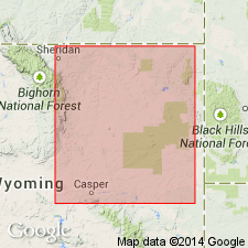
Shows correlation and distribution in Powder River basin and eastern part of Wind River basin, WY. Map shows distribution of named carbonate members, including (ascending): Minnekahta, Forelle, Ervay, and Little Medicine members. Top of formation is difficult to pick in surface exposures where sandy, dolomitic limestone of Little Medicine member grades into a gypsum-anhydrite sequence outside of the Casper area, Natrona Co, WY, Wind River basin. However, the top can be picked with assurance in subsurface by an increase in resistivity on the electric log and a decrease in radioactivity on the gamma log compared to overlying Chugwater formation. Spearfish formation, on east side of Powder River basin, is redefined to exclude from its base rocks assigned to Goose Egg formation. Contains a basin-wide disconformity separating Permian from Triassic rocks at top of Ervay limestone or equivalent beds. Overlain conformably by Spearfish formation (redefined) or Chugwater formation; overlies unconformably Minnelusa formation. Permian and Triassic in age.
Source: GNU records (USGS DDS-6; Denver GNULEX).
- Usage in publication:
-
- Goose Egg Formation*
- Modifications:
-
- Revised
- AAPG geologic province:
-
- Green River basin
Summary:
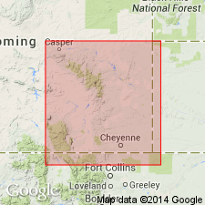
Name applied in Carbon and Albany Cos, WY, Greater Green River basin, to Permian and Triassic rocks. Divided into eight members in this area (ascending): Opeche Shale, Minnekahta Limestone, Glendo Shale, Forelle Limestone (all reduced in stratigraphic rank), Difficulty Shale (named), Ervay, Freezeout, and Little Medicine (all reassigned in this area from other formations) Members. Correlation chart; cross section. Was deposited in a shallow lagoon or tidal flat adjacent to the Phosphoria sea. The hematitic rocks suggest marginal marine, high humidity, and warm arid climate. Chemically deposited rocks suggest submergence of detrital source area or increased evaporation rate. Of Early and Late Permian and Early Triassic age. The Early-Late Permian boundary is placed at the top of the Minnekahta. The Late Permian-Early Triassic boundary is placed at the top of the Ervay.
Source: GNU records (USGS DDS-6; Denver GNULEX).

- Usage in publication:
-
- Goose Egg Formation*
- Modifications:
-
- Areal extent
- AAPG geologic province:
-
- Powder River basin
Summary:
Identified in the subsurface of the Powder River basin in MT and WY where it unconformably overlies Minnelusa Formation and underlies Chugwater Formation. Divided into (descending) an unnamed upper part, Minnekahta Limestone and Opeche Shale Members. Of Triassic and Permian age. [This nomenclature shown on 22 cross sections in this OC series.]
Source: GNU records (USGS DDS-6; Denver GNULEX).
For more information, please contact Nancy Stamm, Geologic Names Committee Secretary.
Asterisk (*) indicates published by U.S. Geological Survey authors.
"No current usage" (†) implies that a name has been abandoned or has fallen into disuse. Former usage and, if known, replacement name given in parentheses ( ).
Slash (/) indicates name conflicts with nomenclatural guidelines (CSN, 1933; ACSN, 1961, 1970; NACSN, 1983, 2005, 2021). May be explained within brackets ([ ]).