

- Usage in publication:
-
- Gober tongue
- Modifications:
-
- Original reference
- Dominant lithology:
-
- Chalk
Summary:
Pl. 1; Pg. 8-12. Gober tongue of Austin chalk. Above Brownstown marl as here restricted is a tongue of Austin chalk formerly incorrectly correlated with Annona chalk and in this paper designated Gober tongue of Austin chalk. Village of Gober, Fannin Co., is located on this chalk. Where the tongue connects with main body of Austin chalk it probably is not less than 400 feet thick, but it gradually thins out to [the] east and appears to pinch out entirely in eastern part of Lamar County. Between Honey Grove, Fannin County, and High, Lamar County, the lower part of the Gover is composed in part of soft, more or less chalky clay or marl. The lowest layers of chalk exposed in cut 0.25 mi west of High are regarded as forming base of Gober tongue. From central Fannin County to eastern part of Lamar County the uppermost bed of Gover tongue is a soft tough limestone facies 1 to 10 feet thick. It is conformably overlain by Taylor marl.
Source: US geologic names lexicon (USGS Bull. 896, p. 832).

- Usage in publication:
-
- Gober Chalk
- Modifications:
-
- Mapped 1:250k
- Dominant lithology:
-
- Chalk
- Marl
- AAPG geologic province:
-
- Ouachita folded belt
Summary:
Gober Chalk. Argillaceous, between Honey Grove, Fannin County, and High, Lamar County, northeastern Texas, lower part chalky marl, brittle, bluish-gray; weathers white. Thickness 300 feet, feathers out eastward. Lies below Roxton Limestone, and where Roxton is absent, Ozan Formation. Lies above Brownstown Marl. Age is Late Cretaceous.
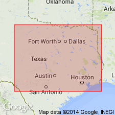
[Mapped in mostly continuous belt in western part of map sheet, north of North Sulphur River, in Fannin and Lamar Cos., northeastern TX.]
Source: Publication.
- Usage in publication:
-
- Gober Chalk*
- Modifications:
-
- Paleomagnetics
- AAPG geologic province:
-
- Ouachita folded belt
Summary:
Paleomagnetic (a.f. demagnetized) data indicates the Upper Cretaceous Gober Chalk in the Ouachita tectonic belt province in northeast TX possesses a weak remanent magnetization of normal magnetic polarity. The normal polarity is assumed to be primary magnetization, and is interpreted to represent deposition during the Gubbio (Italy) normal polarity zone B+ (Campanian to early Maestrichtian).
Source: GNU records (USGS DDS-6; Denver GNULEX).

- Usage in publication:
-
- Gober Chalk
- Modifications:
-
- Mapped 1:250k
- Dominant lithology:
-
- Chalk
- AAPG geologic province:
-
- East Texas basin
- Ouachita folded belt
- South Oklahoma folded belt
Summary:
Pamphlet [p. 3]. Gober Chalk of Austin Group. Bluish-gray, weathers white, brittle, argillaceous. Thickness approximately 400 feet, thins eastward. [Overlies Brownstown Marl, and in places Bonham Marl; underlies Roxton Limestone; all of Austin Group. Where Roxton is absent, underlies Ozan Formation.] Age is Late Cretaceous.
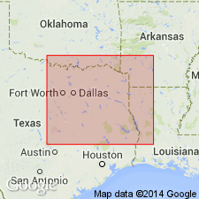
[Mapped in central eastern part of map sheet, in Collin, Fannin, Grayson, and Hunt Cos., northeastern TX.]
Source: Publication.
For more information, please contact Nancy Stamm, Geologic Names Committee Secretary.
Asterisk (*) indicates published by U.S. Geological Survey authors.
"No current usage" (†) implies that a name has been abandoned or has fallen into disuse. Former usage and, if known, replacement name given in parentheses ( ).
Slash (/) indicates name conflicts with nomenclatural guidelines (CSN, 1933; ACSN, 1961, 1970; NACSN, 1983, 2005, 2021). May be explained within brackets ([ ]).