

- Usage in publication:
-
- Glenray limestone
- Modifications:
-
- Named
- Dominant lithology:
-
- Limestone
- AAPG geologic province:
-
- Appalachian basin
Summary:
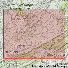
Glenray limestone, named in this report, is described as a gray, usually hard and somewhat sandy, but sometimes shaly limestone, 44 to 125 ft thick. Contains marine fossils. Underlies Webster Springs sandstone and overlies Lillydale shale. All members of Bluefield group [formation]. Type locality in Summers Co., on northwest side of Greenbrier River, opposite Glenray. Also observed in Mercer and Monroe Cos., WV, and in Tazewell Co., VA. Age is Mississippian.
Source: GNU records (USGS DDS-6; Reston GNULEX).
- Usage in publication:
-
- Glenray limestone
- Modifications:
-
- Overview
- AAPG geologic province:
-
- Appalachian basin
Summary:
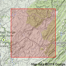
Glenray limestone of Reger (1926) is represented in Greenbrier Co. by 10 to 60 ft of more or less impure limestone. Commonly a bluish-gray siliceous thick-bedded very fossiliferous limestone, belonging 100 to 150 ft above the base of Mauch Chunk series. Above Lillydale shale and below Webster Springs sandstone of Bluefield group.
Source: GNU records (USGS DDS-6; Reston GNULEX).

- Usage in publication:
-
- Glenray Limestone Member
- Modifications:
-
- Overview
- AAPG geologic province:
-
- Appalachian basin
Summary:
The Glenray Limestone Member of Bluefield Group is also known as "Little Lime" by drillers. Lies 50 to 150 ft above the base of the Bluefield and directly above the Lillydale Shale Member. The limestone is medium-light gray, very fine grained, silty, dolomitic, micritic, and contains black chert nodules. Member is thin to thick bedded, ripple bedded and is interbedded with light-greenish-gray shale and siltstone containing abundant ARCHIMEDES sp. The Glenray varies between 10 and 80 ft in thickness. Underlies unnamed strata below the Indian Mills Sandstone Member that consists of fossiliferous, light-greenish-gray shale and limestone and grayish-red to greenish-gray, fine-grained sandstone. Age of the Glenray is Late Mississippian (Chesterian).
Source: GNU records (USGS DDS-6; Reston GNULEX).
For more information, please contact Nancy Stamm, Geologic Names Committee Secretary.
Asterisk (*) indicates published by U.S. Geological Survey authors.
"No current usage" (†) implies that a name has been abandoned or has fallen into disuse. Former usage and, if known, replacement name given in parentheses ( ).
Slash (/) indicates name conflicts with nomenclatural guidelines (CSN, 1933; ACSN, 1961, 1970; NACSN, 1983, 2005, 2021). May be explained within brackets ([ ]).