The National Geologic Map Database is migrating to a new infrastructure. We apologize for any service disruptions during this process.
|
|---|


- Usage in publication:
-
- Geneseo black shale
- Modifications:
-
- Named
- Dominant lithology:
-
- Shale
- AAPG geologic province:
-
- Appalachian basin
Summary:
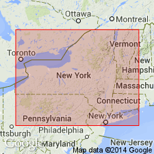
To avoid confusion with the Genesee, the variant Geneseo is used for the 84 feet thick unit in the fall on Fall Brook, Geneseo, NY. The name Genesee is in duplicate use for the group (including the West River) and for the part beneath the Genundewa limestone, which is under water at Hall's type locality.
Source: GNU records (USGS DDS-6; Reston GNULEX).

- Usage in publication:
-
- Geneseo Shale Member*
- Modifications:
-
- Areal extent
- AAPG geologic province:
-
- Appalachian basin
Summary:
Geneseo Shale Member of Genesee Formation extended from southwestern NY into western PA, eastern OH, and northern WV.
Source: GNU records (USGS DDS-6; Reston GNULEX).
For more information, please contact Nancy Stamm, Geologic Names Committee Secretary.
Asterisk (*) indicates published by U.S. Geological Survey authors.
"No current usage" (†) implies that a name has been abandoned or has fallen into disuse. Former usage and, if known, replacement name given in parentheses ( ).
Slash (/) indicates name conflicts with nomenclatural guidelines (CSN, 1933; ACSN, 1961, 1970; NACSN, 1983, 2005, 2021). May be explained within brackets ([ ]).